Weekend forecast
SUMMARY: Warm, humid, tropical air will continue into next week. Through the weekend pop-up showers and storms will be most likely from late morning until just after sunset. Rain chances look to tick up a bit for the middle of next week as a weak cold front tries to enter the region.
TROPICS: Tropical Storm Hanna will make landfall in South Texas on Saturday. Tropical Storm Gonzalo is expected to move into Caribbean Sea and weaken back into a depression or tropical wave next week. Another area of disturbed weather off Africa will continue to be monitored for potential development during the coming days.

FRIDAY NIGHT: Evening showers & t-showers will fade away. Lows in the low 70s with light SE winds.
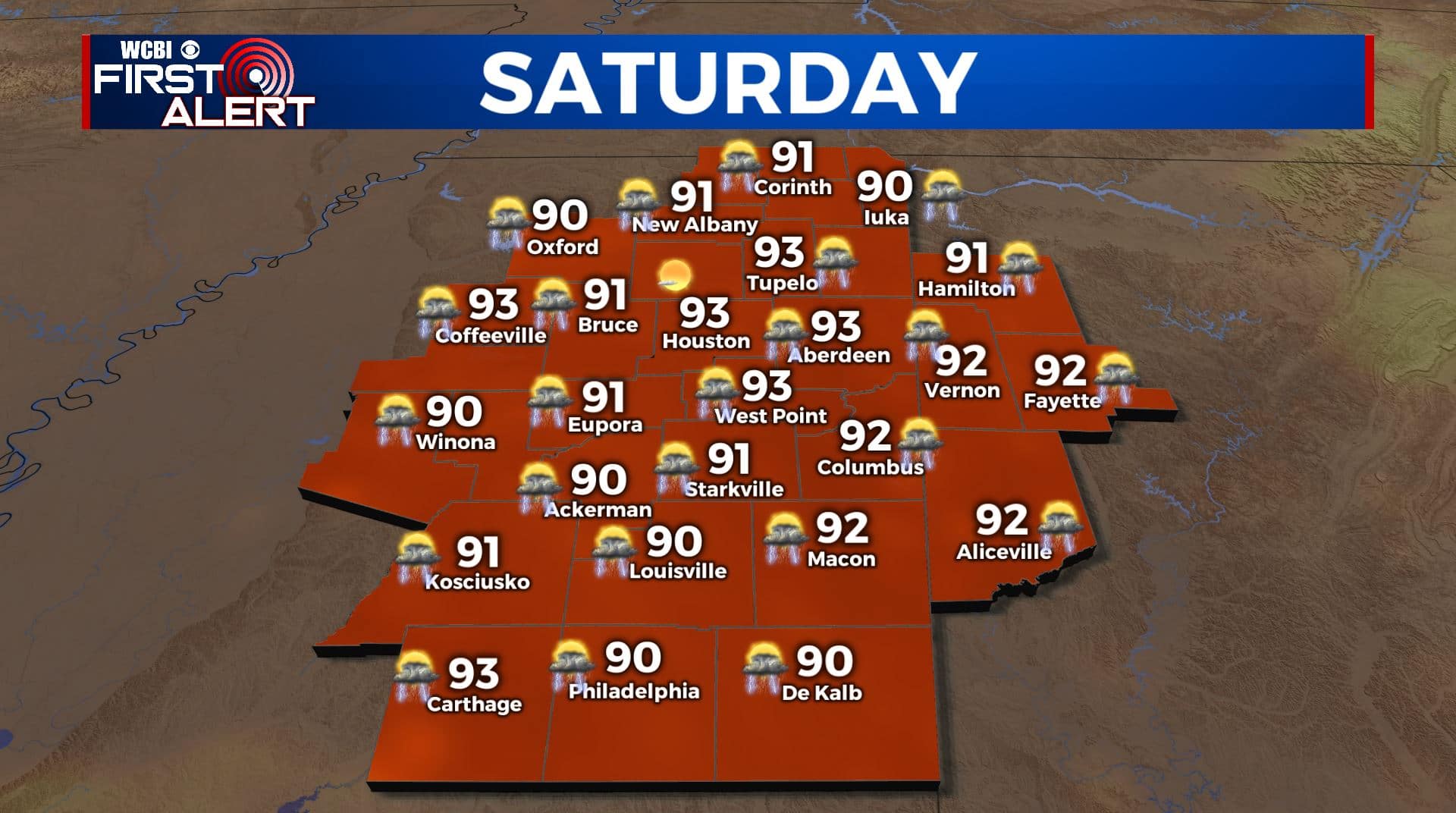
SATURDAY-MONDAY: Partly cloudy, warm, and humid. Highs in the low 90s with heat indices around 100. Lows in the 70s. A daily 30% chance of showers and storms primarily during the heating of the day.
TUESDAY-THURSDAY: Rain chances go up to 40-60% as a weak cold front enters the region. Increased cloud cover may keep highs mainly in the upper 80s for at least a few days.
Follow @WCBIWEATHER on Facebook, Twitter, Instagram, and the WCBI News App


Leave a Reply