Weather remains fairly quiet locally, temperatures stay warm
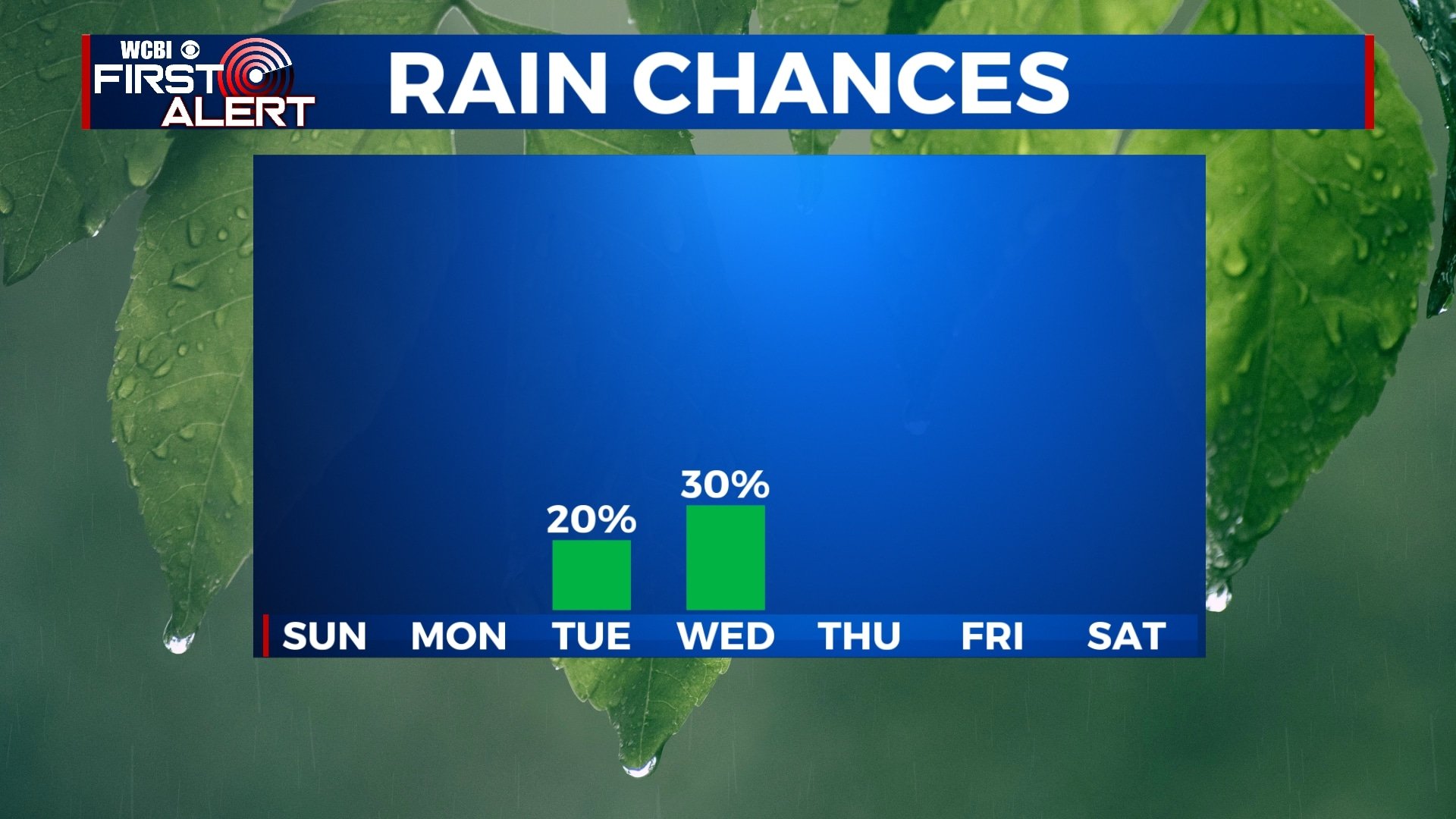
After a few rounds of fall-like weather over the past month or so, warmer weather has returned to the area. Aside from some showers on Tuesday and Wednesday, no major weather is expected over the next seven days.
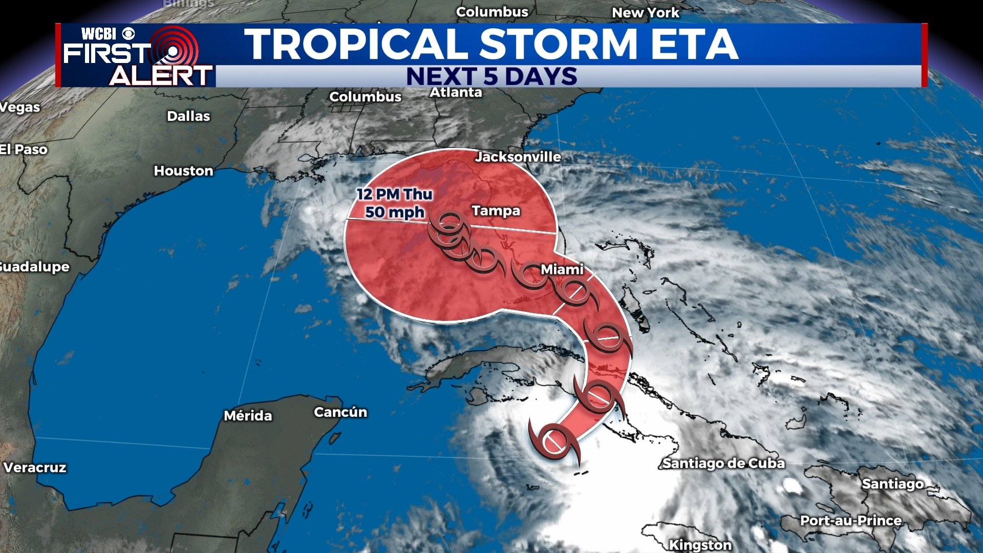
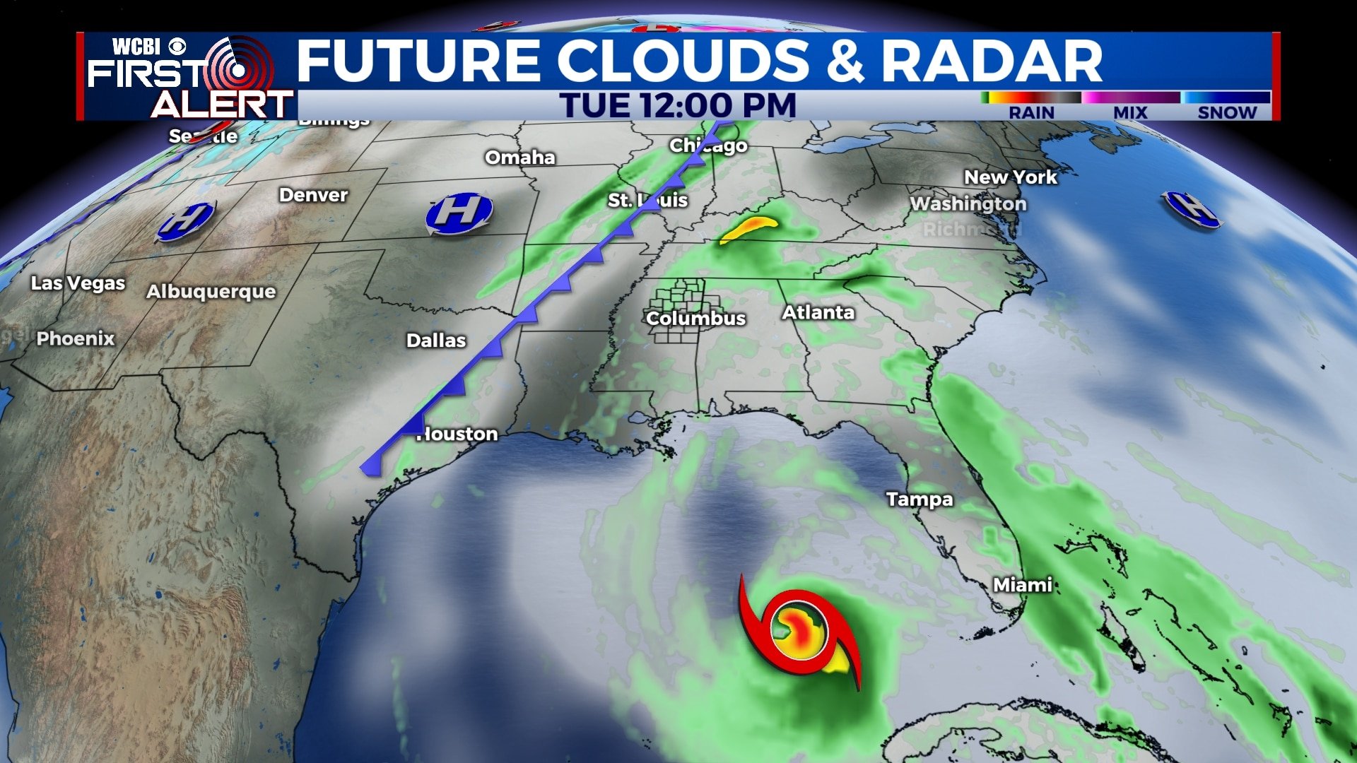
TROPICAL UPDATE: Tropical Storm Eta is currently bringing heavy rain and wind to Cuba and will continue to move north toward Central Florida. Impacts will be felt from Miami up to Tampa and Orlando early next week in the way of flooding rain and wind. As of now, we’re not expecting anything from Eta in our area.
SATURDAY NIGHT: A few clouds will continue to move through the area as temperatures fall to the low 60s by morning. A sprinkle or two is possible, but most will stay dry. Winds will remain light out of the southeast.
SUNDAY: While some clouds will be present on Sunday, we’re expecting a little more in the way of sunshine, which will allow temperatures to climb to near 80 in some spots by the afternoon. Southeasterly winds will be breezy at times, 10-15 mph.
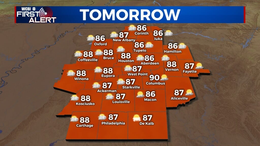
MONDAY-TUESDAY: Temperatures will remain warm for the first half of the week with highs in the upper 70s and morning lows in the low 60s. We’ll see a mix of sun and clouds with a sprinkle or light shower possible on Tuesday.
WEDNESDAY: An approaching cold front will bring us a shot for a shower or two on Wednesday, but we’re not expecting widespread rain. This front will also help to keep Tropical Storm Eta to our east, so we’re not expecting any impacts from that here locally. Morning lows will be in the low 60s with afternoon highs in the mid 70s.
THURSDAY-SATURDAY: Skies will remain partly cloudy for the rest of the week and the weekend with temperatures climbing to the mid 70s each afternoon.
Follow WCBI Weather on Facebook, Twitter, and Instagram
Follow Meteorologist Trevor Birchett on Facebook and Twitter


Leave a Reply