Watching rain & storms chances and the tropics closely
SUMMARY: Showers and storms are likely Thursday, Friday and perhaps into Saturday as a disturbance drifts through the Deep South. Rain chances will lower a bit by Sunday but return next week. Highs will be in the upper 80s to lower 90s as the summer humidity also returns. We are continuing to monitor three tropical systems that could have some impact on the Southeast in the next week or so.
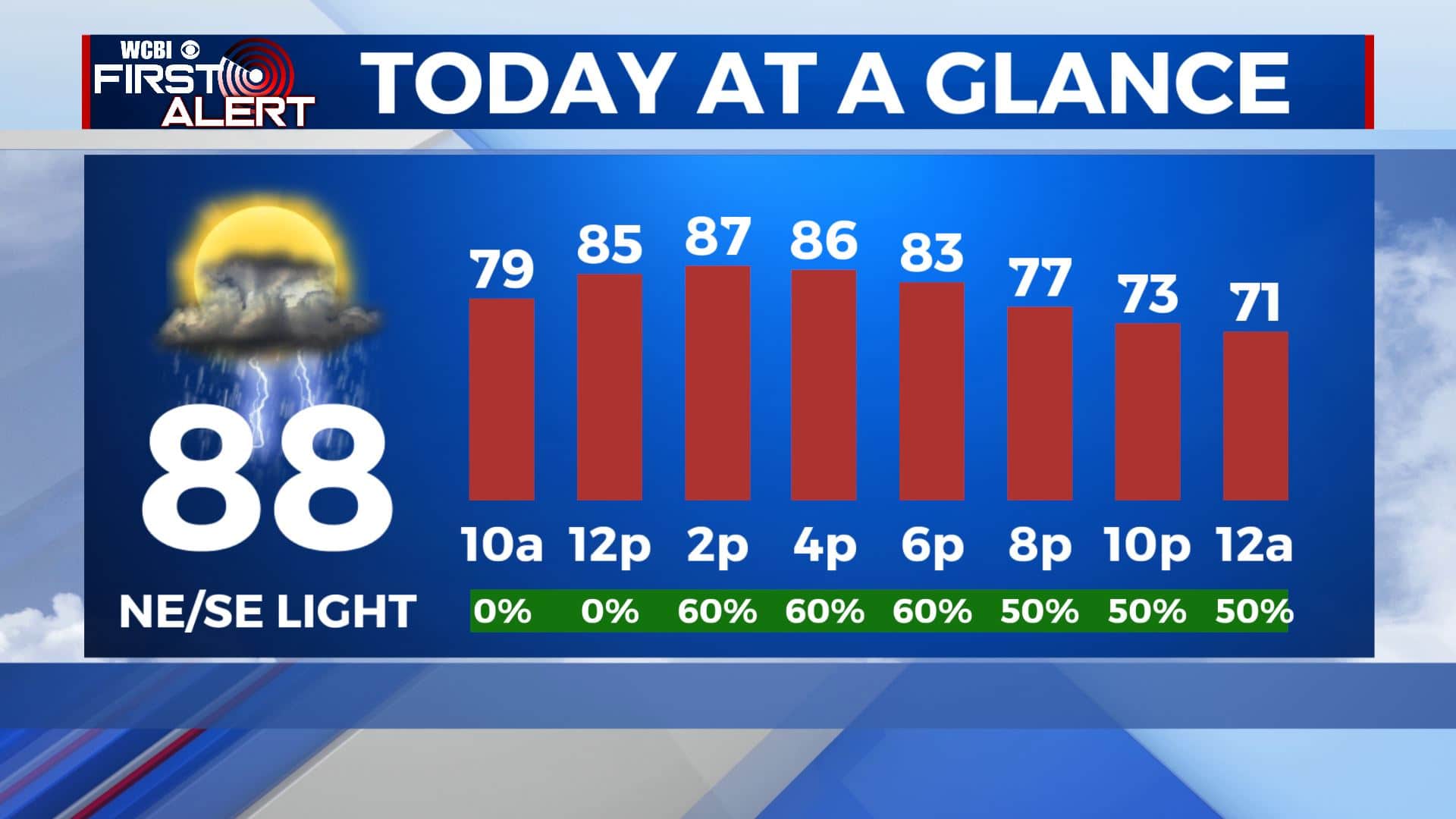
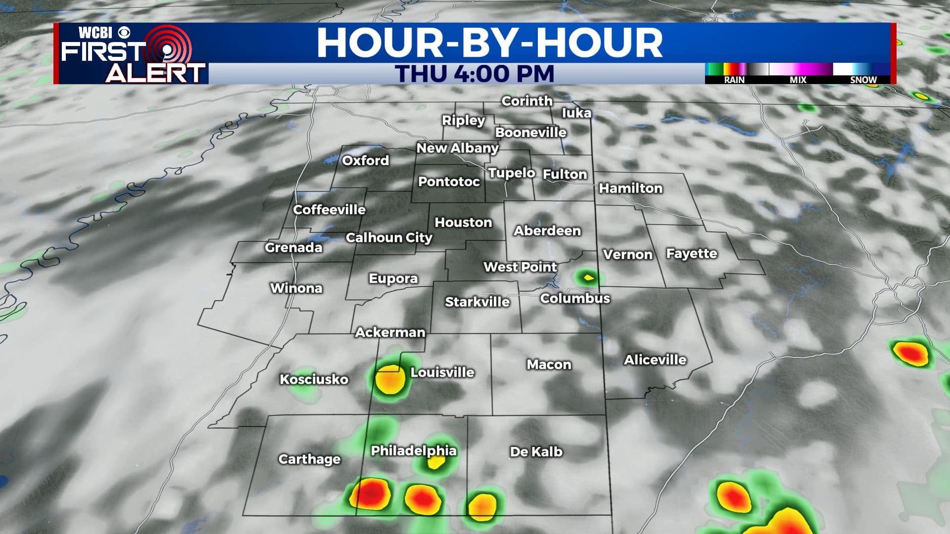
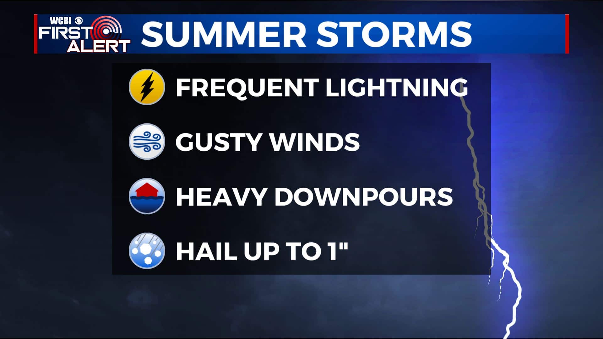
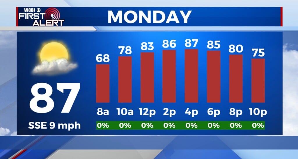
THURSDAY: Some of us are dealing with some mist and patchy fog this Thursday morning while others are just dealing with a mix of sun & clouds. Chances of showers and storms are likely by the afternoon and evening hours. Any storms that pop-up this afternoon will be those usual summertime storms with heavy rain, gusty winds and lightning at times. Keep the umbrella handy! We’ll stay warm with highs in the upper 80s. NE/SE light winds.
THURSDAY NIGHT: A few early evening showers are possible otherwise expect mostly cloudy skies overnight. Lows should dip back into the mid to upper 60s. Calm winds.
FRIDAY: Mostly cloudy. Warm with highs in the upper 80s. Good chances of showers and storms are possible each day. Overnight lows in the upper 60s.
SATURDAY: A mix of sun & clouds with scatted chances of showers and storms. Very warm with highs around 90 and the humidity makes a comeback.
SUNDAY: Sun & clouds. A few isolated showers or t-showers can’t be totally ruled out. Highs into the lower to mid 90s with overnight lows in the low 70s.
EARLY NEXT WEEK: Seasonably warm and humid conditions with highs in the low 90s and a daily chance of passing showers and storms. Lows in the lower 70s.
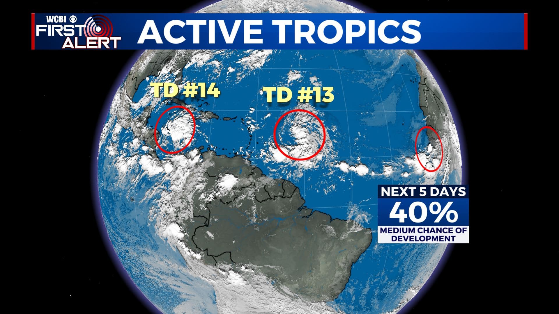
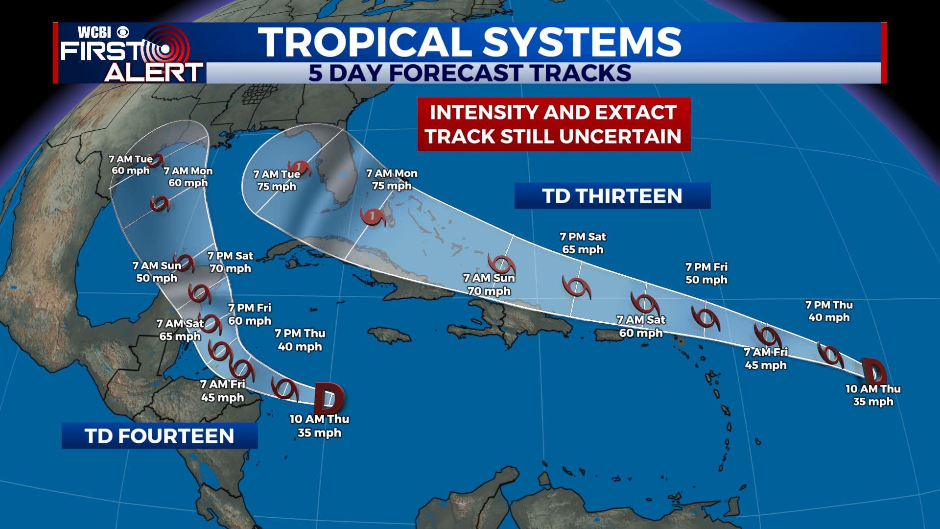
TROPICS: There are still three tropical systems that need to be watched closely. Tropical Depression Fourteen is moving through the eastern Caribbean Sea, while Tropical Depression Thirteen and another one are now in the open Atlantic. They will most likely become Laura, Marco and Nana as they have a good chance of development over the coming days. Some impacts are possible across the Southeast by early next week. If nothing else they may transport a lot of moisture in our region.
Stay connected with @WCBIWEATHER on Facebook, Twitter, Instagram, and the WCBI News App


Leave a Reply