Warmer Friday, Nice Weekend Before Showers and Storms Arrive Next Week
SUMMARY: A picture perfect day is on tap for us across the area as high pressure settles in over the region for the next couple of days. Sunshine returns today and into the weekend with even warmer temperatures through Sunday. Another unsettled weather pattern expected for the work week with showers and storms returning by Monday morning.
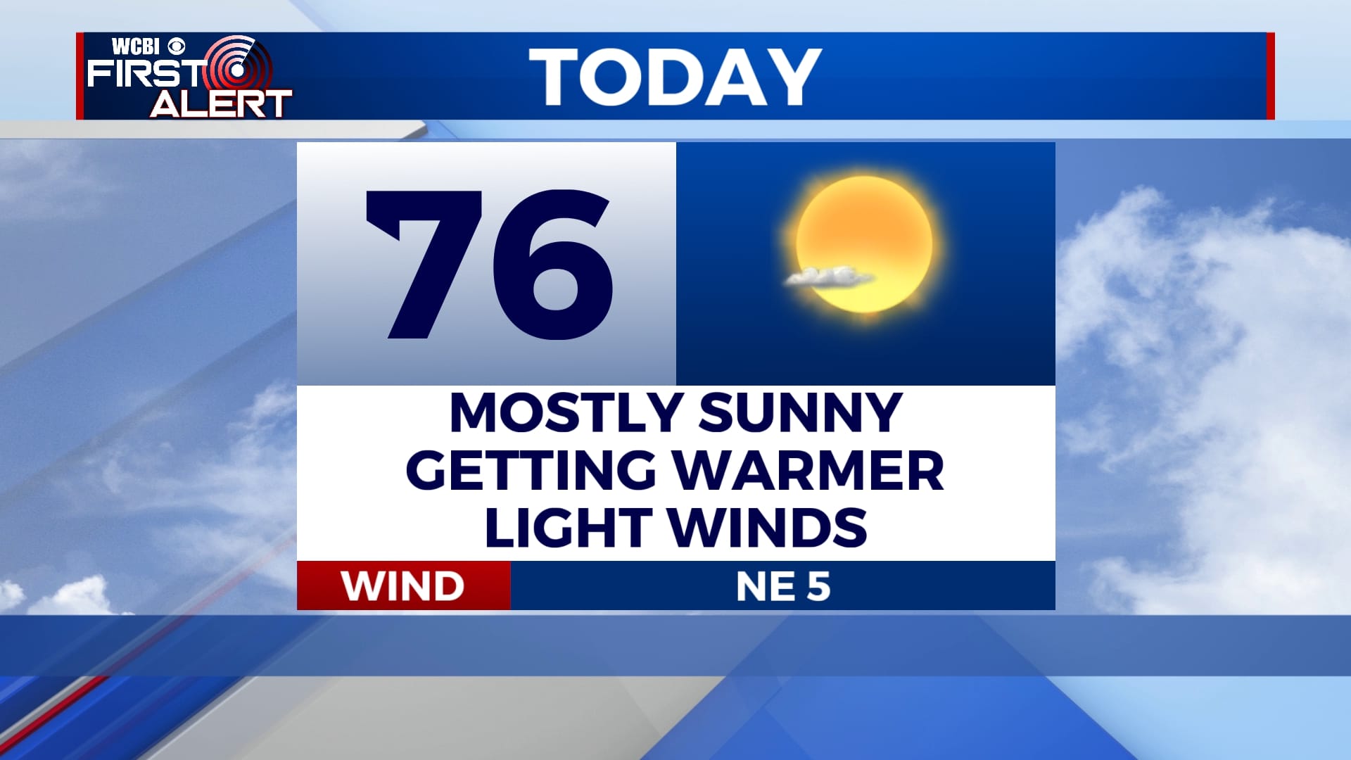
TODAY: Mostly sunny skies with a light northerly wind. Highs today will reach the mid 70s.
TONIGHT: Clear skies but an overall comfortable night. Low temperatures will dip into the lower 50s.
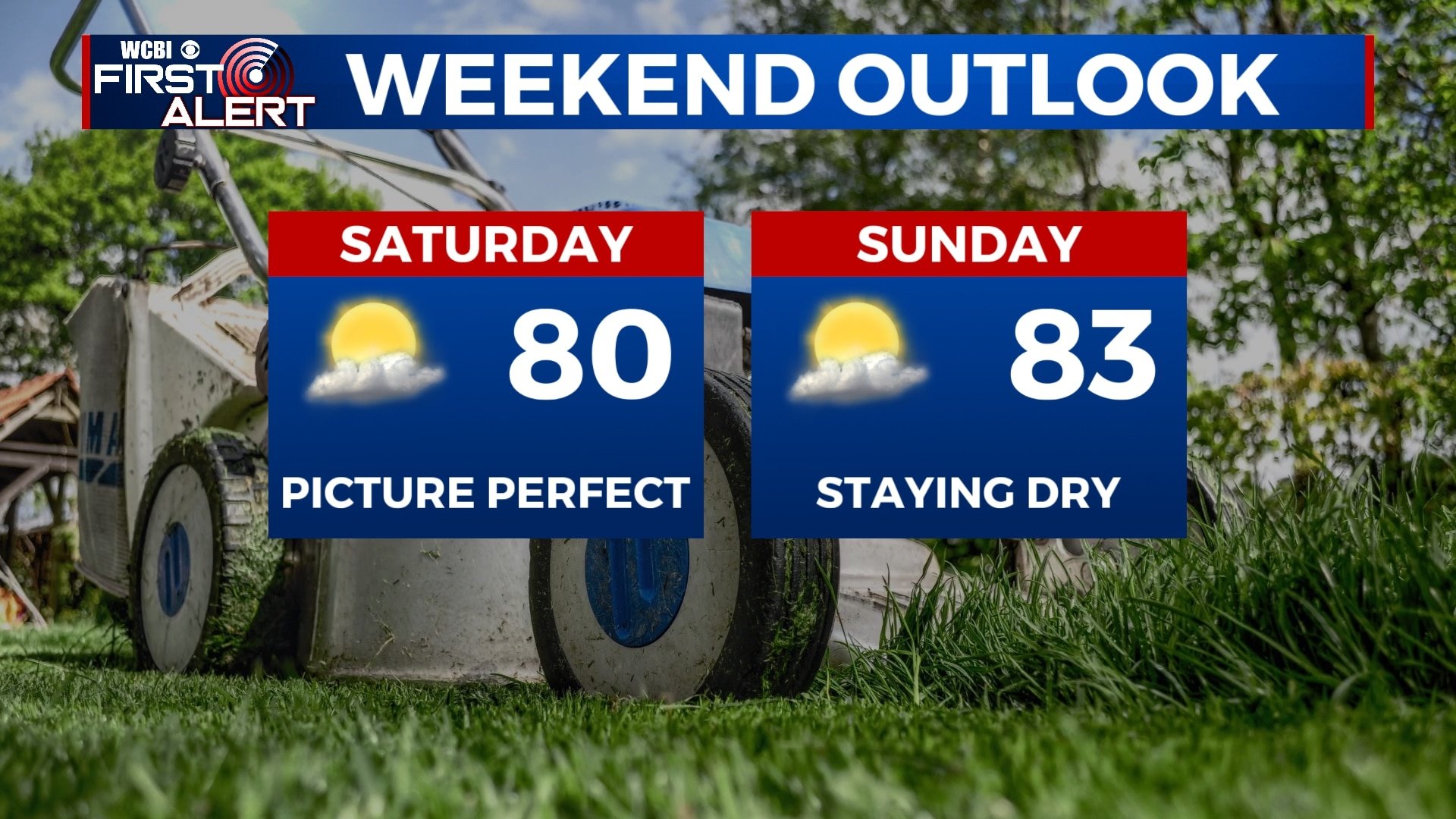
SATURDAY: Winds finally shift out of the south bringing in a bit warmer temperatures in the low 80s with returning sunshine to the area. Overnight lows will be in the 50s.
SUNDAY: A mix of sun and clouds with even warmer temperatures in the low-to-mid 80s. Overnight lows will remain in the 60s.
MONDAY: Showers and storms return to the picture with highs in the low 80s. Heaviest of showers look to remain in the afternoon/evening hours. Overnight lows will be in the 60s.
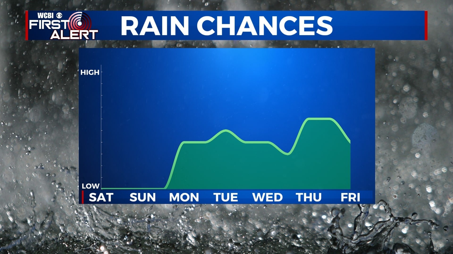
TUESDAY-FRIDAY: Continuing a wet-weather pattern across the area with isolated to scattered showers and storms for most of the work week. High temperatures remain warm in the low 80s.


Leave a Reply