Warmer ahead of weekend storms
COLUMBUS, Mississippi (WCBI) – Conditions calm for the end of the week and into the beginning of the weekend. Temperatures will continue to climb, ahead of the next system bringing in storm potential to northern MS.
FRIDAY NIGHT: A few lingering clouds will move off to the East and NE through the early evening. This will leave a mostly clear sky overnight. Temperatures are expected to drop into the upper 30s to lower 40s tonight.
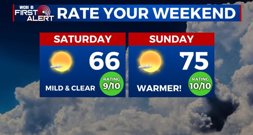
WEEKEND: Saturday will be the day to get outside. There will be a nice mix of sun and clouds, with high temperatures reaching the middle 70s. With the addition of a few extra clouds, overnight lows will be mild.


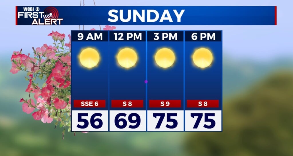
Sunday stays dry for most of the day, as heavier clouds continue to fill in from the SW. By the afternoon, scattered showers will begin popping up. The driving line will bring heavier showers, storms and a potential severe weather threat Sunday night and into Monday morning. The main threats are gong to be gusty wind and hail potential. But late March, tornadoes cannot be ruled out. Stay aware of weather conditions, as storm anxiety will likely be higher.
NEXT WEEK: Once the front clears, conditions will become clearer. Temperatures will hold in the middle 70s most of the week.