Warm early next week before cold return to normalcy
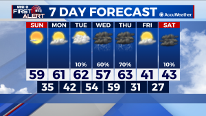
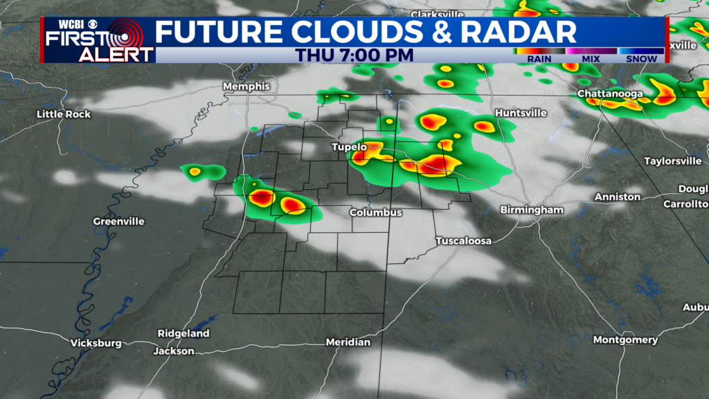
COLUMBUS – SUMMARY: Highs climb into the 60s early next week before a strong cold front pushes lows back into the 40s heading into the weekend. Gradually increasing cloud cover and increased rain chances will stall the warming trend around midweek next week. Rain chances concentrate in the middle part of the week and bring a large chance for decent rain totals.
SUNDAY: It will feel a bit warmer outside Sunday as highs nearly touch 60 in the afternoon. Lows reach into the mid 30s, as clear skies allow for the trend of gradual warming to continue. No rain chance is expected on Sunday.
NEXT WEEK: We warm up into the 60s and stay there until about Thursday, when our next cold front is set to move through. At the highest, afternoon temperatures this week will climb close to the mid 60s, and bring a welcome change from the cold and dreary pattern experienced over the past few weeks. Rain chances in addition to increasing cloud cover will stall the warming trend, and a Thursday cold front will bring back the polar air into the region. Look for highs to drop into the 40s and lows into the 20s after the front passes through.




Leave a Reply