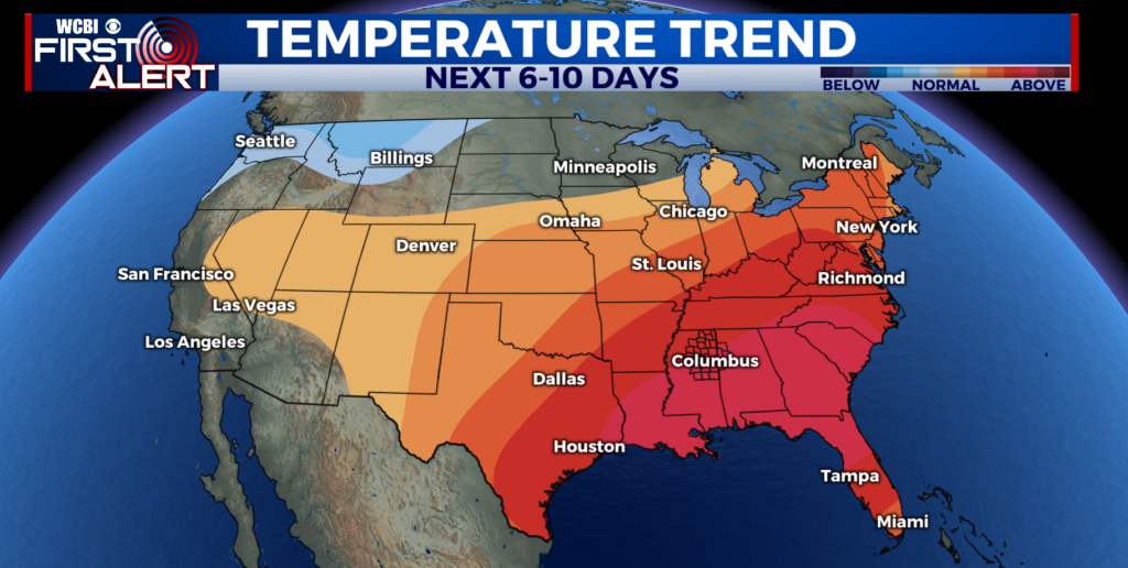
Tuesday front brings temporarily cooler air
COLUMBUS, Mississippi (WCBI) – Briefly cooler air is expected through Wednesday before above average temperatures return for the end of the week and weekend.
TUESDAY: Early clouds will give way to steady clearing into the afternoon with highs in the 60s to low 70s. North to northwest winds will also pick up to 15-20 mph by afternoon.
TUESDAY NIGHT: High pressure will build in through the evening, relaxing winds and keeping the sky clear. This will allow for temperatures to drop to the 39-44 degree range – perhaps the last gasp at “chilly” air for the season.

REST OF WEEK: Sunshine continues Wed-Fri with warming afternoons and nights.
WEEKEND: Saturday stays dry as does most of Sunday. There could be a system to impact parts of the Mid-South late Sunday into Monday with rain and storm potential. Right now, the severity looks questionable…with the more favorable severe weather area closer to the Memphis metro. We’ll watch trends and update throughout the week!