Afternoon Storms Continue, Quieter Tonight
SUMMARY: A Tornado Watch is in effect until 4 pm Tuesday as another round of strong to severe storms with heavy rain is likely for our Tuesday. We’re under a Level 3 Risk. All modes of severe weather are possible. Stay tuned! Much cooler and less humid air is going to build in for a few days starting Wednesday. More storms could return to the region by the end of the weekend early next week.
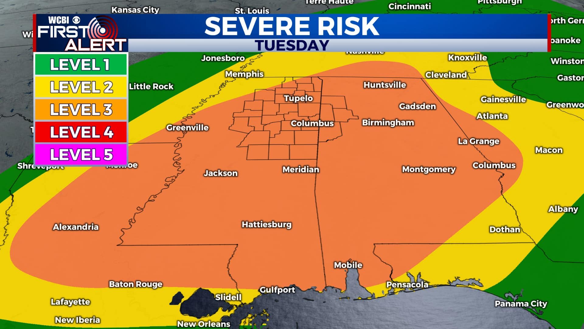
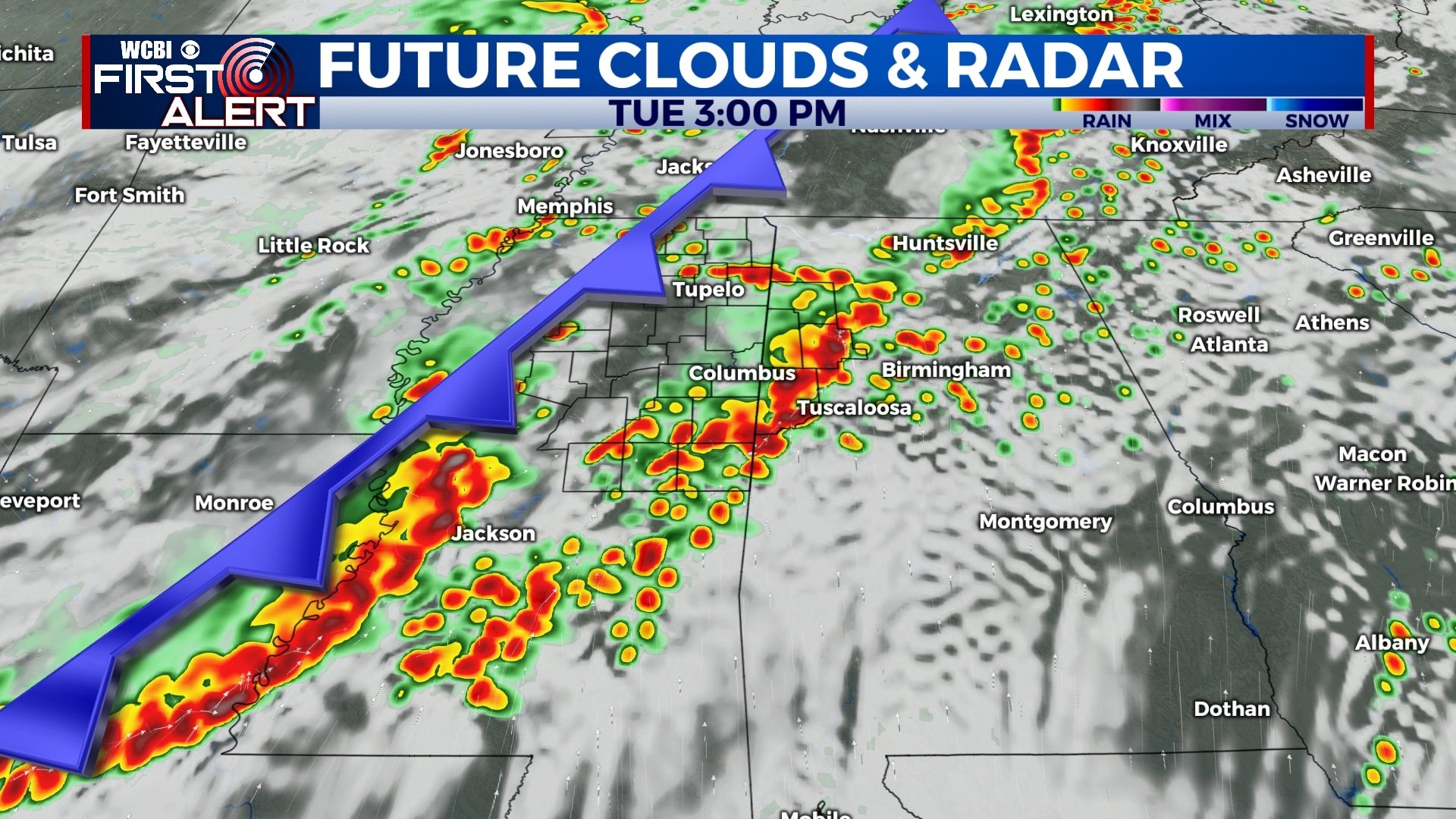
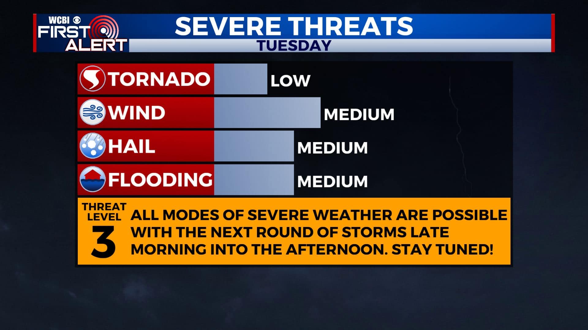
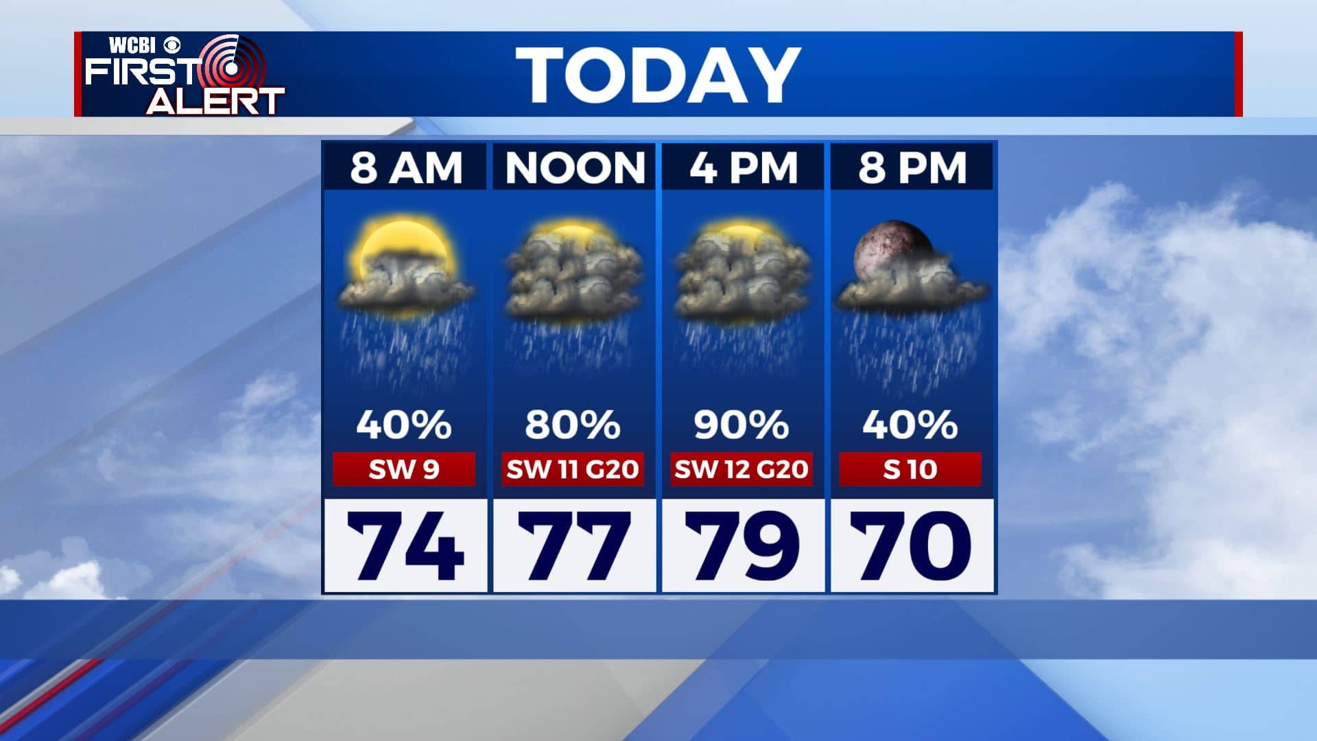
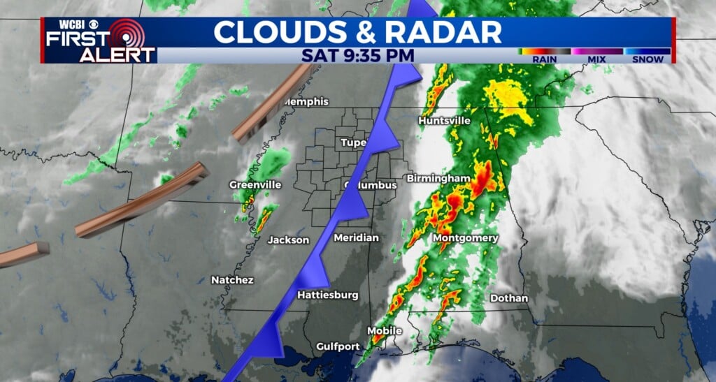
TUESDAY: Morning showers even some thundershowers continue to increase. Expect heavy downpours and maybe some rumbles of thunder, but the severe weather threat will hold off until around midday as a cold front approaches the region. Large hail, damaging wind gusts, heavy rain and perhaps a few isolated tornadoes are the main threats. The most organized activity is likely from late morning through the afternoon into the early evening hours. Highs from the upper 70s to near 80 degrees. Winds SW 10-15 mph, gusts up to 20 mph.
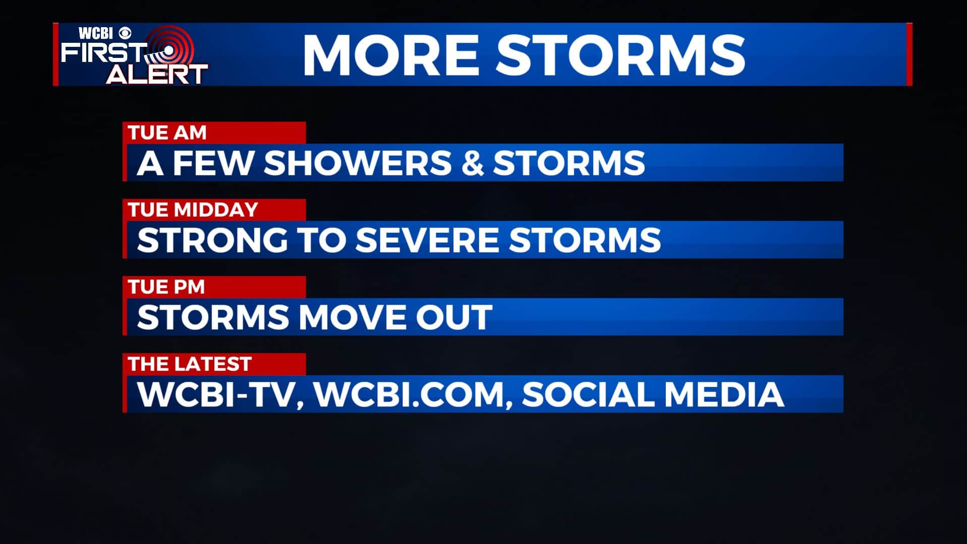
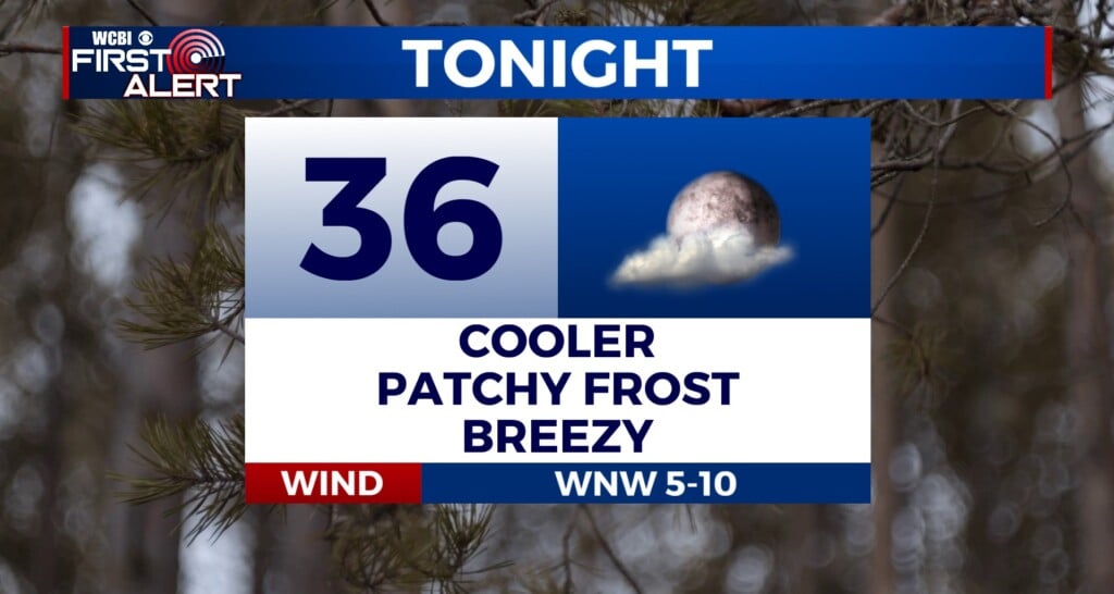
TUESDAY NIGHT: Showers and storms end but cloudy skies hang on overnight. Lows in the upper 50s.
WEDNESDAY: Cloudy to start with sunshine developing during the day. Much cooler and less humid with highs in the lower to mid 70s. NW winds 5-10 mph.
WEDNESDAY NIGHT: Mostly clear skies and cool. Overnight lows in the upper 40s.
THURSDAY: Mostly sunny & cooler. Highs in the lower to mid 70s. Lows in the lower 50s Thursday night.
FRIDAY: Mostly sunny skies. Highs in the mid 70s. Lows around 50 degrees Friday night.
SATURDAY: A mix of sun & clouds. Highs around 80 degrees. Lows in the upper 50s Saturday night.
SUNDAY-MONDAY: Chance of showers and storms. Highs in the mid 80s.
Stay connected with @WCBIWEATHER on Facebook, Twitter, Instagram, and the WCBI News App.


Leave a Reply