Take precautions to stay cool once again for your Wednesday
SUMMARY: A Heat Advisory is once again in effect for our Wednesday as the extreme heat and humidity will remain in place the rest of the workweek into the weekend. Take the proper precautions to stay cool & hydrated to help prevent heat stress or heat exhaustion issues! While a few stray storms are possible Wednesday, rain chances overall will take a back seat to sun in the near term. Higher odds of rain (and cooler temps) look to return by Sunday and early next week. 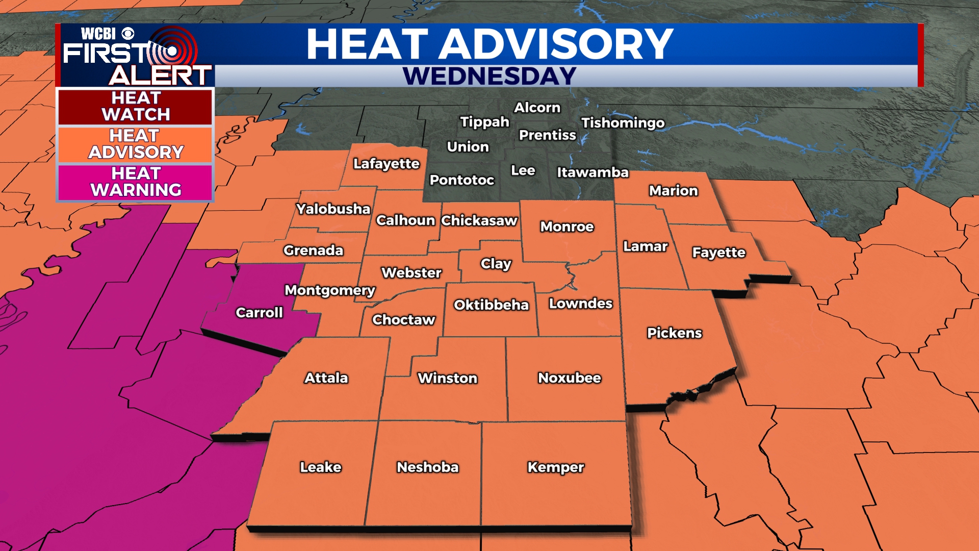
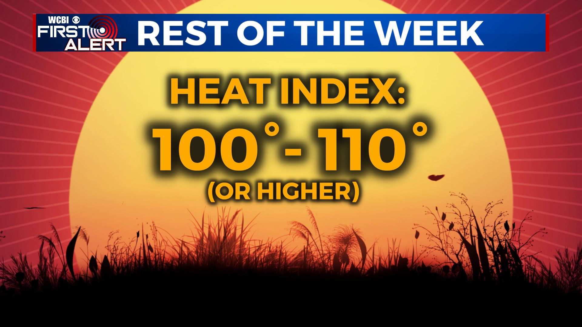 WEDNESDAY: Mix of sun & clouds, hot, and humid. Highs in the lower to mid 90s. Heat indices up to 110. A chance of pop-up showers and storms.
 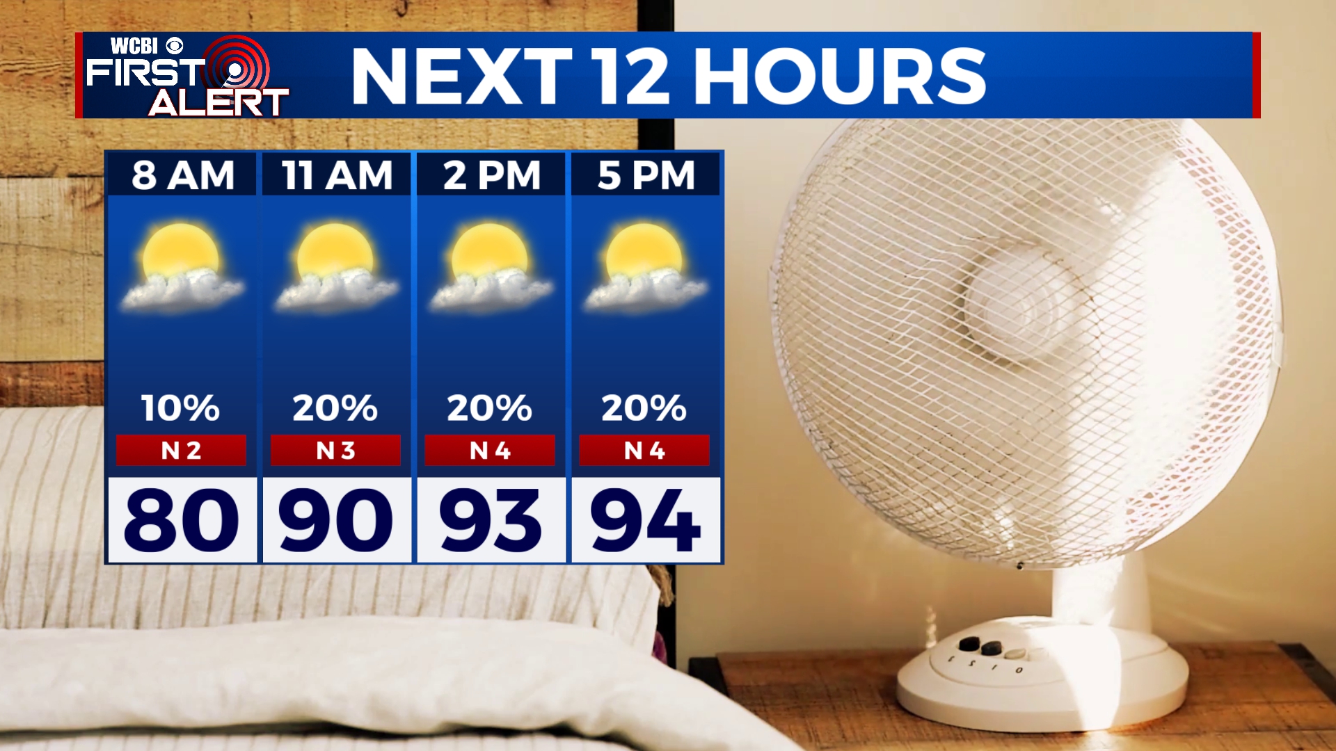 WEDNESDAY NIGHT: Clear skies and muggy. Overnight lows in the mid 70s. THURSDAY & FRIDAY: Continued hot and humid. Highs in the mid 90s with heat indices near 110 during the afternoon. While a few isolated storms are possible no widespread activity is likely. Overnight lows stay in the mid 70s. WEEKEND: Mix of sun & clouds, hot, and humid. Highs in the mid to upper 90s with heat indices well into the 100s. An isolated chance of pop-up storms. MONDAY: A chance of showers and storms with a cold front approaching the region. Temperatures much cooler in the upper 80s. TUESDAY: Mix of sun & clouds. Temperatures remain in the upper 80s. A chance of pop-up showers and storms. Stay connected with @WCBIWEATHER on Facebook, Twitter, Instagram and the WCBI News App


Leave a Reply