Summertime weather continues & watching the tropics
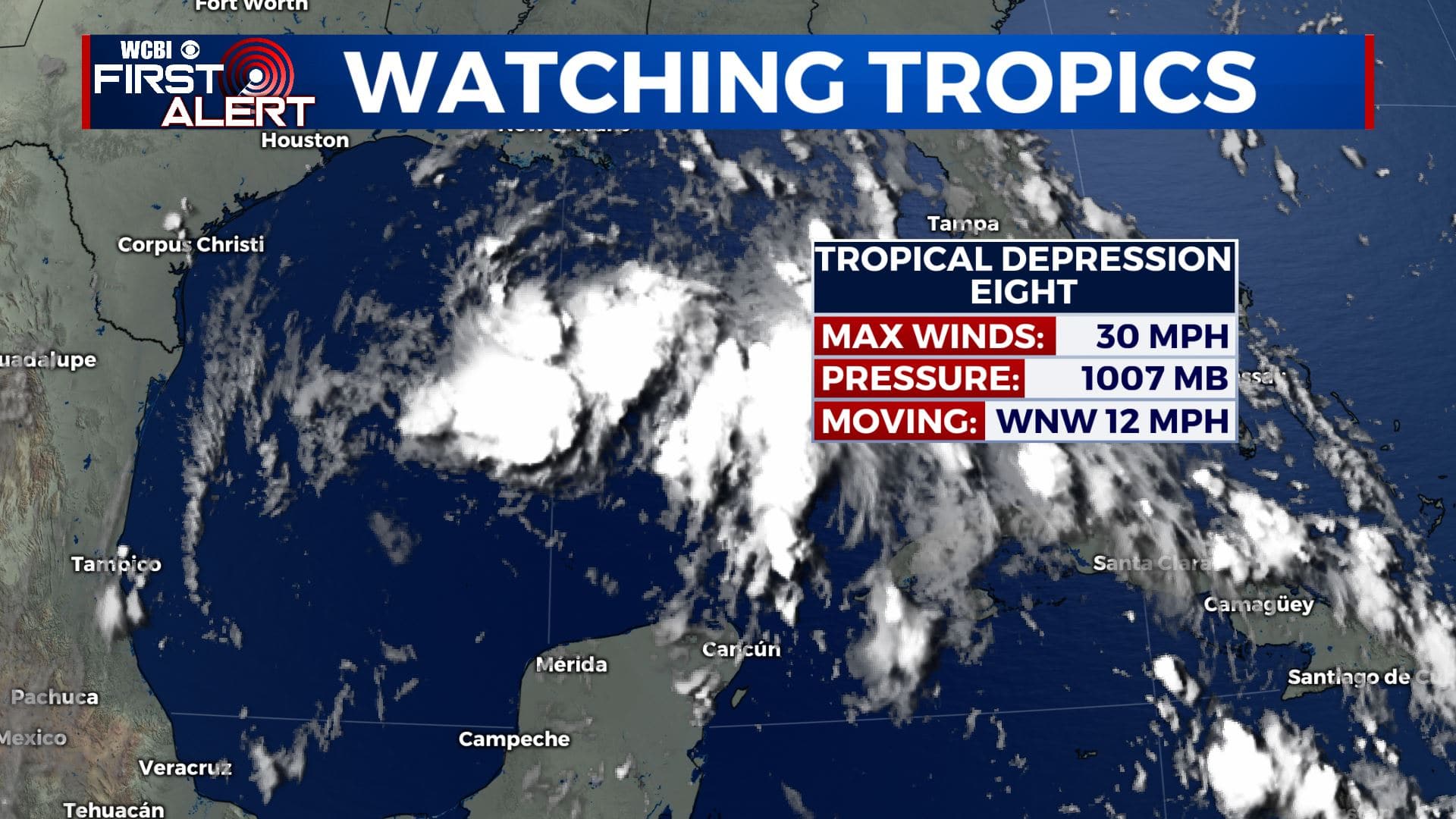
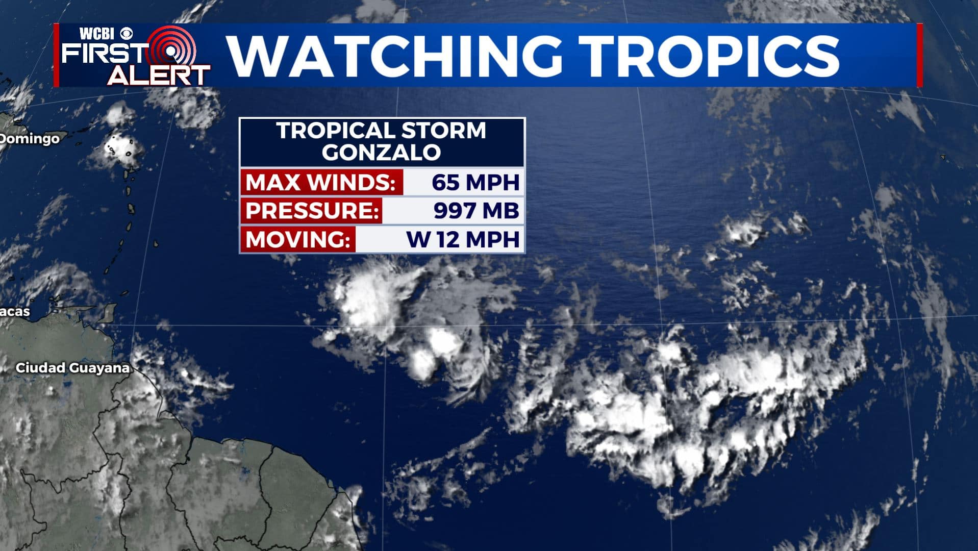
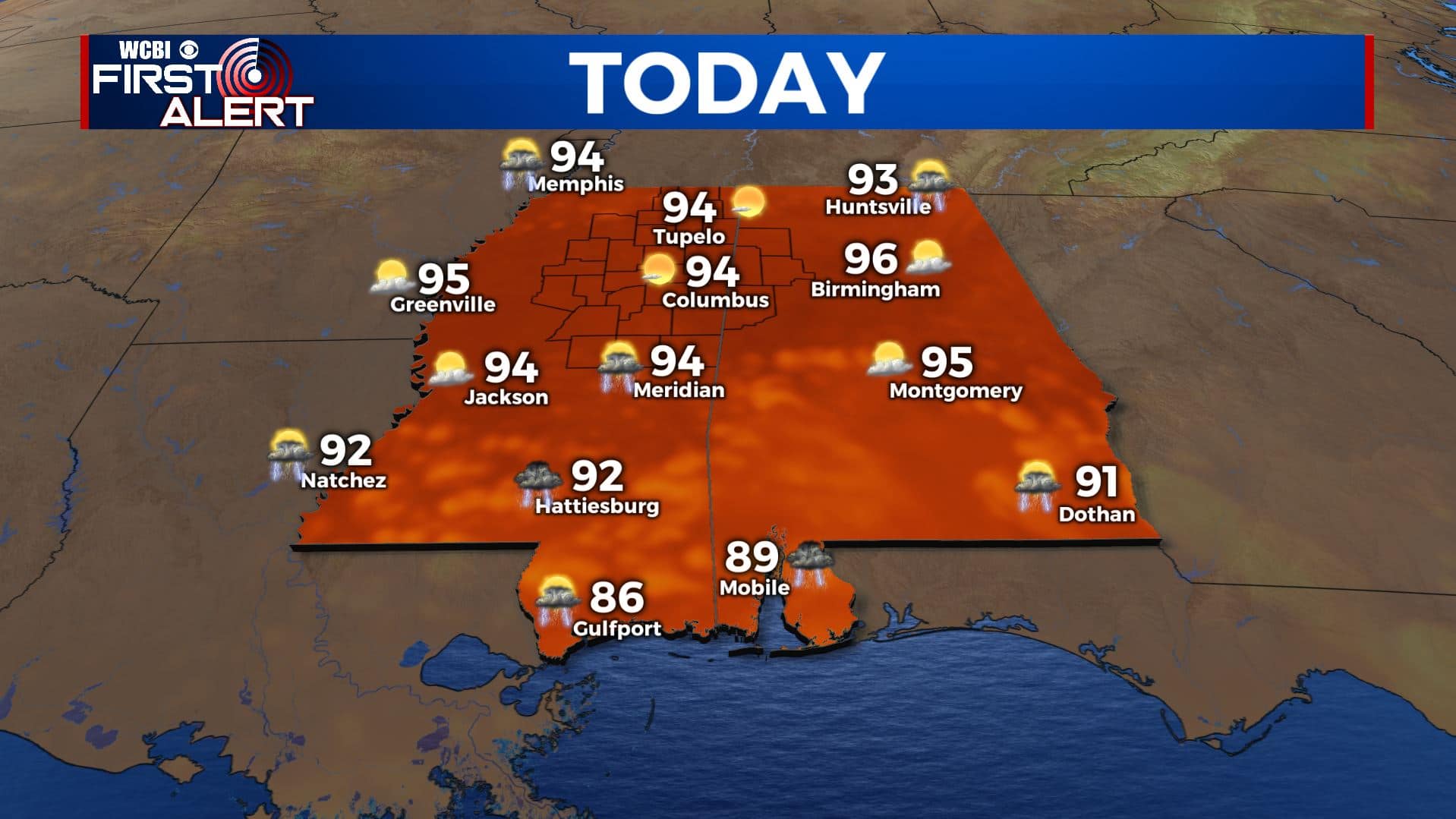
SUMMARY: The late July summer heat and humidity will continue as we end the workweek and head into the weekend with highs in the mid 90s. Heat index values will be approaching 100 degrees or more at times. Afternoon pop-up showers and storms will be possible everyday, but not looking to be a washout. We’re also watching the tropics with both Tropical Storm Gonzalo in the Atlantic Ocean and Tropical Depression Eight in the Gulf of Mexico. They are not expected to have any impact on our area at this time.
THURSDAY: Another hot and humid day is ahead along with afternoon pop-up showers & storms for our Thursday. Highs in the mid 90s with heat index values over 100. SE winds 5-10 mph. Stay cool!
THURSDAY NIGHT: Partly cloudy to mostly clear after any isolated storm fades away. Overnight lows will be in the 70s.
FRIDAY: Hot and humid weather will continue for the remainder of the week with temperatures climbing into the mid 90s each afternoon. Chances for afternoon pop-up storms will be there, but still not everyone will see rain each day. If you’re lucky enough to see a quick downpour, it will help to cool you down a few degrees.
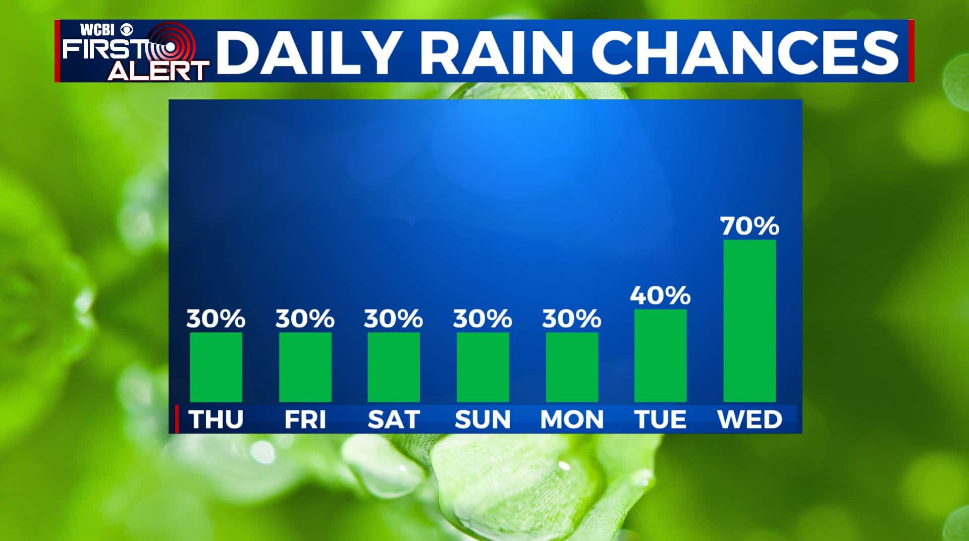
WEEKEND-TUESDAY: As of right now, the weekend into early next week is looking dry for the most part aside from a few afternoon pop-up scattered showers or storms. High temperatures will remain hot with highs in the lower to mid 90s. Overnight lows in the mid 70s with partly cloudy to mostly clear skies.
WEDNESDAY: We’ll be watching closely our weather for midweek next week as a cold front is looking to push through the region to help bring us some relief from the summer heat and more widespread rain chances. Highs only in the upper 80s to near 90.
Stay connected with @WCBIWEATHER on Facebook, Twitter, Instagram, and the WCBI News App


Leave a Reply