Summer pattern continues
SUMMARY: Late July weather in the Deep South usually means high heat and humidity along with pop-up storms. That’s indeed what’s on our plate for at least the next week. Most rain and storm activity will be from late morning through early to mid evening. Some of you may get soaked from time to time while others remain dry.
TUESDAY NIGHT: Isolated evening storms then partly cloudy to mostly clear. Lows in the mid to low 70s with light wind. Some patchy fog is possible.
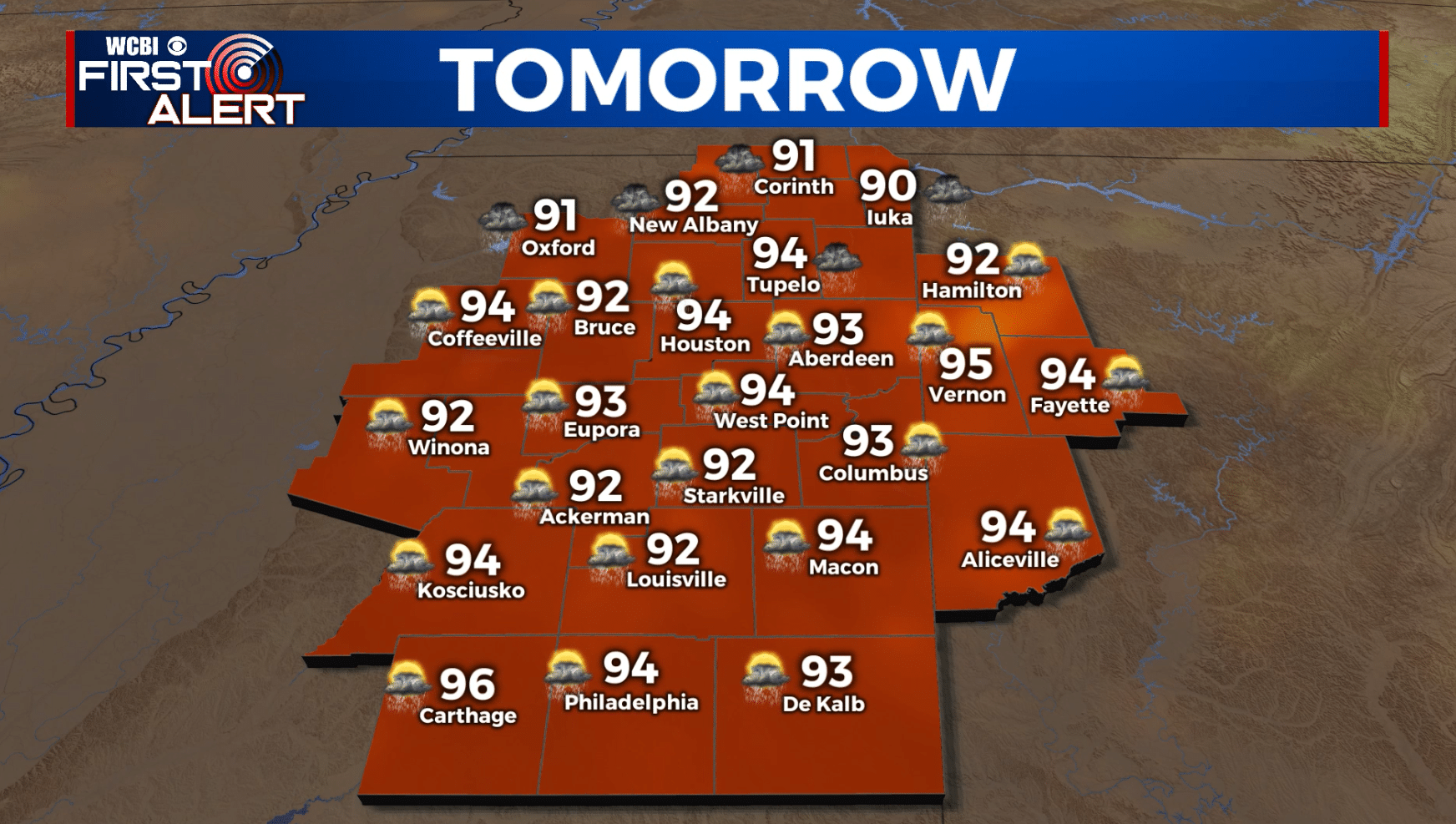
WEDNESDAY: Partly cloudy, hot, and humid. Highs in the low 90s with heat indices over 100. More pop-up showers and storms are possible from late morning through the afternoon and into the early evening hours. The chance of rain is about 40%.
WEDNESDAY NIGHT: Turning mostly clear to partly cloudy after any isolated storm fades away. Lows will be in the mid to low 70s.
THURSDAY-TUESDAY: Partly cloudy, hot, and humid. Daily pop-up showers and storms will remain possible. Highs in the 90s with heat indices in the 100s. Lows in the 70s.
Follow @WCBIWEATHER on Facebook, Twitter, Instagram, and the WCBI News App


Leave a Reply