Stormy end to 2020, start to 2021
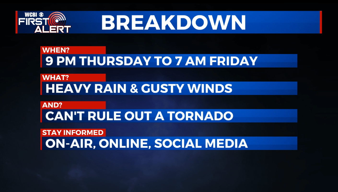
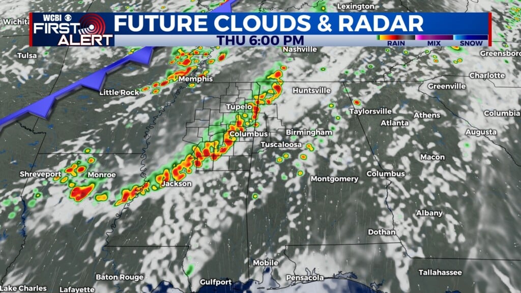
SUMMARY: A big storm system and cold front will affect the region Thursday and Friday. While scattered showers are possible tonight and during the day Thursday, the most intense weather is expected Thursday night and early Friday morning. Gusty winds and rain continue to be the main concerns for our area but we can’t totally rule out an isolated tornado. Don’t let down your guard but this doesn’t appear like it will be a major severe weather event in our area at this time.
WEDNESDAY NIGHT: Mostly cloudy with areas of rain possible, especially across our northwestern counties. Milder mid/upper 50s across our SE counties, including the Golden Triangle. Colder mid/low 40s across our NW counties. Winds 5-15 mph.
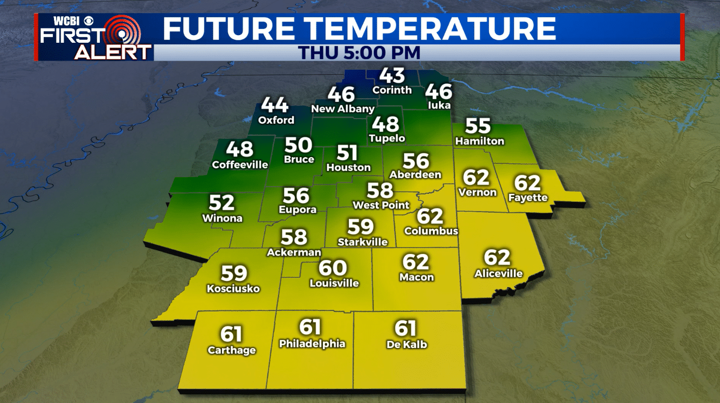
THURSDAY: Cloudy with areas of rain & showers during the day. Daytime high temperatures ranging from the low 50s north to the low 60s south. Winds E 5-20 mph with higher gusts.
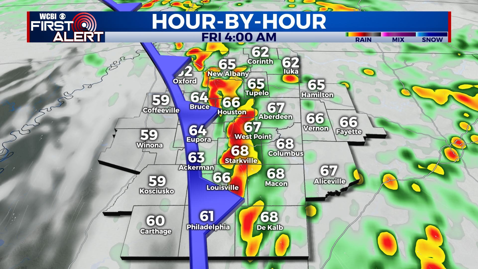
THURSDAY NIGHT: Rain and storms. Some storms could be severe with damaging wind gusts and perhaps even an isolated tornado. Rising temperatures into the mid 60s. Breezy SE winds 15-25 mph with gusts over 30 mph possible.
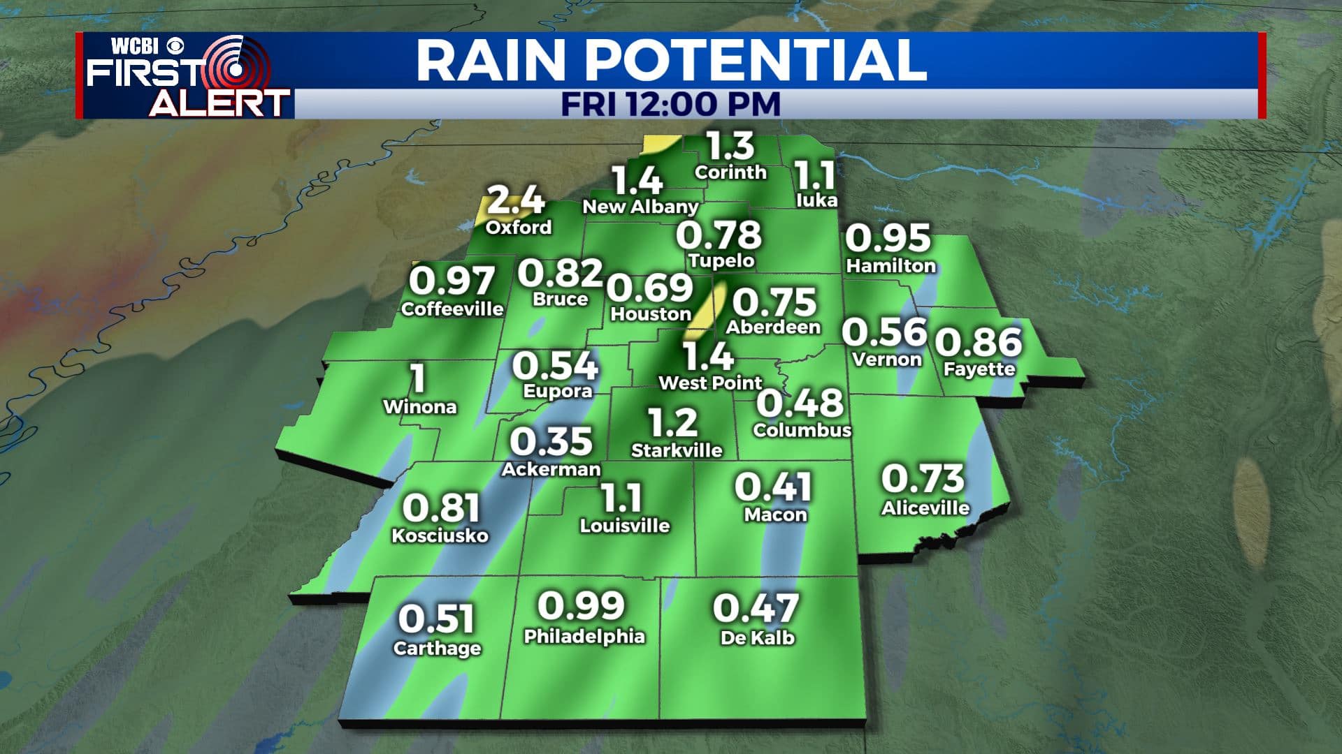
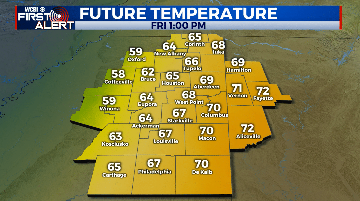
NEW YEAR’S DAY: Early day rain & thunder with developing sunshine by late morning. Breezy SW winds 10-25 mph with gusts over 30 mph. Very mild highs in the upper 60s to low 70s.
FRIDAY NIGHT: Variably cloudy and colder. Lows around 40.
SATURDAY: A mix of clouds and sun with a slight chance of a shower or two. Highs in the low to mid 50s.
SATURDAY NIGHT: Colder. Lows in the mid 30s.
SUNDAY: Mostly sunny. Highs in the 50s.
MONDAY: Mostly sunny. Highs in the low 60s.
Follow @WCBIWEATHER on Facebook, Twitter, Instagram, and the WCBI News App


Leave a Reply