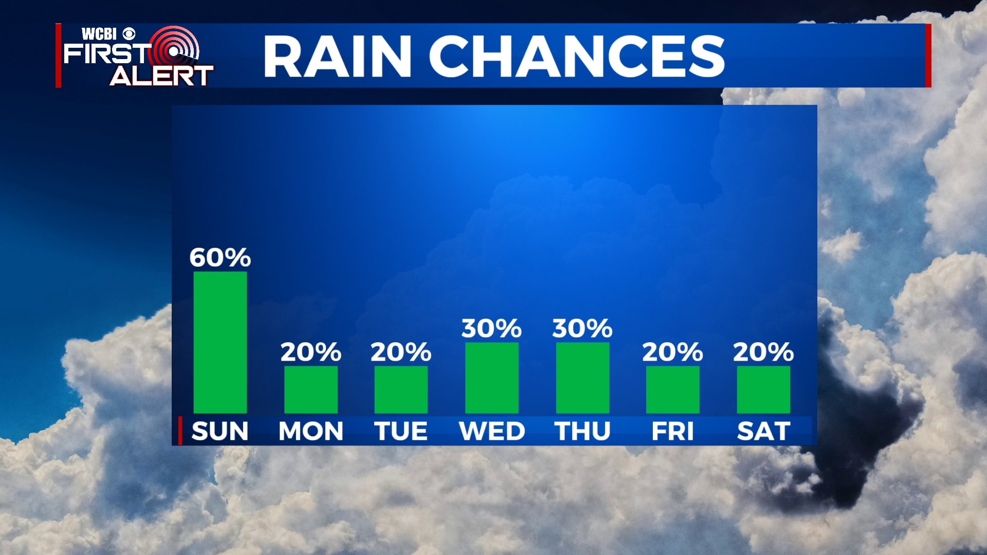
Storms likely Sunday, hot weather continues
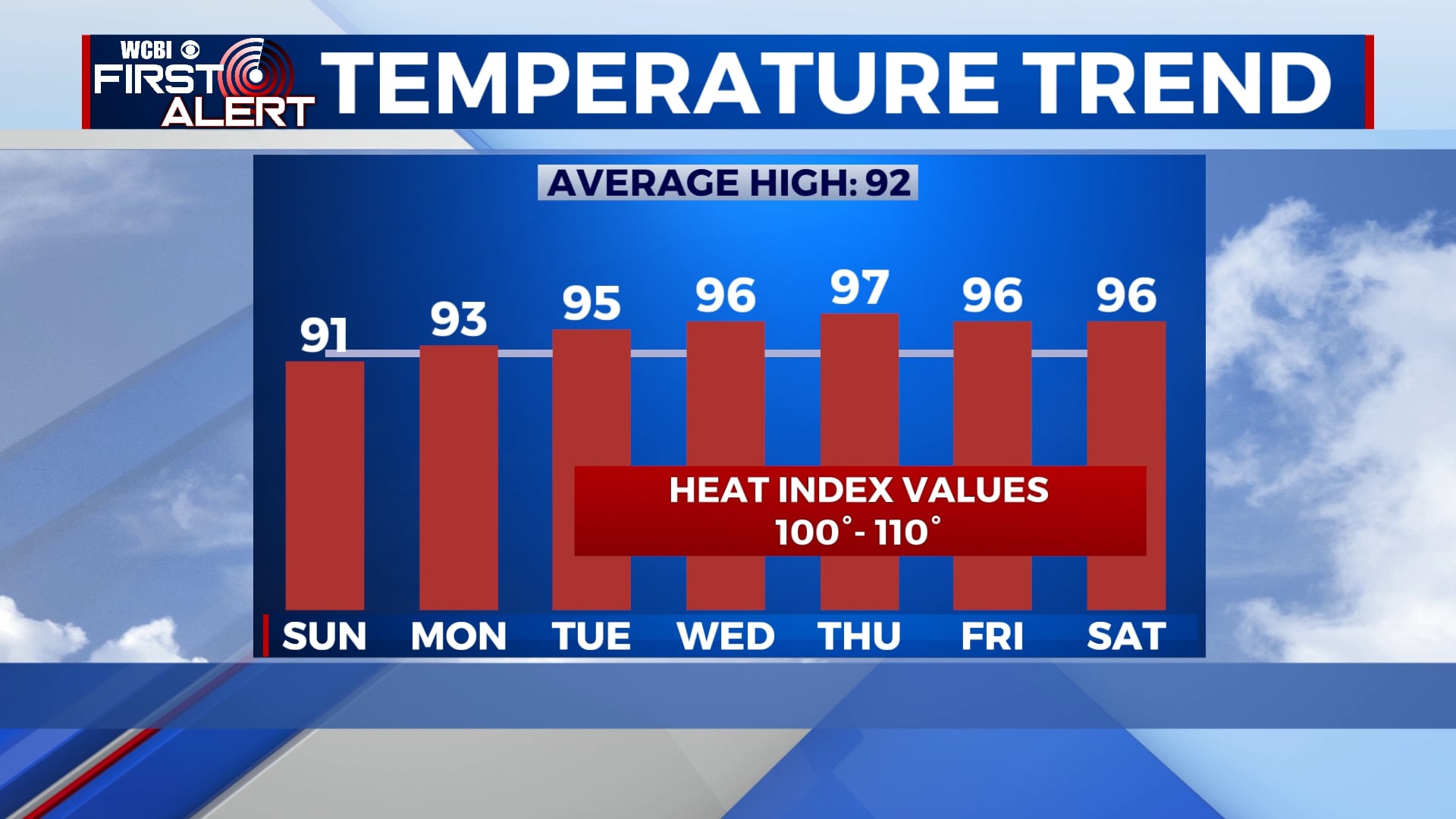
It will certainly be feeling like July for the next several days with highs climbing into the mid and upper 90s and heat index values closer to 110 at times. Storms will be likely Sunday, but rain chances are minimal for the remainder of the week.
SATURDAY NIGHT: We’ll remain mostly clear and warm tonight with lows in the low 70s. Clouds will increase after midnight with storms possible by sunrise. Winds will be generally light out of the southwest.
SUNDAY: We’re expecting a complex of storms to move through the area early on Sunday between 5am and 10am. Pop-up storms will remain possible through the rest of the day as temperatures climb into the low 90s. Storms through the day on Sunday could produce damaging wind, heavy rain, or small hail. Heat index values will be as high as 105 at times if you aren’t caught in the rain.
MONDAY-TUESDAY: Rain chances diminish significantly going into next week with only an off chance of an isolated shower or storm. Skies will remain mostly sunny, allowing our temperatures to climb into the low and mid 90s. Heat index values will be near 105 in the peak hours of heating.
WEDNESDAY-SATURDAY: We’ll see a mix of sun and clouds for the rest of the week and into the weekend as temperatures continue to rise. Afternoon highs will be as high as the upper 90s in spots with heat index values approaching 110. Again, an isolated shower or storm will be possible, but most of us won’t see any relief from the heat. Morning lows will remain in the low to mid 70s.


Leave a Reply