Staying warm with increased cloud coverage
COLUMBUS, Mississippi (WCBI) – Temperatures will stay well above average through Saturday. A strong front will knock temperatures down quite a bit Sunday into Monday.
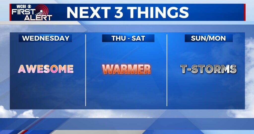
TUESDAY: After Monday’s stunning day, clouds will be more widespread (thanks to an incoming stalling front)with highs in the middle 70s. While most of the day will be dry, a sprinkle or light shower will be possible.
TUESDAY NIGHT: Clouds stay fairly widespread with lows in the upper 50s.
WEDNESDAY: Tuesday’s stalled front will retreat north, dragging warmer and potentially more unstable air northward. At least isolated showers and possibly a storm or two aren’t out of the question by midday into the afternoon hours. Highs will stay in the middle 70s.

REST OF WEEK/WEEKEND: The sky will be variably cloudy Thursday – Saturday w/highs well into the 70s. It still looks like Saturday may be warmest day before big changes arrive Sunday. After Sunday, a wacky weather pattern may set up with lots of changes/weather systems the week of Valentine’s!