Stay weather aware late Friday into Saturday morning
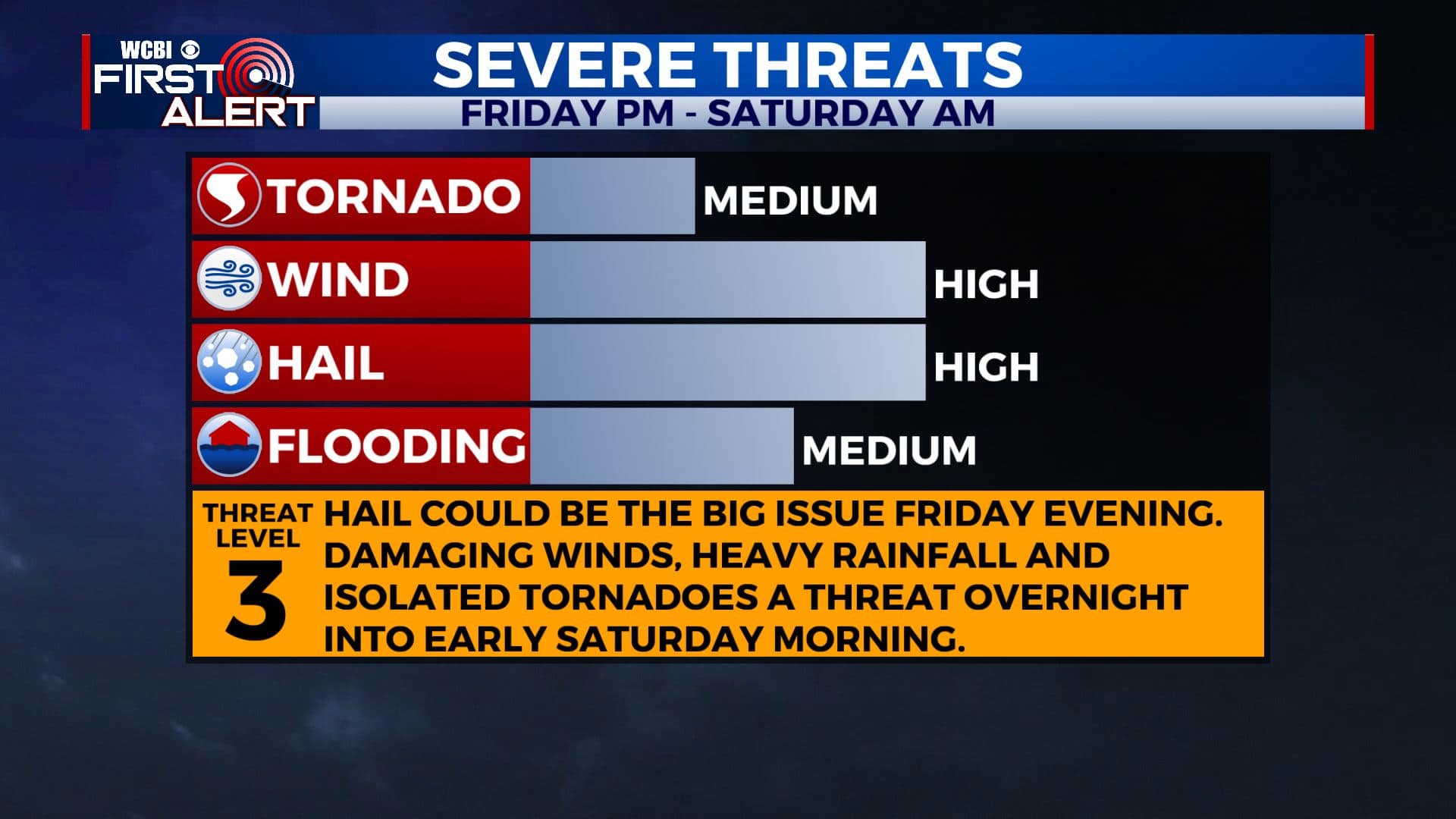
SUMMARY: Another round of strong to severe storms and heavy rain is likely from Friday evening through early about sunrise Saturday. We are under a Level 3 Risk for severe weather while areas to our south and west are under a Level 4. All modes of severe weather are possible. Stay tuned to WCBI for the very latest! Conditions will settle down by midday Saturday. Quiet weather can be expected to carry over into Sunday and into early next week.
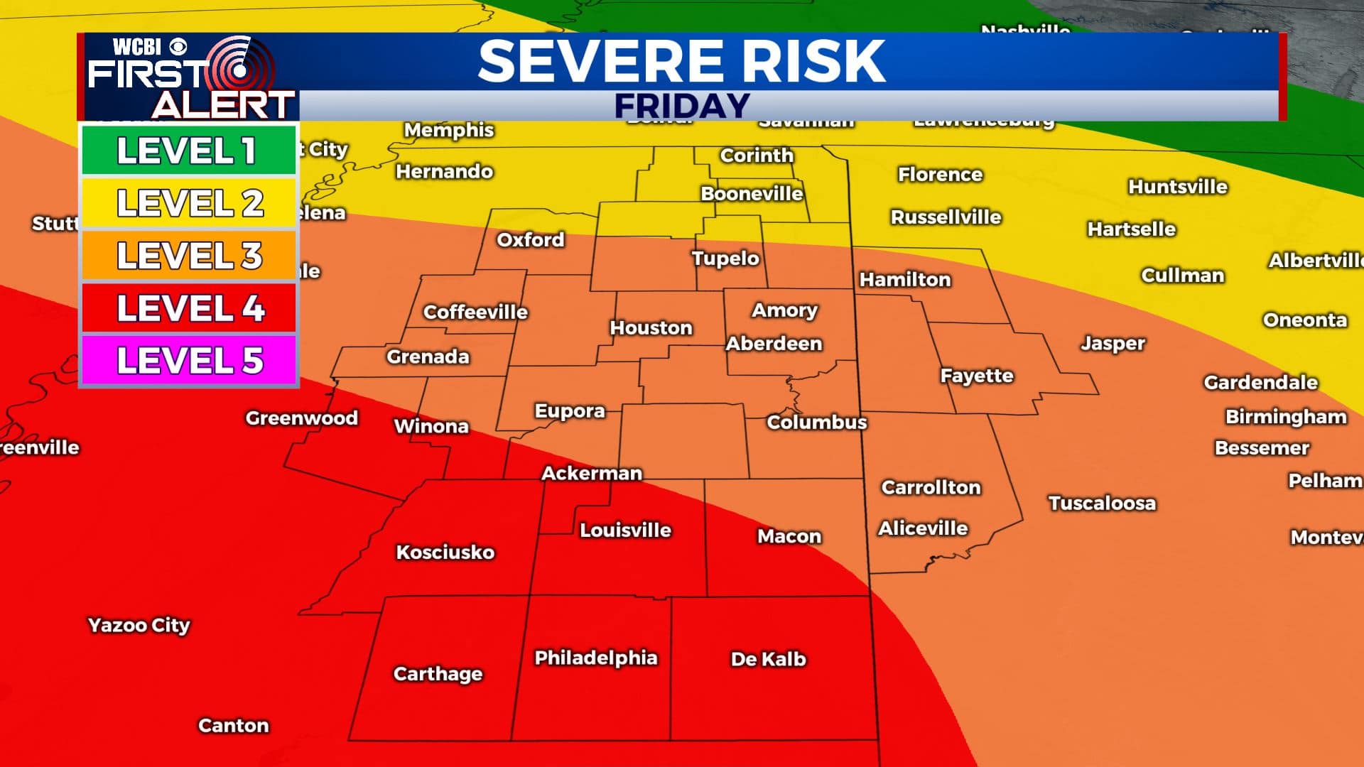
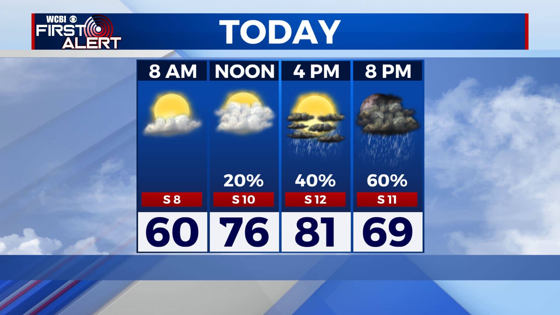
FRIDAY: Clouds are increasing this morning and will continue throughout the day. It will be very warm with highs in the lower 80s with a brisk south wind at 10-15 mph. A few showers and storms are possible during the afternoon. Higher odds of scattered storms will return by the evening hours. Large hail could become an issues with some of the storms Friday evening.
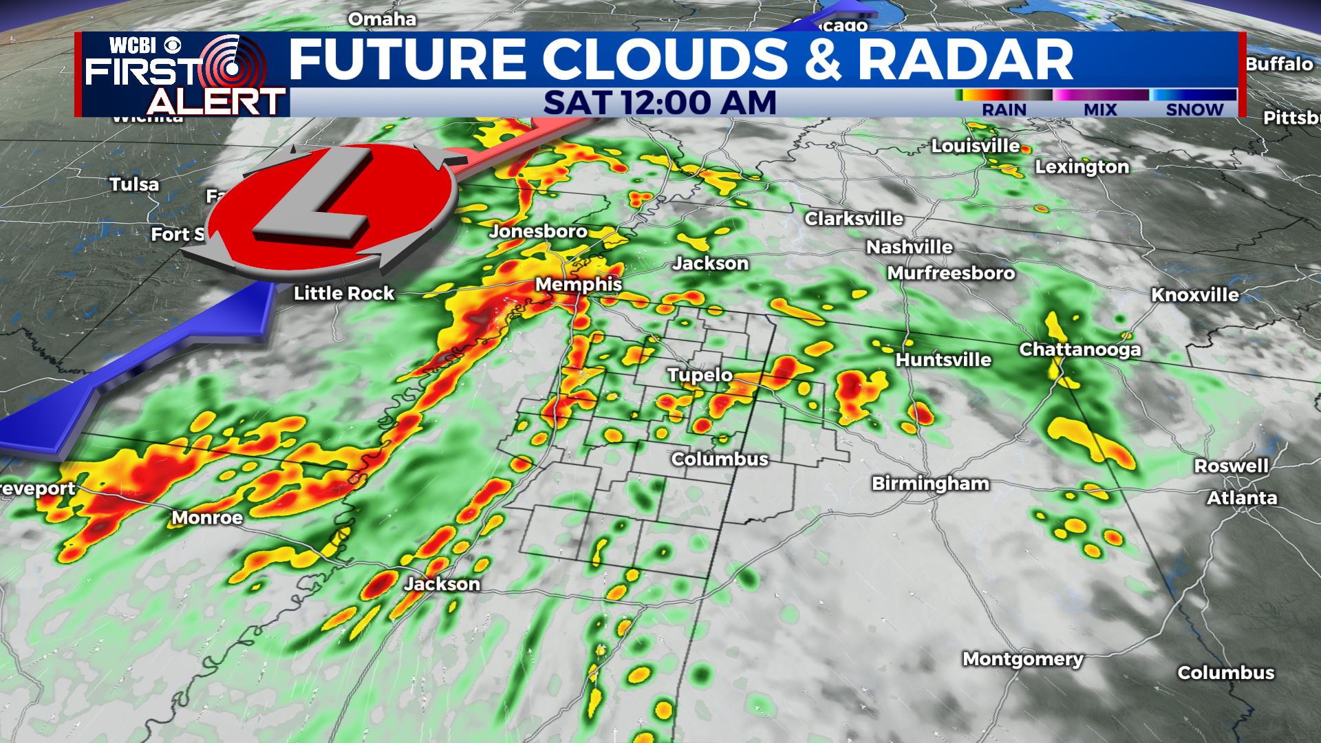
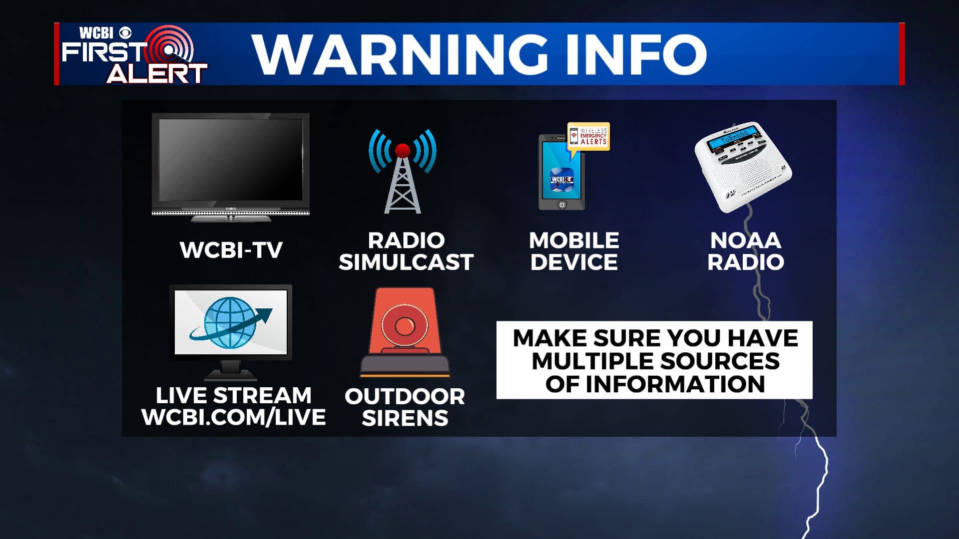
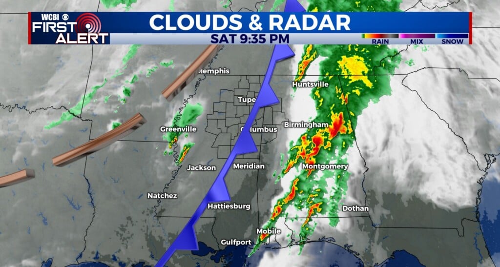
FRIDAY NIGHT-SATURDAY MORNING: Clusters of rain and storms will develop Friday evening after 7pm and last through 7am Saturday. Data suggest that they’ll eventually merge into some sort of squall line that will then march from NW to SE across the area. Damaging wind gusts, large hail, flooding rain, and isolated tornadoes are all possible. Be sure to have a way to get those watches and warnings since most of this will occur during the overnight hours. Overnight lows will be in the low 60s.
SATURDAY AFTERNOON: Drier & cooler conditions take over. Afternoon highs in the mid 70s. Winds SW 10-15 mph.
SATURDAY NIGHT: Partly cloudy and cooler. Overnight lows in the upper 40s.
SUNDAY: Mostly sunny skies. Highs in the mid 70s.
SUNDAY NIGHT: Mostly clear. Overnight lws in the mid to upper 40s.
MONDAY: A mix of sun and clouds. Highs in the upper 70s.
TUESDAY-WEDNESDAY: More chances of scattered showers return to the forecast. Highs in the lower to mid 70s.
Stay connected with @WCBIWEATHER on Facebook, Twitter, Instagram, and the WCBI News App.


Leave a Reply