Spring begins breezy and cool
COLUMBUS, Mississippi (WCBI) – After a cold front passed overnight, a cool and breezy Thursday will kick off the official start to Spring! Unfortunately, spring-like conditions haven’t quite arrived yet. Frost is expected Friday morning, with temperatures bordering the freezing mark.

TODAY: March 20th is the Vernal Equinox, marking the official start to Spring! The sun starts to tilt towards the North Pole, resulting in longer daylight hours and warmer temperatures. Although we’ve turned the calendars to Spring, the forecast is stuck in cooler conditions for now. The high temperature will be below-average, sitting in the mid to upper 50s. It will be windy as well, with wind gusts up to 25 mph.

TONIGHT: Frigid temperatures are in store before sunrise, with a low around 32. A freeze warning is in effect with frost expected from 1 am – 8am Friday, so be prepared to defrost the car and bundle up on the way out the door! It will remain breezy overnight with wind gusts up to 20 mph. Lingering cloud cover is expected to gradually clear.
TOMORROW: Winds will calm to end the week, and more sunshine is expected. The high temperature will warm into the upper 60s Friday, with a low for Saturday morning in the 40s.

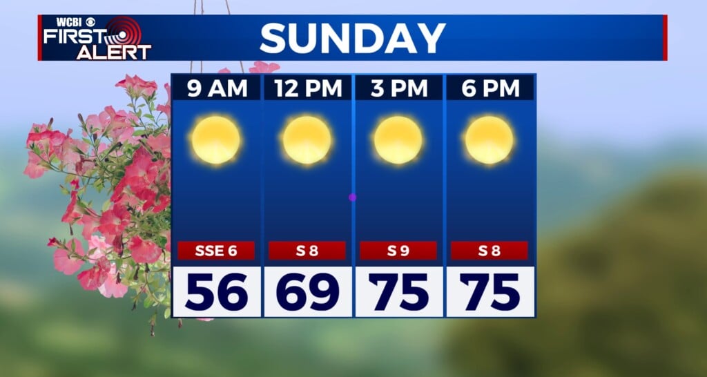
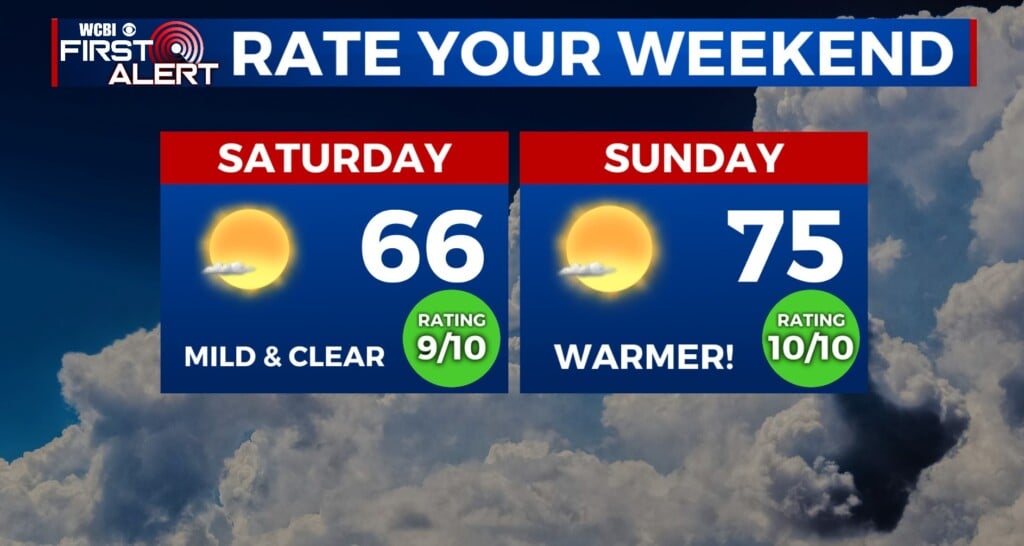
THIS WEEKEND: Sunshine and clear conditions are expected through Friday, with highs reaching the upper 70s. Clouds will build in Saturday before the next storm and rain chance returns Sunday evening. If you have any weekend plans, Saturday will be the best bet, as some storms on Sunday could become severe with strong winds and hail possible. Keep updated, as we continue to track Sunday’s system.