Some rain chances & staying warm this week
SUMMARY: Temperatures will remain warm and above average this workweek with highs in the 70s. Rain chances will return to the forecast midweek. Overall, staying quiet here in north Mississippi and west Alabama with a mix of sun & clouds.
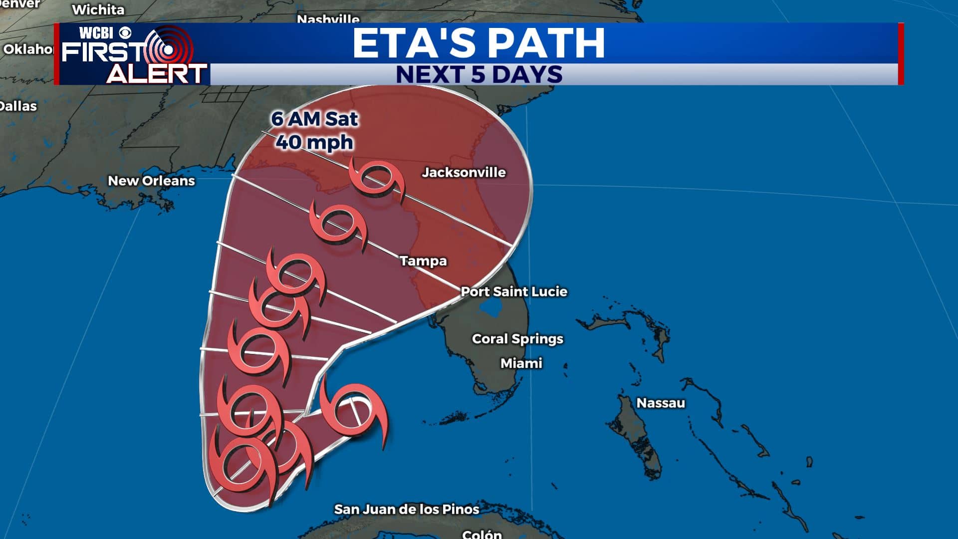
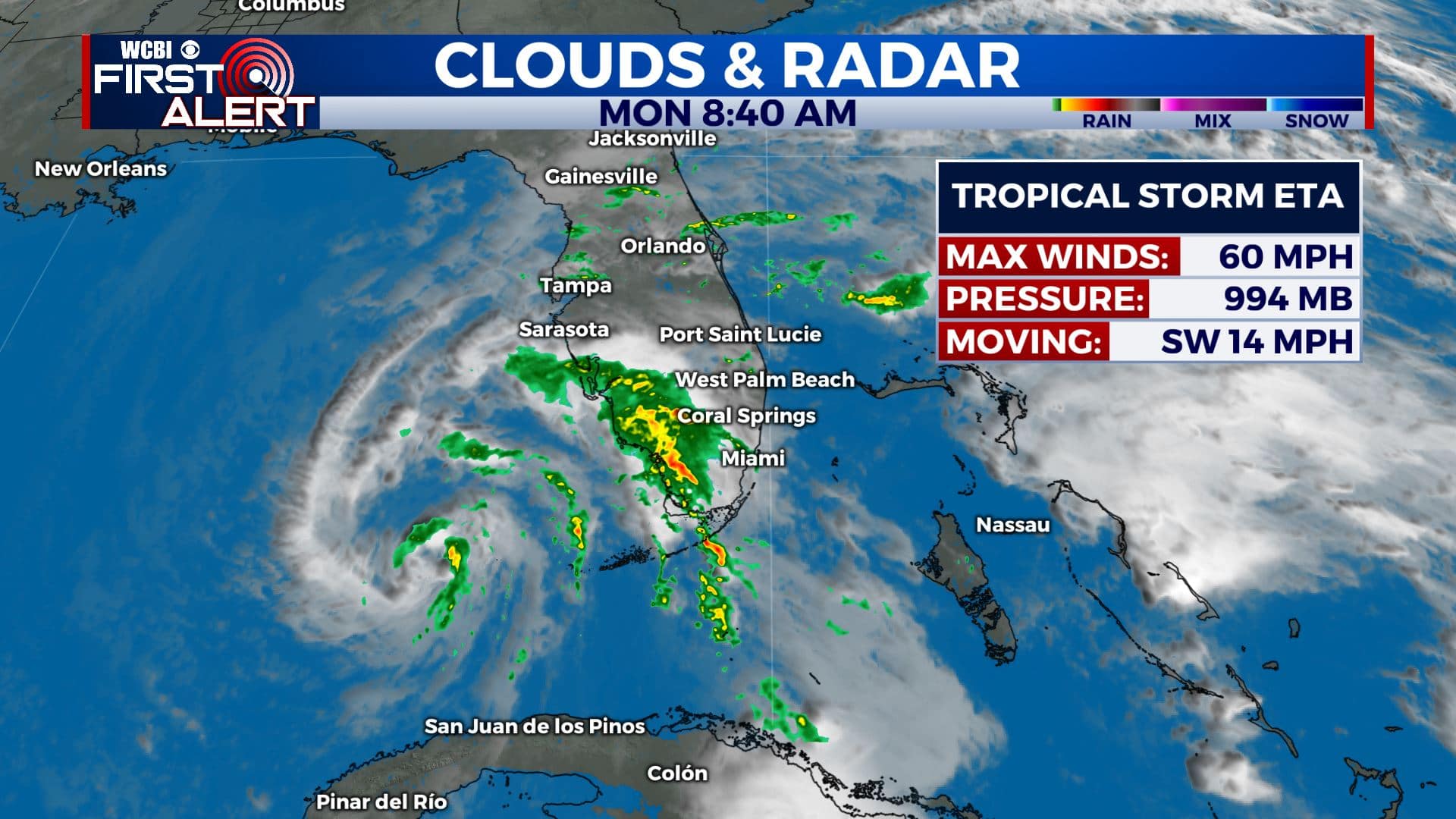
TROPICAL UPDATE: Tropical Storm Eta made landfall over the Florida Keys late last night with winds at 65v mph. It is currently still bringing heavy rain and gusty winds to South Florida as the storm continues northward. The Sunshine State will be dealing with this storm all week long as it stalls over the eastern Gulf before making a second landfall in Florida late week into the weekend. As of now, we’re not expecting anything from Eta in our area.
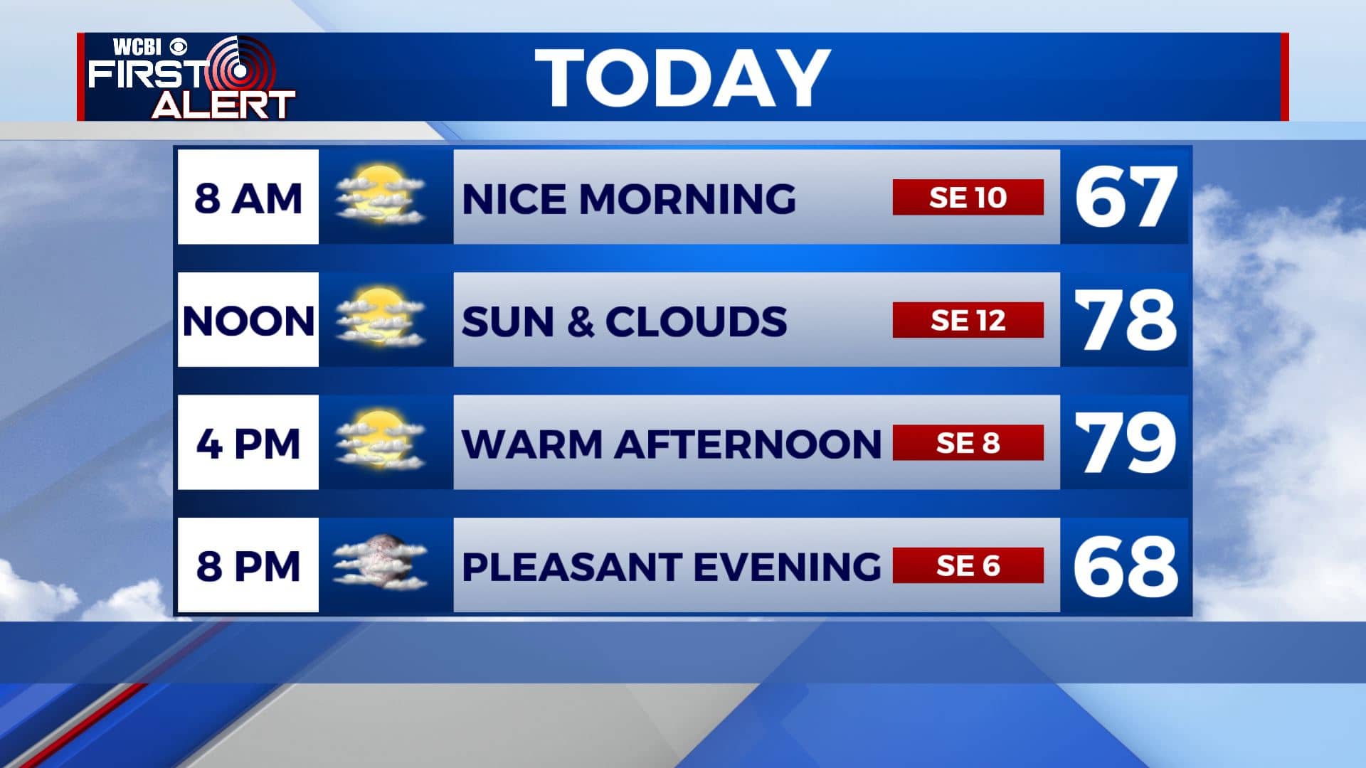
MONDAY: Temperatures will remain warm as we start off the new week with highs in the upper 70s and a breezy southeasterly wind at 5-15 mph for our Monday. Gusts could be as high as 20 mph at times with a mix of sun & clouds. Rain chances will return to the forecast midweek.
MONDAY NIGHT: A few clouds overnight. Staying quiet & mild with lows in the 60s.
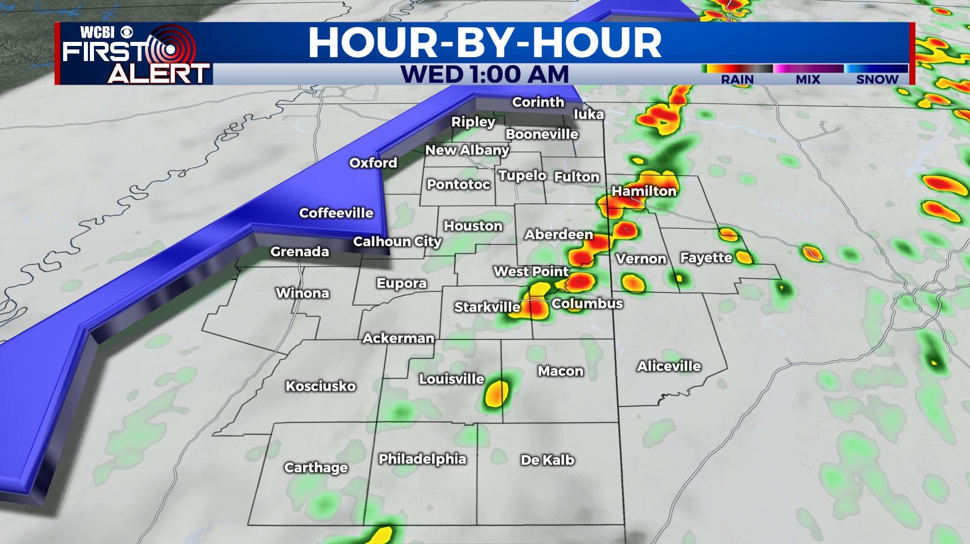
TUESDAY-WEDNESDAY: We’ll see more cloud cover midweek as an approaching cold front will bring us our next chances for some showers Tuesday into Wednesday morning. This front will also help to keep Eta to our east. Overnight lows in the 60s and afternoon highs in the mid 70s.
THURSDAY-FRIDAY: We’ll see a mix of sun & clouds as we end the workweek. High temperatures climbing into the mid 70s. Overnight lows will be in the lower to mid 50s.
WEEKEND: A shower or two is possible on Saturday and Sunday, but we’re not expecting significant rainfall. Highs remaining in the 70s.
Stay connected with @WCBIWEATHER on Facebook, Twitter, Instagram, and the WCBI News App


Leave a Reply