Slight breaks in between severe threats
COLUMBUS, Mississippi (WCBI)- Thursday’s conditions were fairly calm, a few areas got to experience isolated showers. Overall, Thursday was our first break before the next severe weather threat on Friday.
THURSDAY NIGHT: Warm temperatures tonight, only falling into the upper 50s. A few isolated and scattered showers may still be possible across the NE corner.
FRIDAY: End of the week, but also the next severe weather threat. Temperatures will remain hot, in the upper 80s. The SPC has northeastern Mississippi split between a Level 1 – Marginal and a Level 2 – Slight Risk for severe weather. Gusty winds, heavy rain, and hail are all possible. Low temperatures stay warm, in the upper 60s.

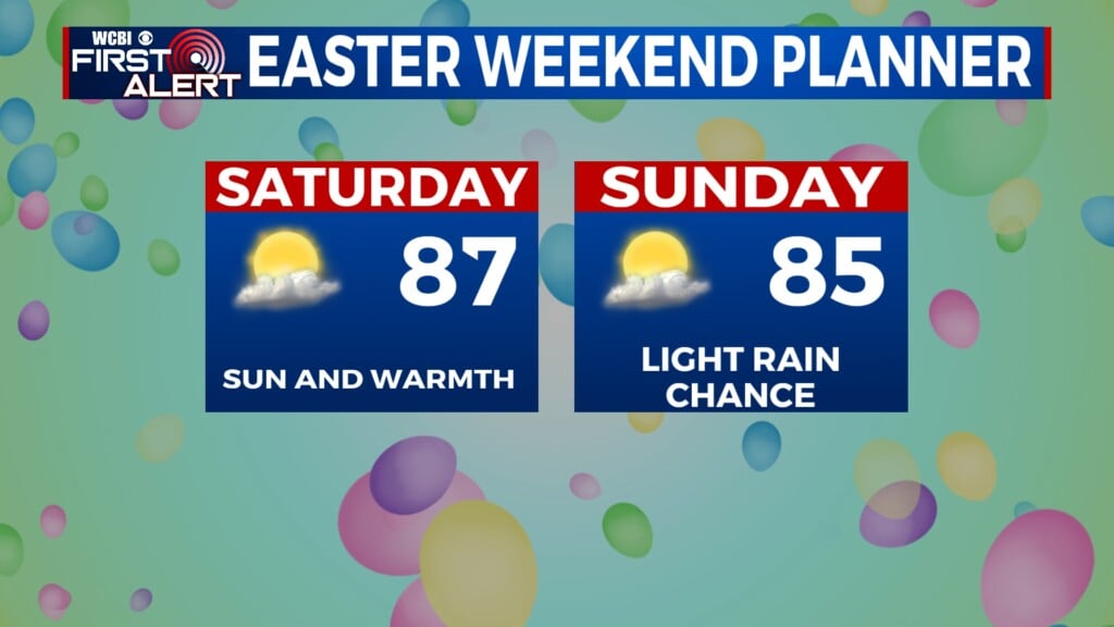
WEEKEND: Conditions calming down for Saturday, in regard to the rain. However, temperatures will push there way into the lower 90s. Cloud coverage will be mostly to partly cloudy, after the early morning showers. By Sunday, temperatures again fall back into the middle 80s. The storm chance picks back up, with a Level 2 – Slight Risk for severe weather across most of northern Mississippi. Overnight temperatures will be in the upper 60s.