Severely Spring
COLUMBUS, Mississippi (WCBI) – We are definitely in the swing of Spring. Pollen is collecting and turning everything yellow. Storms are on a near routine pattern.
FRIDAY NIGHT: Mild and getting more muggy. Moisture and clouds will continue filing in overnight. Lows will fall into the lower 60s.
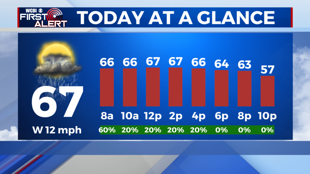
SATURDAY: Heavy clouds maintain into the weekend. Light, scattered showers will start off to the West, before building in the rest of the day. A few rumbles of thunder will be possible throughout the afternoon and early evening. Highs will reach the lower 70s, keeping conditions muggy. Gusts will start picking up from the SSE to about 25MPH. Lows will drop to the low to middle 60s.

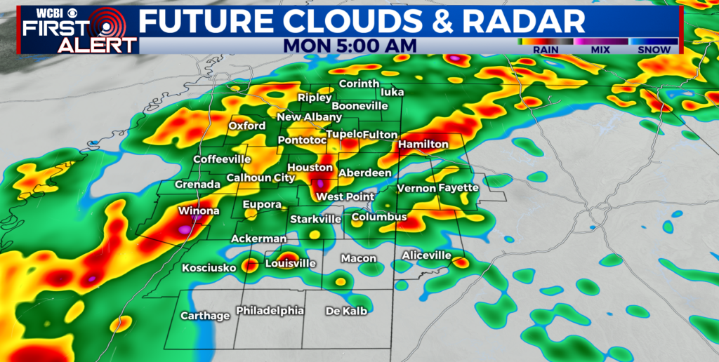
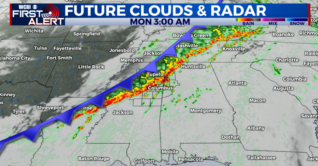
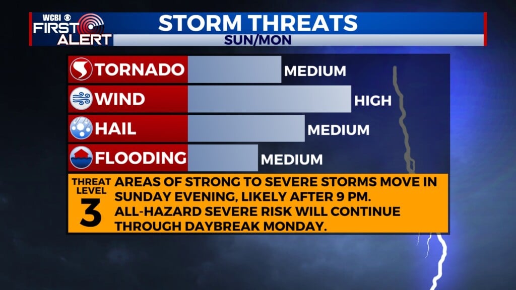
SUN/MON: Spring has sprung in the most severe way. Most of northern Mississippi is in the Level 3- Enhanced Risk for severe weather, out of 5. This will be an all-mode hazard event. The Storm Prediction Center is using phrases like “widespread substantial” storms. Meaning very large hail, damaging winds, and a few strong tornadoes may be possible. The timeline is looking to begin after 9PM and continue until approximately 9AM Monday morning.
Have multiple ways of receiving warnings, as this is an overnight event.