Severe storms possible Friday night, more severe storms Saturday
COLUMBUS, Mississippi (WCBI) – The threat for severe storms will exist Friday night and ramp up further Saturday.
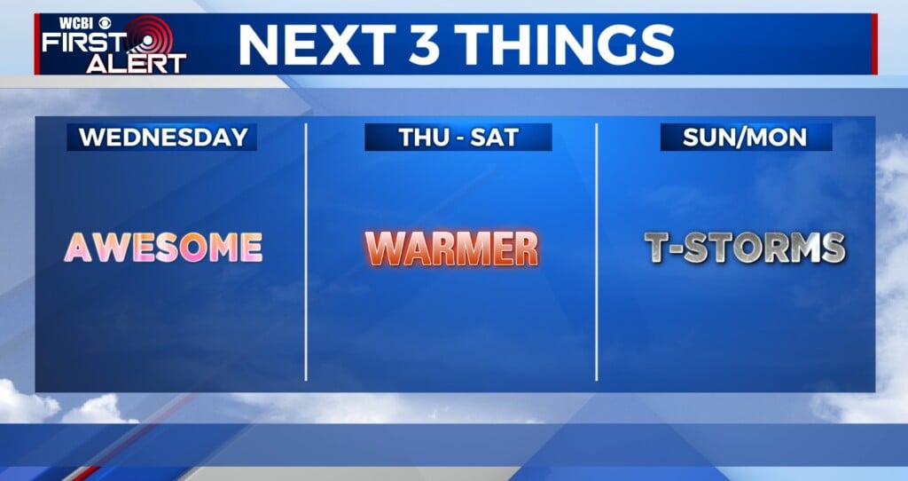
FRIDAY: Expect a warm, breezy day with highs in the upper 70s to lower 80s and southerly wind gusts up to 25-35 mph.
FRIDAY NIGHT: Isolated, locally intense storms are possible after sunset into the overnight hours. These will be capable of all severe hazards, but the coverage of storms will be fairly limited. Be weather aware tonight!
SATURDAY: This has potential to be a DANGEROUS severe weather day across Mississippi and Alabama. Supercell storms are expected to erupt in central Mississippi by mid to late morning and track into the area by midday & afternoon. These will have the potential to produce long-tracked, intense tornadoes in addition to high winds and large hail. The time frame to watch is from roughly 11 AM to 7 PM, though keep in mind some storms could form before and linger after.

CALL TO ACTION: Being safe means being prepared – Know what county you live in. Have multiple ways of receiving your watches and warnings. Charge your electronics. Set up your safe places so all of your essentials are ready to go. Wear closed-toed shoes. Bring in any objects from outside or tie them down.

SUNDAY/EARLY NEXT WEEK: Gradual clearing is expected Sunday, and sunshine returns for St. Patrick’s Day Monday and Tuesday.