Rain tonight, breezy & cool Wednesday coming
SUMMARY: Two wet weather makers are on tap for the next 7 days. The first is going to pass on by tonight and early Wednesday with the second one coming Saturday and Saturday night. No major winter or severe weather issues are anticipated between now and Christmas but seasonable temperatures will stick around.
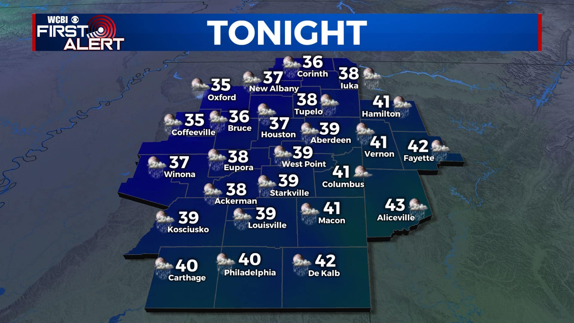
TUESDAY NIGHT: Cloudy skies with areas of rain. Lows ranging from the mid 30s (NW) to the low 40s (SE). Some snow could mix in with the rain across our northwestern counties but no big impacts are expected at this time. Winds SE/NW 3-8 mph.
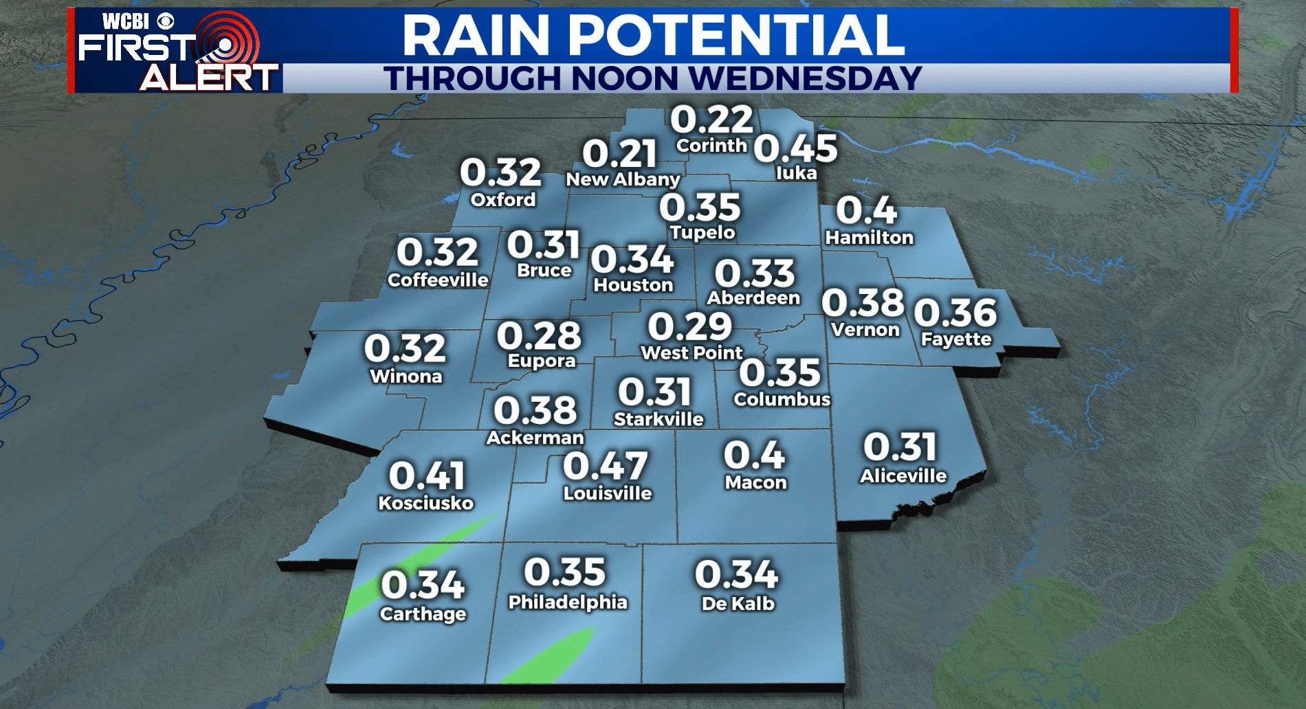
WEDNESDAY: Morning rain then mostly cloudy. Breezy NW winds 10-15 mph with gusts to 20 mph. Highs in the 40s. Total rainfall between 1/4″ and 1/2″.
WEDNESDAY NIGHT: Partly cloudy. Much colder lows in the upper 20s.
THURSDAY: Abundant sunshine. Highs in the mid to upper 40s.
THURSDAY NIGHT: Clear and cold. Lows in the mid 20s.
FRIDAY: Mostly sunny. Highs in the low 50s.
SATURDAY: Mostly cloudy with a 50% chance of showers. Highs around 50.
SUNDAY: Mostly cloudy. Highs in the low 50s.
EARLY NEXT WEEK: Mostly sunny to partly cloudy. Milder highs in the upper 50s to around 60.
Follow @WCBIWEATHER on Facebook, Twitter, Instagram, and the WCBI News App


Leave a Reply