More rain and storms in store for Monday
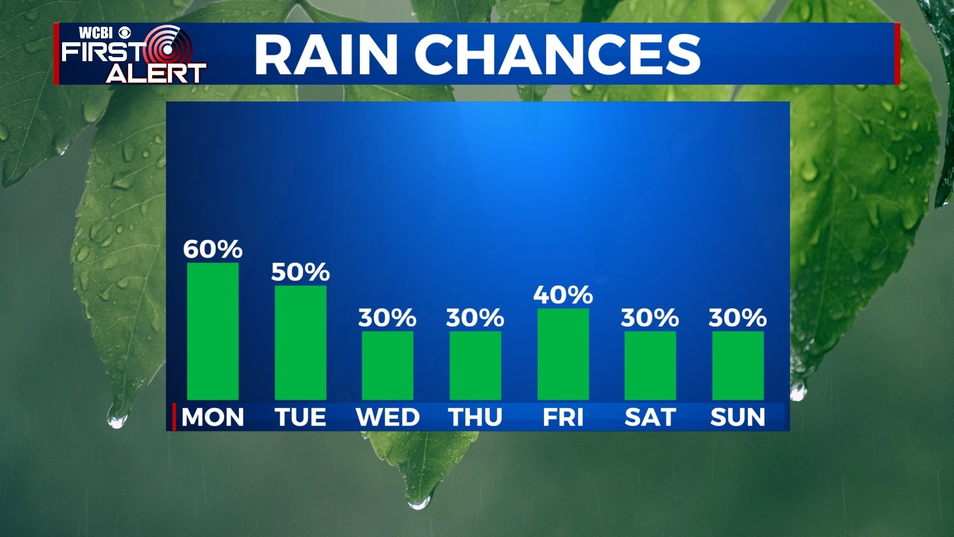
Our wet and stormy pattern will continue to start off the week with chances for rain for the next several days. It won’t be a total washout every day, but there could be periods of heavier rain. Some of us could see localized flash flooding.
SUNDAY NIGHT: Most of the night will be dry, but more storms will start to move in by sunrise. We’ll stay mild and muggy with lows in the mid 70s and a light southerly wind.

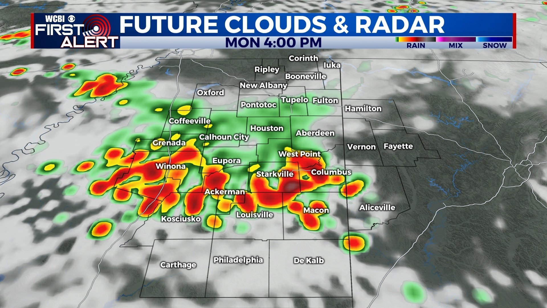
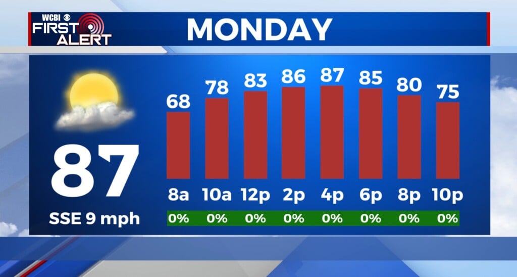
MONDAY: Several rounds of showers and storms will be possible through the day. The morning round looks like it will affect more northern areas (Tupelo) while the afternoon and evening round will dig a little farther south toward Columbus. Either way, rain and storms are possible at anytime tomorrow, so keep the umbrella nearby. We’ll stay warm and muggy as temperatures climb to near 90.
TUESDAY: More off-and-on storms are possible through the day on Tuesday. Highs will once again be near 90 with morning lows in the mid 70s.
WEDNESDAY-THURSDAY: While rain chances don’t go away completely for Wednesday and Thursday, they will diminish just a bit. Not everyone will see rain, but a few isolated showers or storms will be possible Our temperatures will be a bit warmer as temperatures climb into the low and mid 90s each afternoon. Morning lows will remain in the low to mid 70s.
FRIDAY-SUNDAY: We’ll keep a 30%-40% chance of rain in play for Friday and the weekend as a few storms will be possible. This basically means to go about your day as normal, but be prepared for a quick downpour if one pops up. Temperatures will be a touch lower with highs in the upper 80s.


Leave a Reply