Rain chances return this weekend
SUMMARY: It will be a mostly sunny & quiet end to the workweek. Two storm systems will impact the Deep South as we head into the weekend and next week. The first one will push through Saturday evening, giving us rain chances and some thundershowers, but not expecting any severe weather from this event. Another system mid to late week could produce more rain and thunderstorms, but we have many days to watch it. Stay tuned!
FRIDAY: It’s going to be a pretty decent end to the workweek for our Friday. Expect mostly sunny skies throughout the day. Highs a tad warmer in the lower to mid 50s thanks to a light SE wind.
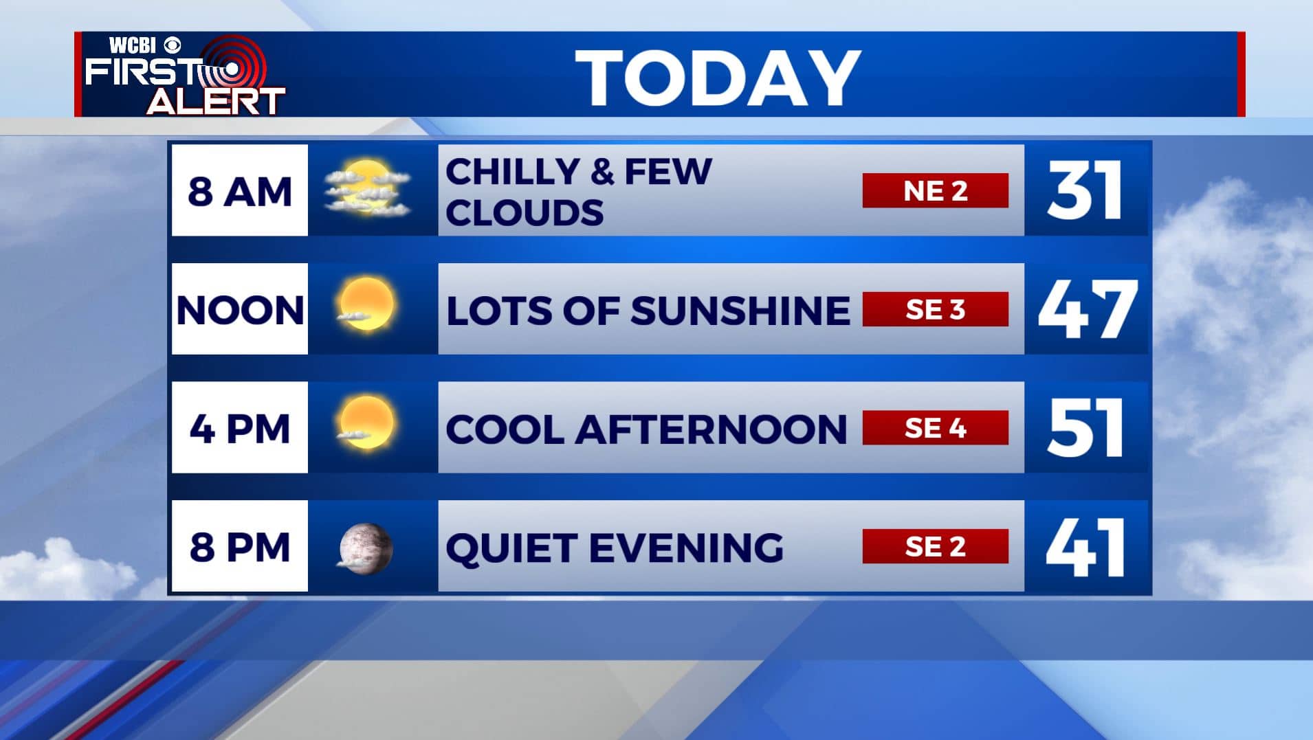
FRIDAY NIGHT: Increasing clouds. Overnight lows not as chilly in the 30s.
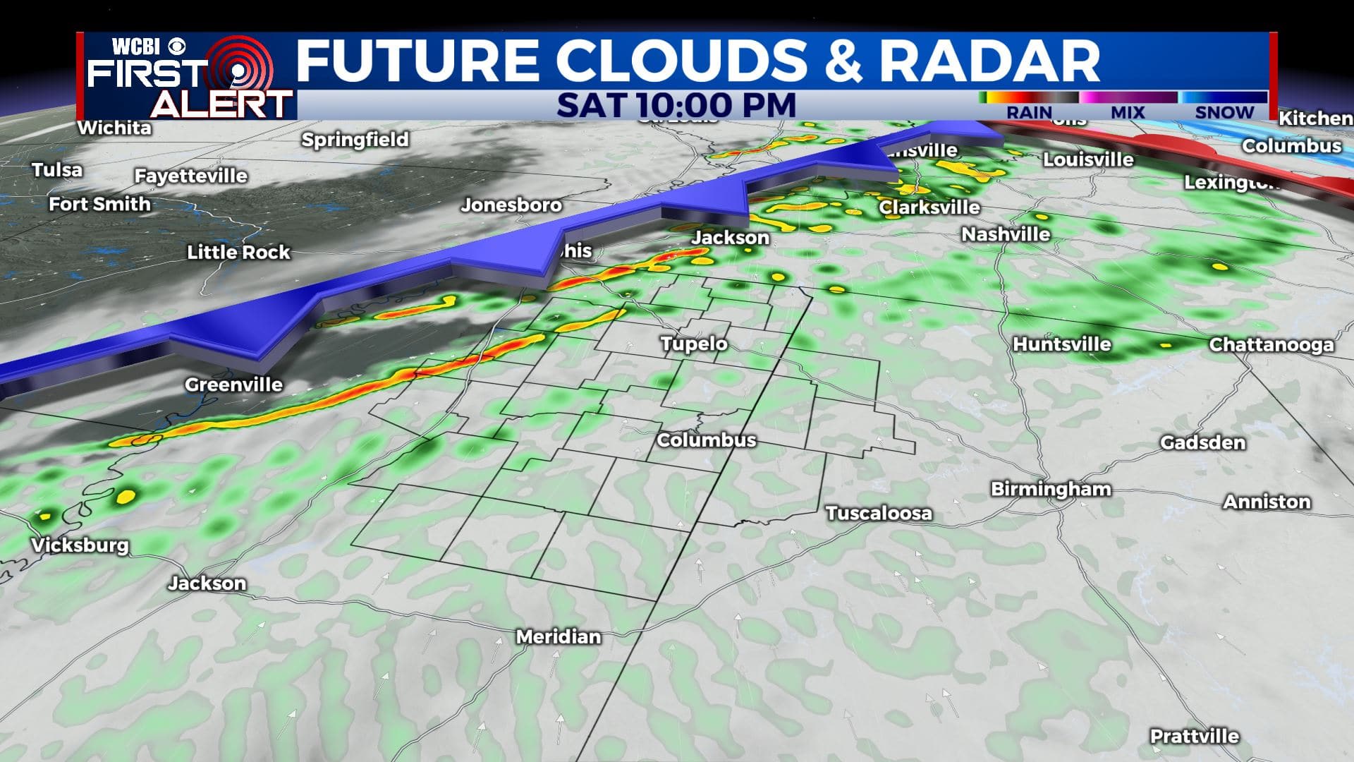
SATURDAY: Mostly cloudy skies. A chance of rain showers during the afternoon and evening. Breezy SE winds 10-15, gusting up to 20-25 mph. Highs in the upper 50s to lower 60s.
SATURDAY NIGHT: Cloudy with areas of rain showers. A few rumbles of thunder are also possible. No severe weather is expected as of right now. Overnight lows in the lower 50s.
SUNDAY: Morning showers then cloudy skies in the afternoon. Breezy NW winds 10-15 mph. Highs in the mid to upper 50s.
SUNDAY NIGHT: Partly cloudy skies. Colder overnight lows in the mid 30s.
MONDAY: A mix of sun and clouds as skies finally start clearing up. A chilly day with below average highs in the mid 40s.
MONDAY NIGHT: Mostly clear skies and cold. Overnight lows in the mid to upper 20s.
TUESDAY: Mostly sunny skies. Highs in the lower 50s.
TUESDAY NIGHT: Mostly clear skies and cold. Lows in the upper 20s.
WEDNESDAY: A mix of sun & clouds. Highs in the mid 50s.
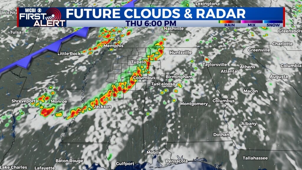
THURSDAY: Rain and storm chances return to the forecast. Mild once again with highs in the lower to mid 60s.
Stay connected with @WCBIWEATHER on Facebook, Twitter, Instagram, and the WCBI News App


Leave a Reply