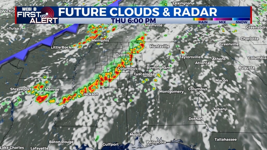
Overnight storms to drier conditions
COLUMBUS, Mississippi (WCBI) – Friday night into Saturday morning, more showers and storms are going to be expected to move through NE MS. End of the weekend and further, temperatures return to the middle 90s and conditions will be drier.
FRIDAY NIGHT: Continuing the chance of scattered showers and thunderstorms across the corner through the rest of the night, with the front pushing slowly southward. With heavy cloud coverage, temperatures tonight will be in the low to middle 70s.

SATURDAY: Showers and storms continue from overnight and into Saturday morning. The slow moving front will bring the southern half of our viewing area the chance for rain. By the afternoon, rain chance will continue moving South. Cloud coverage will gradually be clearing out. High temperatures will be in the middle 80s, with cooler air behind the front. Clearer conditions Saturday night will allow low temps to fall into the upper 60s.
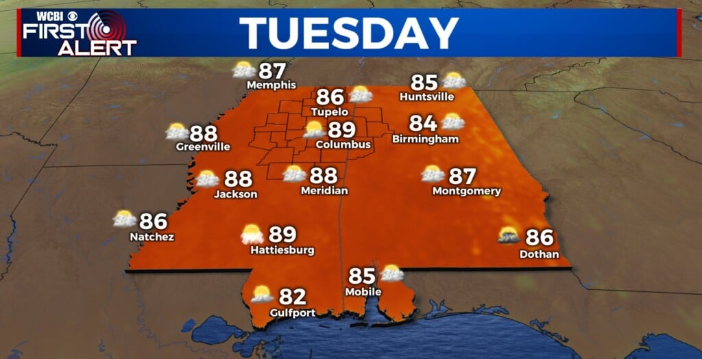
SUNDAY: Sky conditions will be staying clear. Temperatures heat back up in to the lower 90s. Overnight low temperatures will maintain in the upper 60s.
NEXT WEEK: Hot temperatures sticking around, heading back to the middle 90s by mid-week. Conditions will be mostly clear to partly cloudy everyday. Low temperatures will warm up, back into the low to middle 70s.