Nice Weekend, Storms Return Sunday Night
SUMMARY: High pressure will continue to settle over the region this weekend bringing some more sunshine to the area today and tomorrow. Clouds move in Sunday bringing our next chance for some showers and thunderstorms Sunday evening into the overnight. Lingering showers are expected Monday morning. We get into an unsettled weather pattern next week bringing more chances for showers from Tuesday through Thursday.
TODAY: Pleasant temperatures with returning sunshine. Mostly clear skies today with a high near 73.
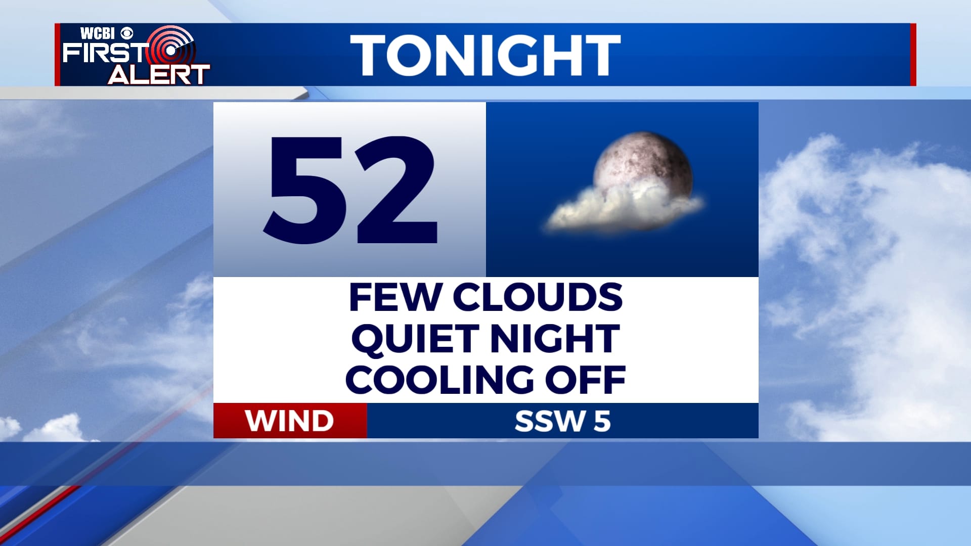
TONIGHT: Some clouds expected but an overall fairly quiet night. Low temperatures tonight will dip into the lower 50s.
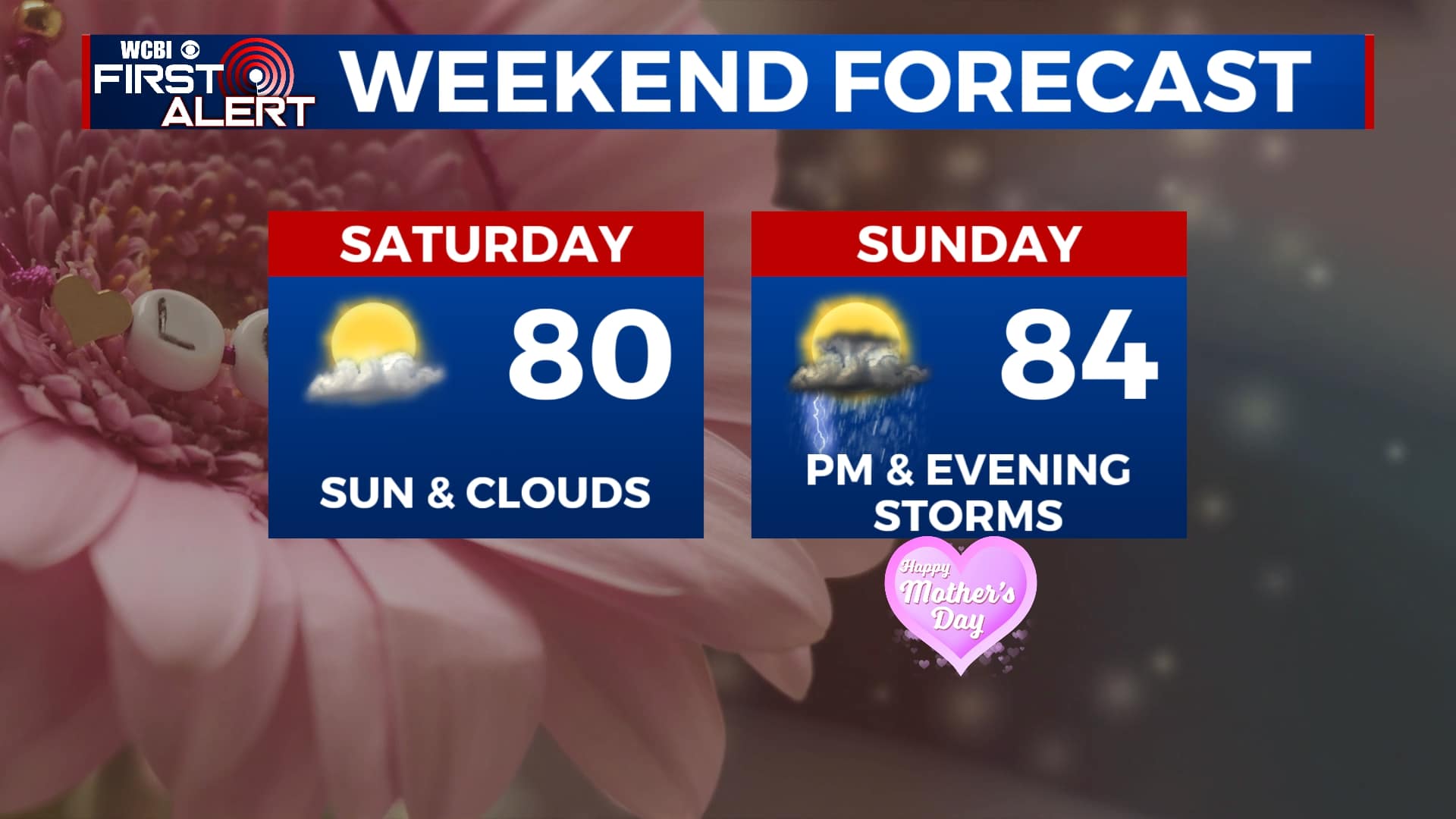
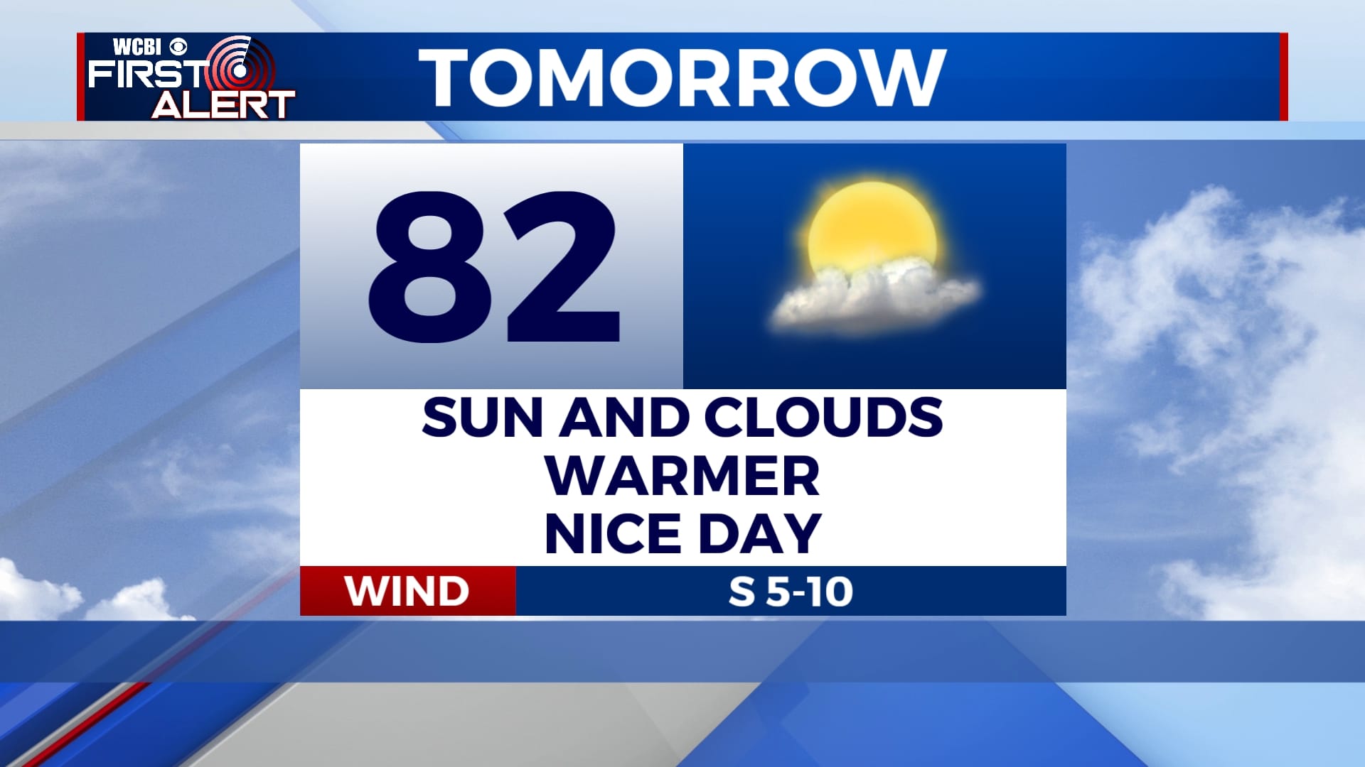
SATURDAY: A mix of sun and clouds with high temperatures in the lower 80s. Clouds will begin to move in late evening with overnight lows will linger in the upper 50s.
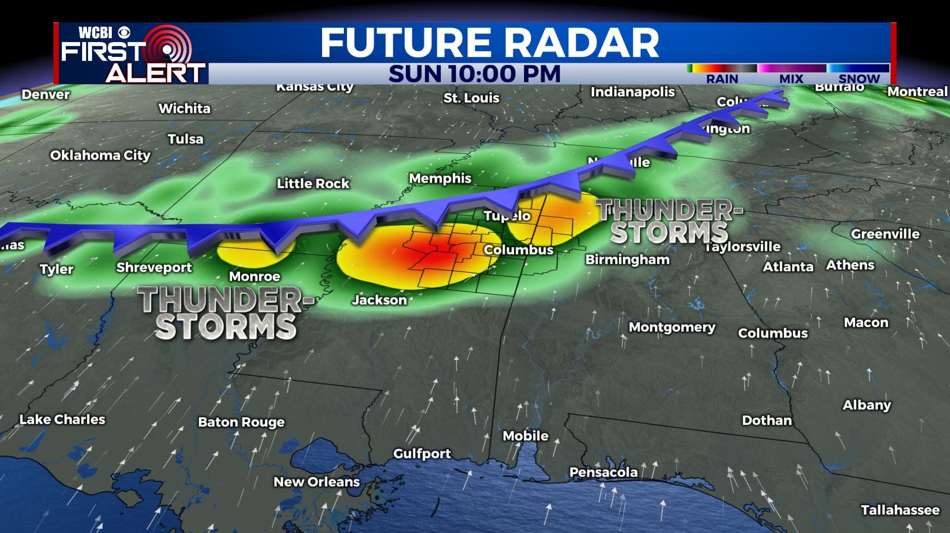
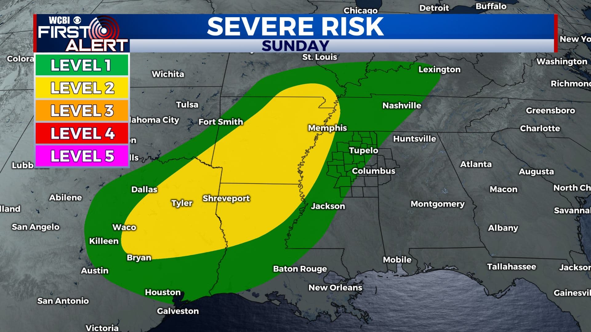
SUNDAY: Cloudy skies for most of the day will bring in our next chance for some showers and thunderstorms in the later evening. Some storms could be strong. These storms will continue overnight into early Monday morning. Highs will be in the mid-80s and overnight lows in the mid-60s.
MONDAY: Some showers will continue into the early morning hours. Those should push out of here by the afternoon leaving us with mostly cloudy skies. Highs will be in the lower 70s and overnight lows in the mid-50s.
TUESDAY-FRIDAY: An unsettled weather pattern sets up overhead at the beginning of the week bringing in more chances for some showers through Thursday. Cloudy skies will continue until Friday. High temperatures will remain in the mid-to-upper 70s.
Stay connected with @WCBIWEATHER on Facebook, Twitter, Instagram, and the WCBI News App.


Leave a Reply