A few more nice days on tap
SUMMARY: Sunny, dry, and mild air will stick around going into the weekend. A weak front may spark some rain/showers Sunday afternoon and evening. A more significant front is expected Tuesday night into Wednesday. Heavier rain and some storms are much more likely with that system. We’ll keep watching for the threat of a few strong/severe storms too.
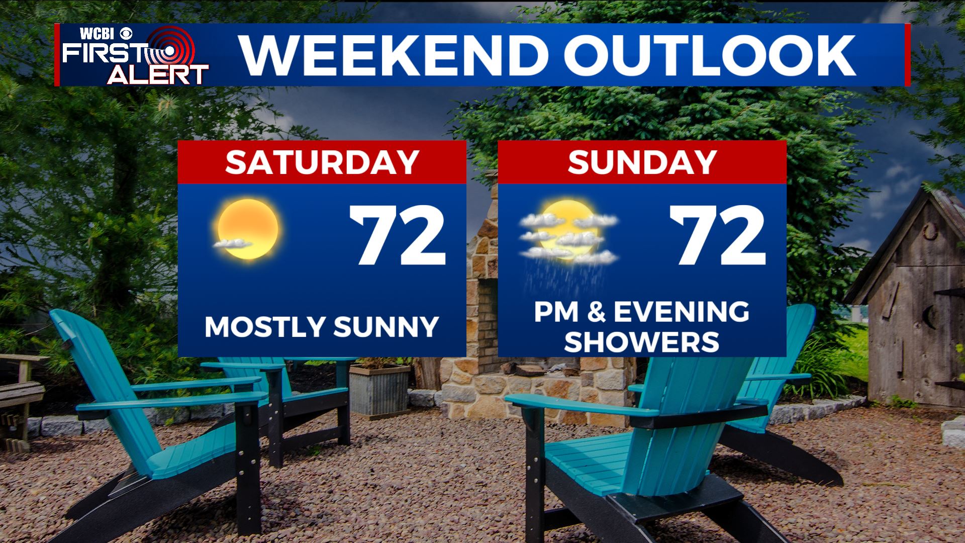
Weekend forecast
THURSDAY NIGHT: Clear and quiet. Lows in the low 40s. Winds SE 2-5 mph.
FRIDAY: Sunny to mostly sunny. Mild highs ranging from the upper 60s to low 70s. Winds S 5-10 mph.
FRIDAY NIGHT: Mainly clear. Lows in the 40s. Conditions look great for high school football with evening temperatures mainly in the 50s.
SATURDAY: Partly cloudy. Mild highs in the low 70s.
SUNDAY: Increasing clouds with a 20-30% chance of afternoon and evening showers. Highs in the low 70s.
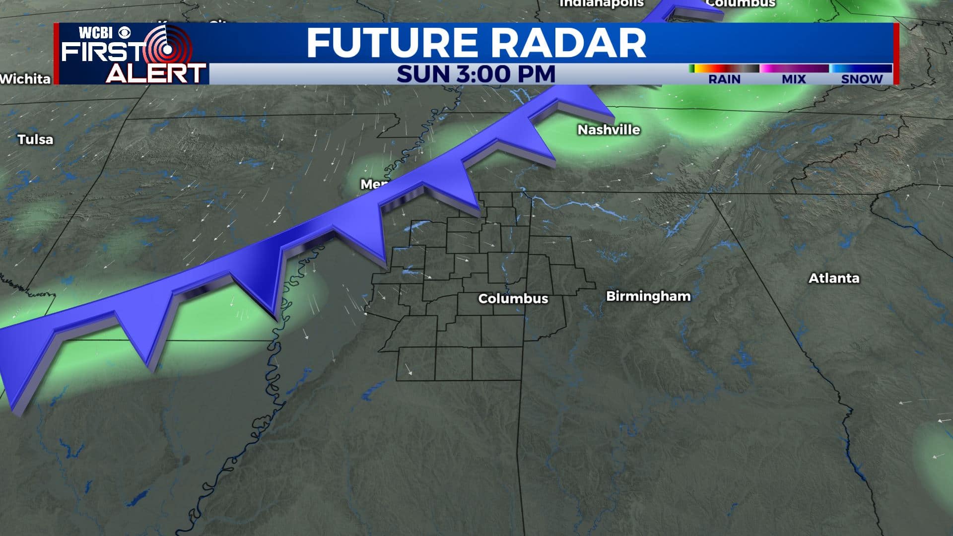
Weak front Sunday afternoon & evening
MONDAY: Sun & clouds. Seasonable highs in the 60s.
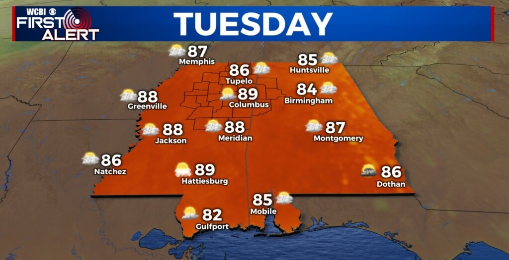
TUESDAY: Partly cloudy. Highs around 70. Some rain and thunder is possible late in the day.
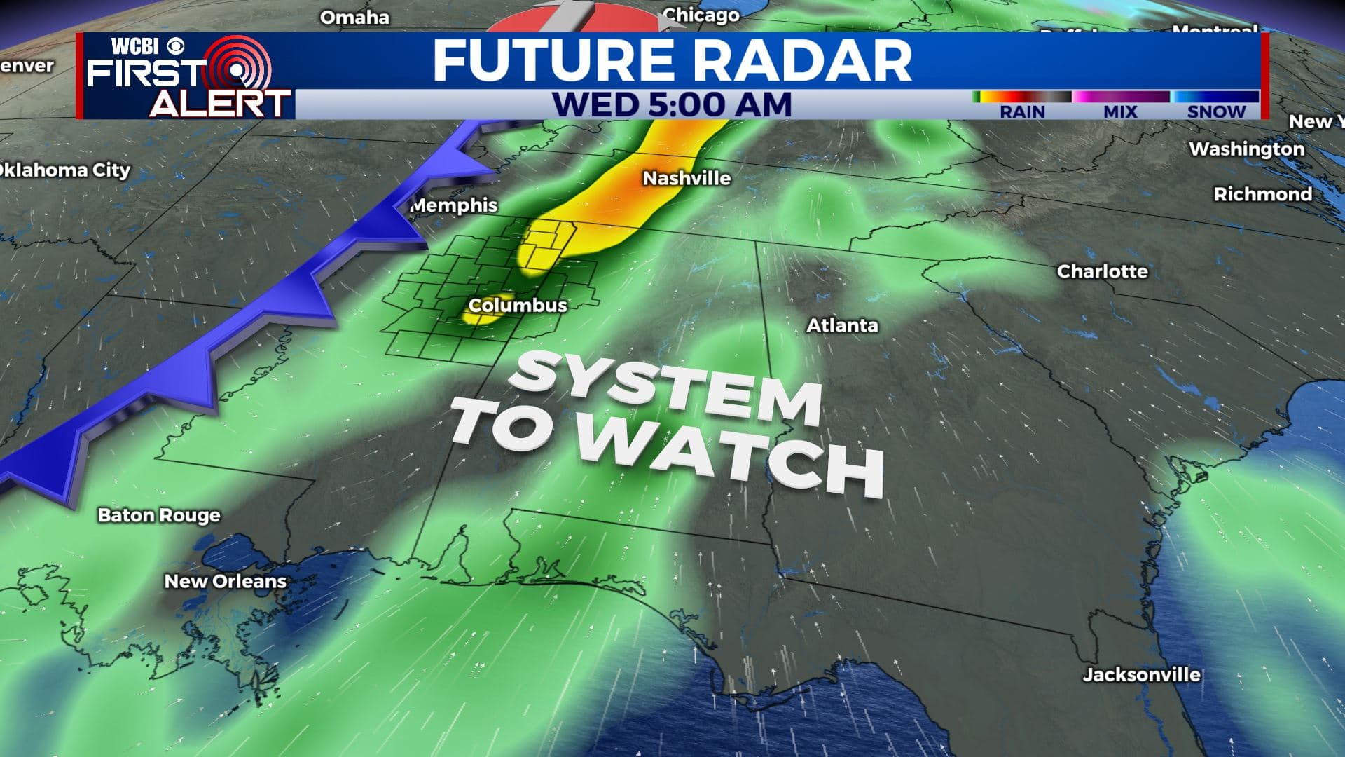
Cold front Tuesday night into Wednesday
WEDNESDAY: Areas of rain and storms. The chance of rain is 60%. Highs in the 60s.
THANKSGIVING DAY: Partly cloudy. Highs in the 60s.
Follow @WCBIWEATHER on Facebook, Twitter, Instagram, and the WCBI News App


Leave a Reply