Mostly cloudy Sunday, cool and sunny next week
Temperatures will remain cool for the next several days with highs in the 50s and lows in the 20s and 30s. Aside from a sprinkle or two on Sunday, most of the upcoming week will be dry.
SATURDAY NIGHT: We’re expecting a few passing clouds before midnight with fog developing early Sunday morning. Temperatures will fall to near freezing in many locations with a light and variable wind.

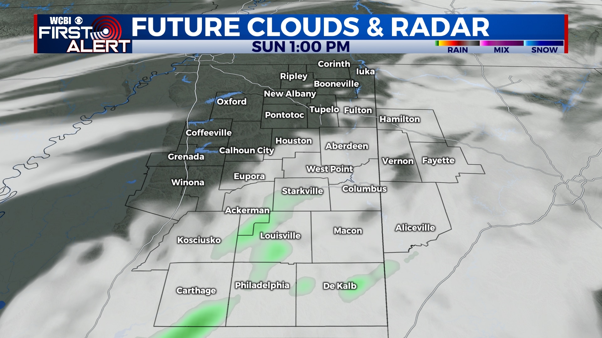
SUNDAY: Morning fog could linger in many locations through 9 am and skies will remain mostly cloudy through the day. A quick afternoon shower is possible in the Golden Triangle and points south, but most of us won’t see rain. Highs will be in the mid 50s with a light and variable wind.
MONDAY-THURSDAY: In general, most of next week looks pretty nice. Skies will remain mostly sunny with highs in the 50s and 60s. Morning lows will be in the 20s and 30s with freezes possible Tuesday and Wednesday morning.
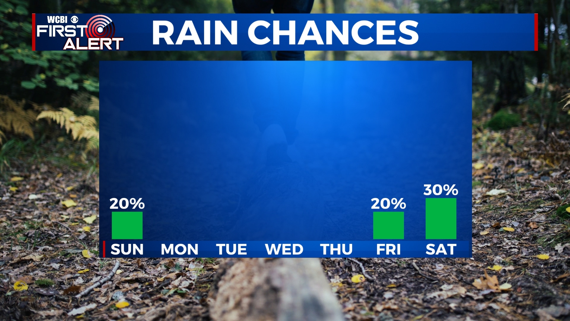
FRIDAY-SATURDAY: Clouds and rain chances return to the forecast by the end of the week and weekend with showers possible late Friday evening into Saturday. Temperatures will reach the 60s each afternoon with morning lows in the 30s and 40s.
Follow WCBI Weather on Facebook, Twitter, and Instagram
Follow Meteorologist Trevor Birchett on Facebook and Twitter


Leave a Reply