Mild through Wednesday, cold for Christmas
SUMMARY: Quiet and dry weather will hold through Wednesday morning. Rain is expected to develop Wednesday afternoon continuing into early Thursday morning. Mild air over the next 2 days will be replaced by much colder air for Christmas Eve and Christmas Day. Dreaming of a white Christmas? Keep on dreaming, it’s not going to happen this year.
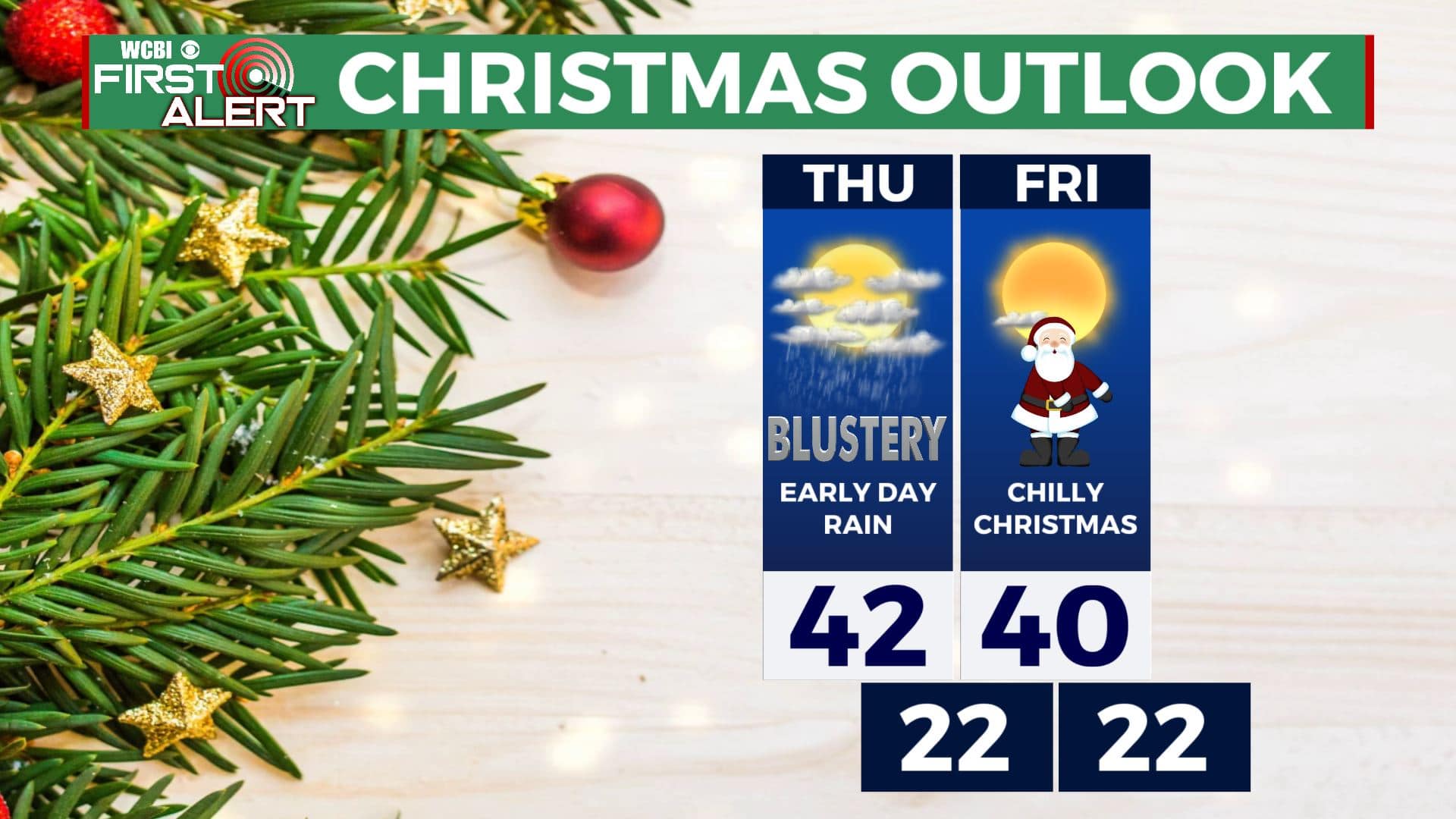
Christmas Outlook
MONDAY NIGHT: Clear and quiet. Lows in the mid to upper 30s. Light wind.
TUESDAY: Sunny skies. Seasonably mild highs around 60. Winds SE 2-7 mph.
TUESDAY NIGHT: Mostly clear. Lows in the low 40s.
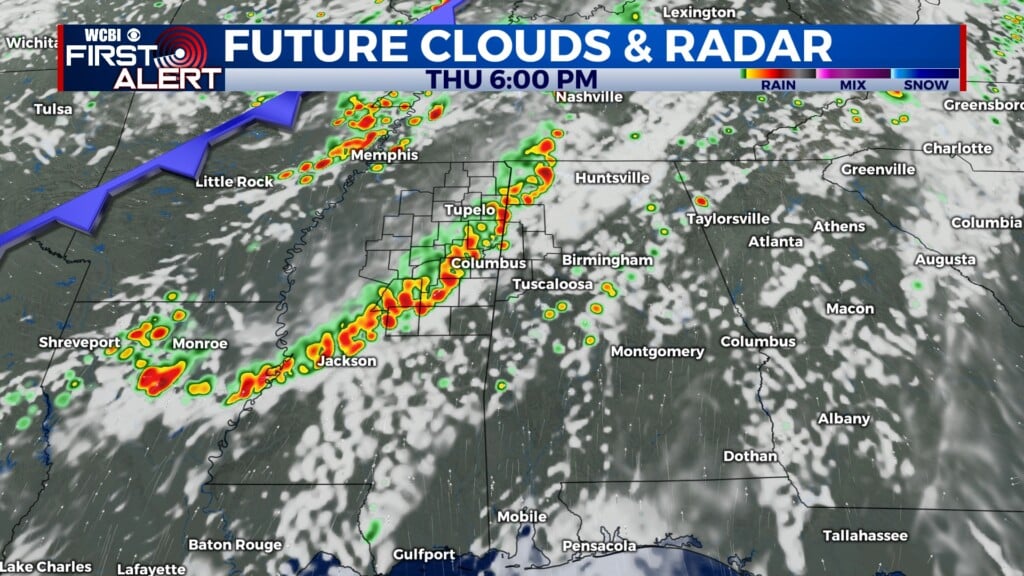
WEDNESDAY: Becoming breezy with increasing clouds. Highs in the low 60s. Afternoon and evening rain will develop.
WEDNESDAY NIGHT: Cloudy, breezy, and wet. Areas of rain and possibly a storm. Temperatures by sunrise Thursday may be down into the mid 30s. Total rainfall between 1/2” and 1 1/2”.
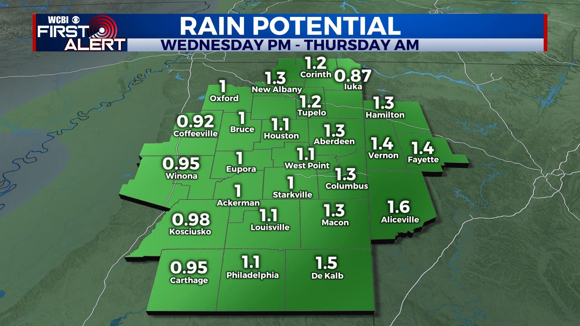
Midweek rain potential
THURSDAY: Early morning rain then partly to mostly cloudy and blustery. Cold afternoon temperatures in the upper 30s to low 40s.
THURSDAY NIGHT: Partly cloudy and cold. No major issues for Santa’s arrival. Lows in the mid to low 20s.
CHRISTMAS DAY: Mostly sunny to partly cloudy. Highs around 40.
SATURDAY: Mostly sunny. Highs around 50.
SUNDAY: Increasing clouds. A chance of afternoon and evening rain showers. Highs in the 50s.
Follow @WCBIWEATHER on Facebook, Twitter, Instagram, and the WCBI News App


Leave a Reply