Midweek cold front pushing through with rain chances
SUMMARY: As our mild November weather continues, the chance for a few showers will return to the forecast midweek as a cold front pushes through Tuesday into Wednesday. We’ll also be watching the path of Tropical Storm Eta, which could bring us some more rain chances this weekend. It appears we’ll be in for another cool down the beginning of next week. Stay tuned!
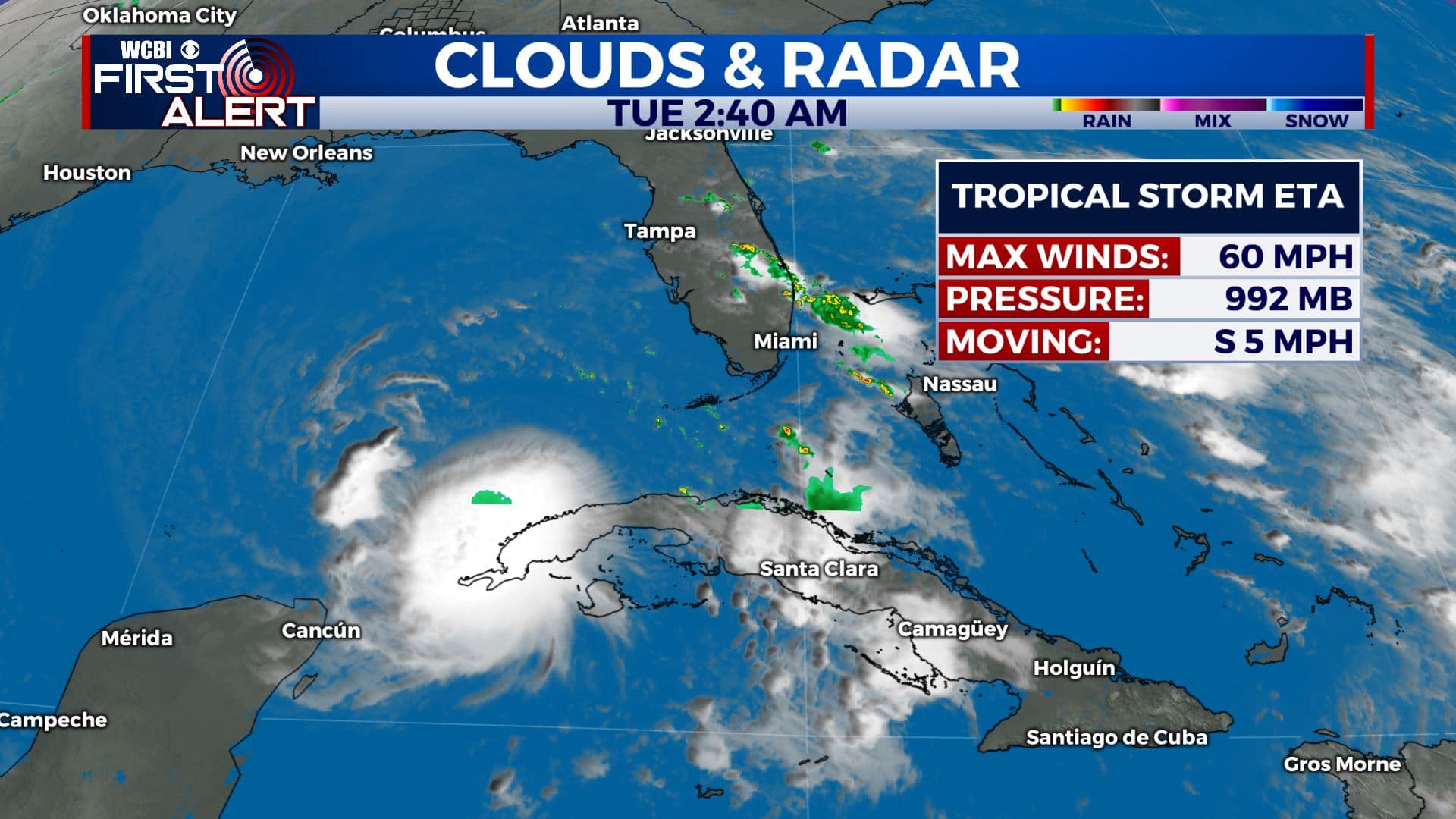
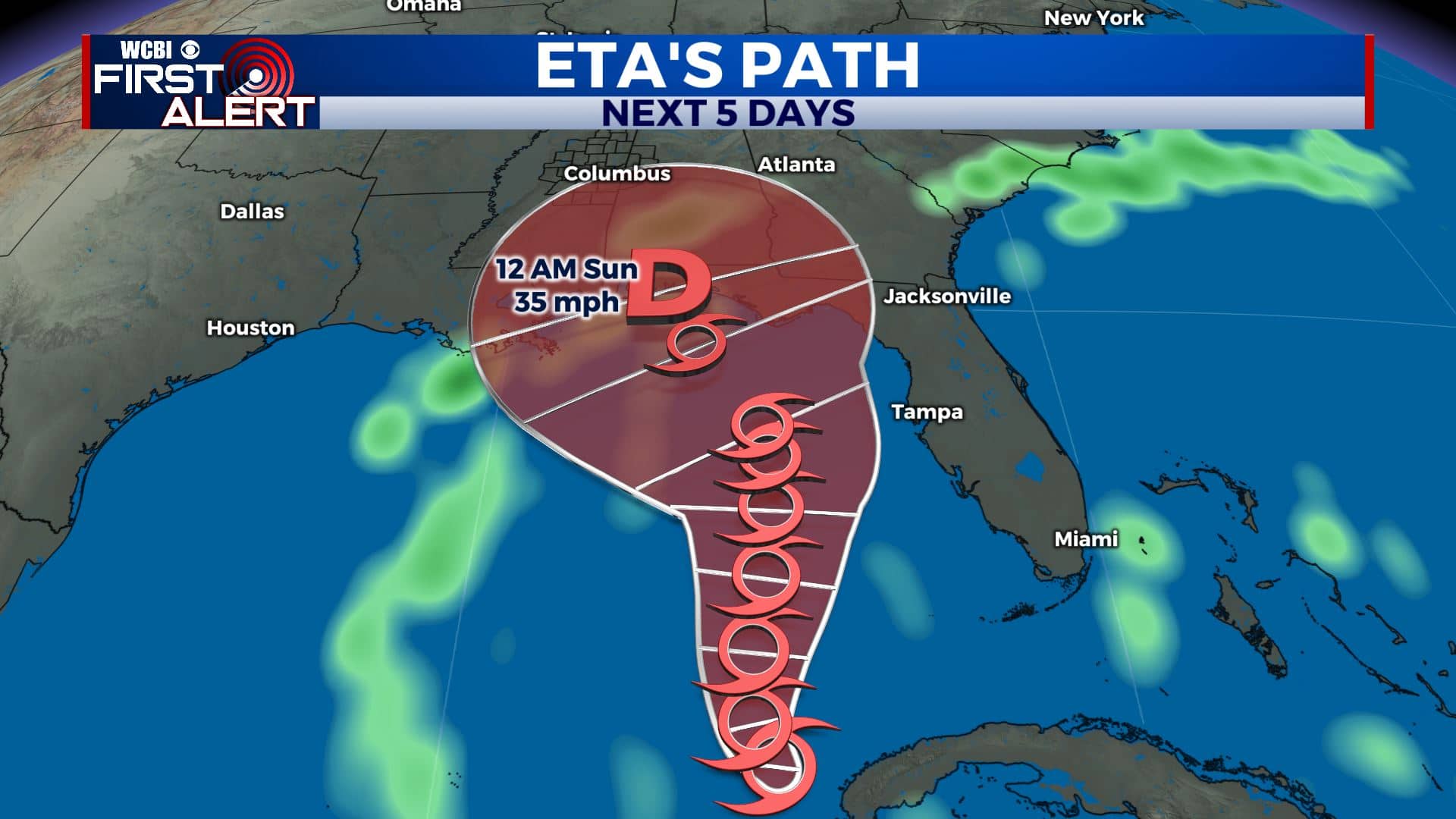
TROPICAL UPDATE: The 2020 Atlantic Hurricane Season now holds the record for the most named storms previously held by the 2005 Hurricane Season thanks to Theta that formed yesterday out in the Atlantic, making it the 29th named storm of the season. Tropical Storm Eta is lingering off the coast of Cuba, bringing still rain and gusty winds to Florida. As of now, the storm is expected to continue lingering in the eastern Gulf of Mexico before making a sharp turn to the north and bringing more impacts to the Florida Panhandle. There is still a chance that the storm continues westward, so we’ll need to continue watching it for possible additional rain chances this weekend.
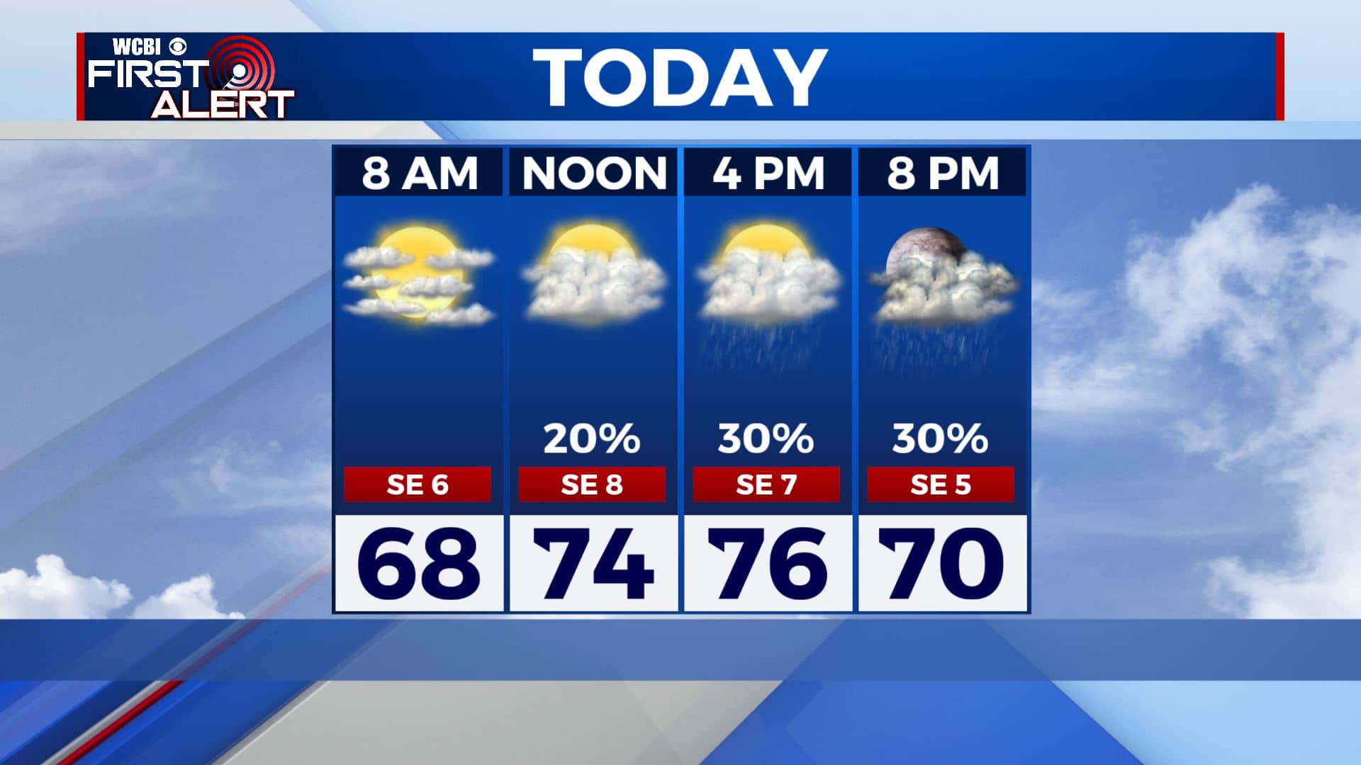
TUESDAY: We’re starting off our Tuesday with clouds increasing across the area. Some showers possible after midday. It won’t be a complete washout, but keep the umbrella nearby just in case. Highs will be in the mid 70s with a breezy SE wind at 5-15 mph.
TUESDAY NIGHT: Light showers will continue overnight with mostly cloudy skies. Some misty or patchy fog could form by early Wednesday morning. Overnight lows in the mid 60s.
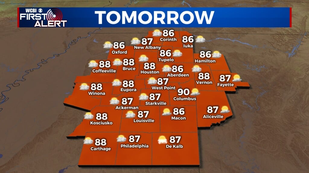
WEDNESDAY: Morning showers will give way to drier conditions by the afternoon and evening once the cold front pushes through. Skies will also clear up through the day. Highs will still be mild in the mid 70s.
THURSDAY-FRIDAY: We’ll see a mix of sun & clouds as we end the workweek. High temperatures in the lower to mid 70s. Overnight lows will be cooler in the upper 40s to near 50 degrees.
WEEKEND: The forecast becomes a bit uncertain by the weekend depending on Eta’s track. We could see some rain or we could remain dry. As of now, we’re going to keep a 30% chance of showers in the forecast. Skies will be mostly cloudy with highs in the mid 70s.
MONDAY: Any rain we receive will exit by Sunday afternoon, leaving us dry and mostly sunny by Monday. Temperatures will cool down once again, with highs only in the upper 60s.
Stay connected with @WCBIWEATHER on Facebook, Twitter, Instagram, and the WCBI News App


Leave a Reply