Maintaining rain chance
COLUMBUS, Mississippi (WCBI) – Rain chance of showers and storms will maintain through the middle of the week. A cold front from the NW will help bring in some drier air going into the weekend. It won’t last long through.
TUESDAY NIGHT: Scattered showers and storms are possible again overnight. Depending on how storms set up and if the train, some localized flooding issues could arise. Temperatures remain warm, only falling into the lower 70s.

WEDNESDAY: Copy and paste! Continuing the summer-like pattern of warm temperatures and scattered rain chances. One more round of scattered storms looks likely Wednesday afternoon before we get a brief upper-air pattern shift. High temperatures will continue in the upper 80s, with lows in the lower 70s.

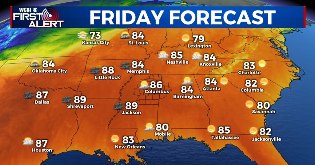
REST OF WEEK/WEEKEND: As the upper-air flow becomes more amplified, a front looks to push through Thursday afternoon. We’ll turn hotter into the lower 90s before it passes, but a brief reprieve in the humidity is expected Friday & Saturday. Just in time for the end of the week/early weekend! Things have trended toward another front Sunday, and we could see additional scattered storms.