Less humid and cooler for your Wednesday
SUMMARY: After a very active first half of the week, things are looking to be calmer and cooler for us as we head into the second half. It will be warmer & humid again by the weekend. Sunshine returns on Wednesday. May see a stray shower or two on Thursday, but we’ll stay mostly dry. Our next chance for some showers and thunderstorms returns Sunday into the first half of next week.
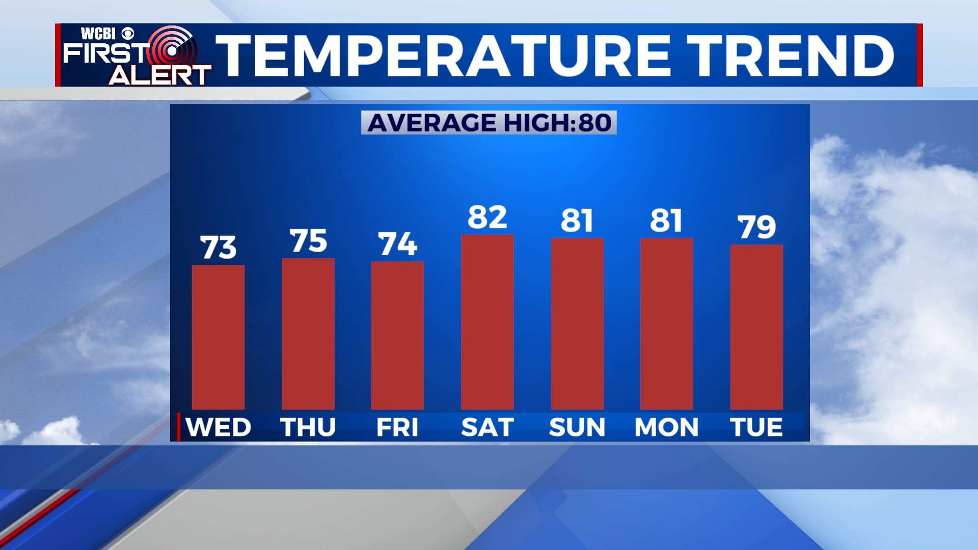
WEDNESDAY: Clouds to start our day with sunshine developing into the afternoon. Much cooler and less humid with highs in the lower to mid 70s. NW winds 5-10 mph.
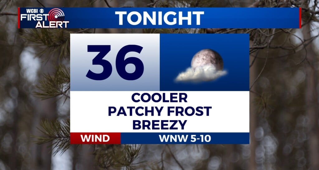
WEDNESDAY NIGHT: Mostly clear skies and cooler. Overnight lows in the upper 40s to near 50 degrees.
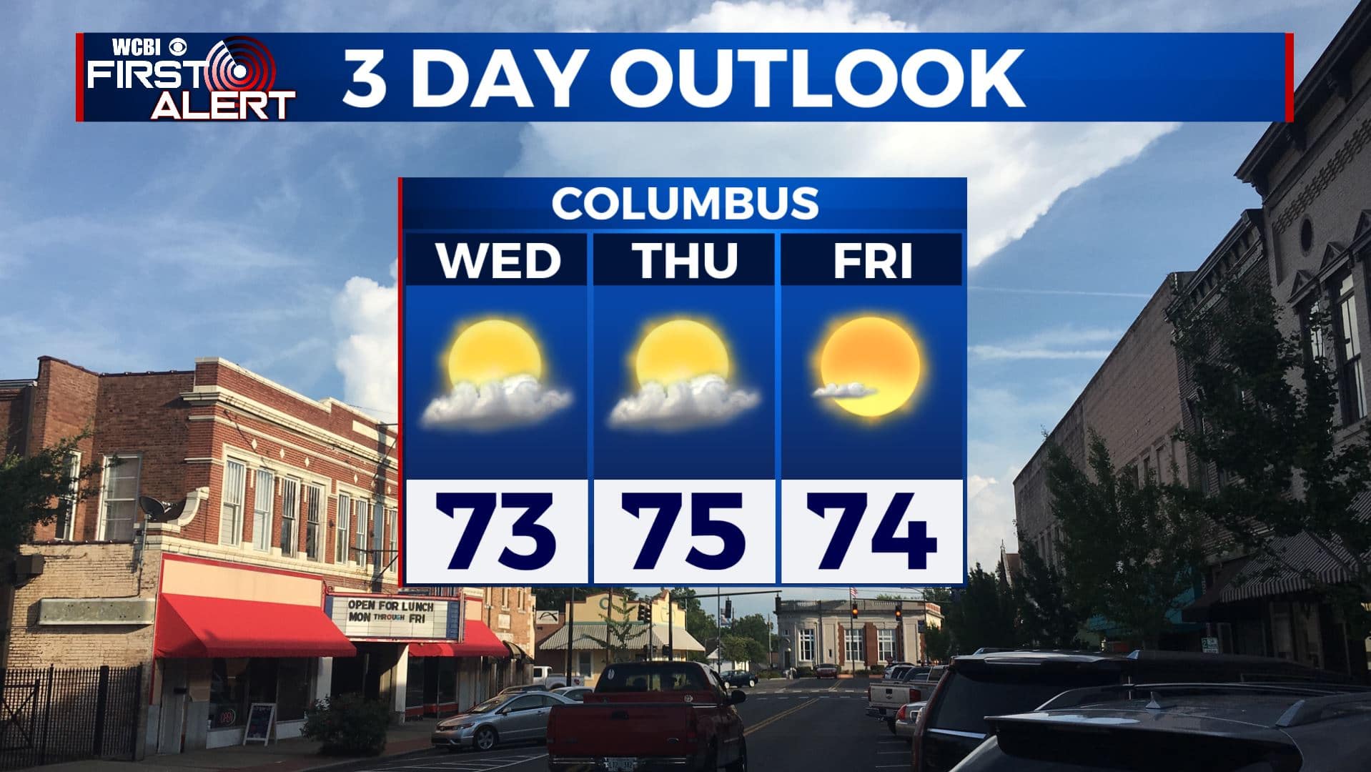
THURSDAY: We’ll start the day with mostly sunny skies, but a few more clouds will move in by the afternoon with a few stray showers. Highs in the lower to mid 70s.
THURSDAY NIGHT: A few clouds overnight and staying cool. Lows in the upper 40s to lower 50s.
FRIDAY: Mostly sunny skies. A pretty nice day for the end of the workweek. Highs in the lower to mid 70s. Lows around 50 degrees Friday night.
SATURDAY: A mix of sun & clouds. Getting warm and humid again. Highs back up into the lower 80s. Lows in the upper 50s to lower 60s Saturday night.
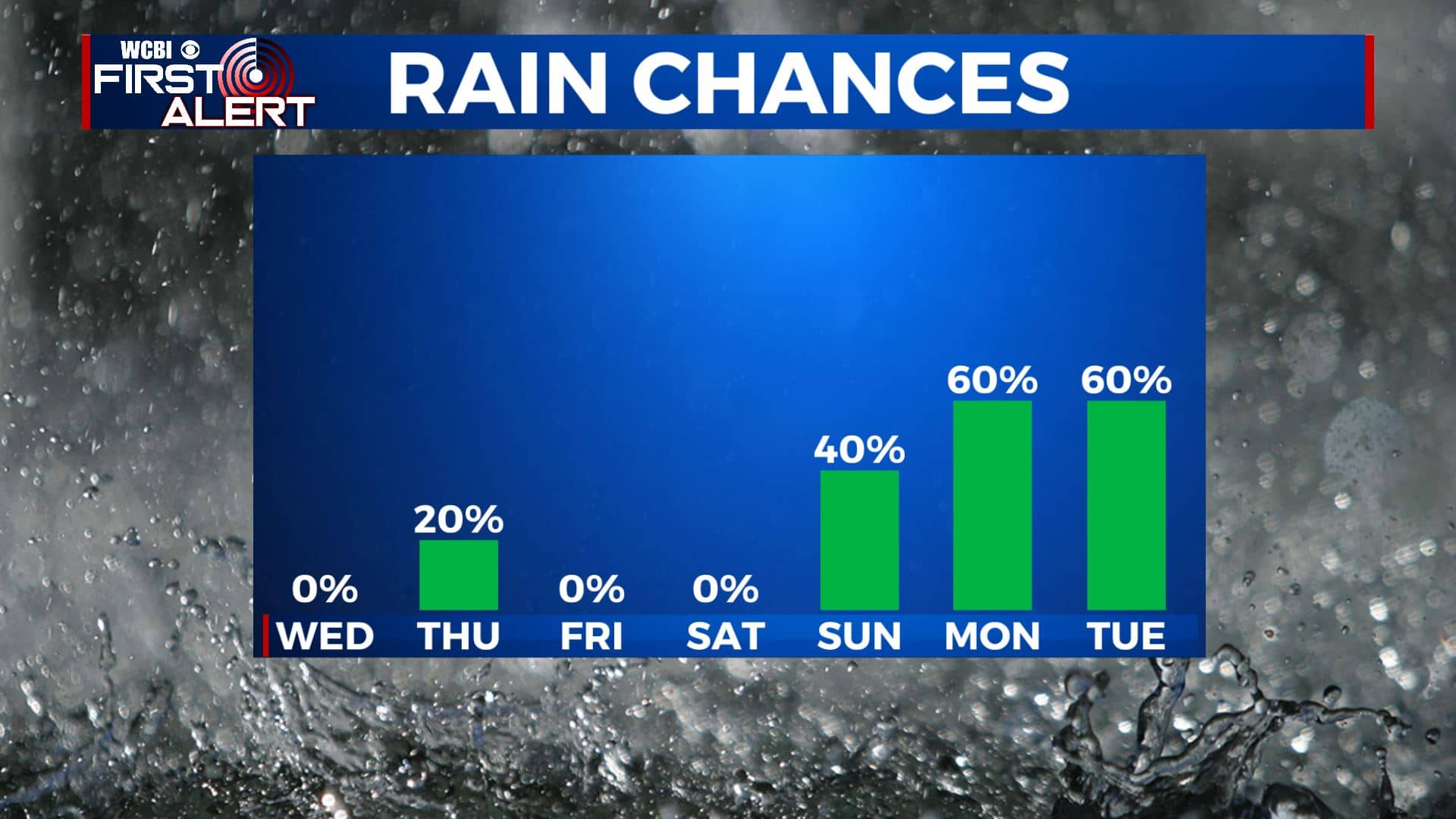
SUNDAY-TUESDAY: Next chance for some showers and thunderstorms will be on Sunday. We’ll see off-and-on again showers and storms through Tuesday. Highs in the upper 70s to lower 80s.
Stay connected with @WCBIWEATHER on Facebook, Twitter, Instagram, and the WCBI News App.


Leave a Reply