Keep the rain gear handy for Monday
SUMMARY: Our wet and stormy pattern will continue as we start off the new workweek with chances for rain & thunderstorms as a stationary front to our north keeps our weather unsettled. It won’t be a total washout every day, but there could be periods of heavier rain. Highs will stay warm & humid in the upper 80s to lower 90s. Some of us could see localized flooding.
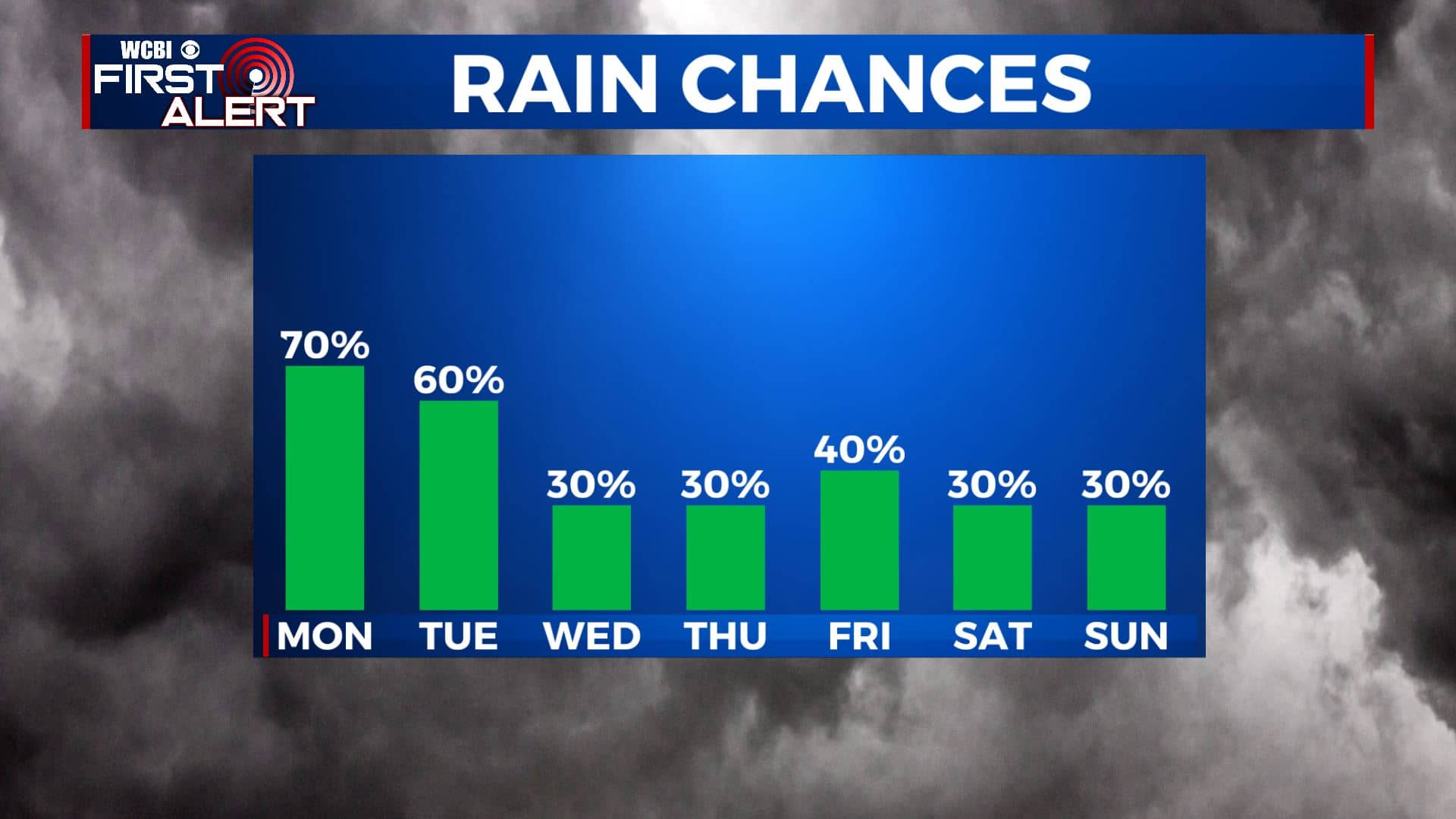
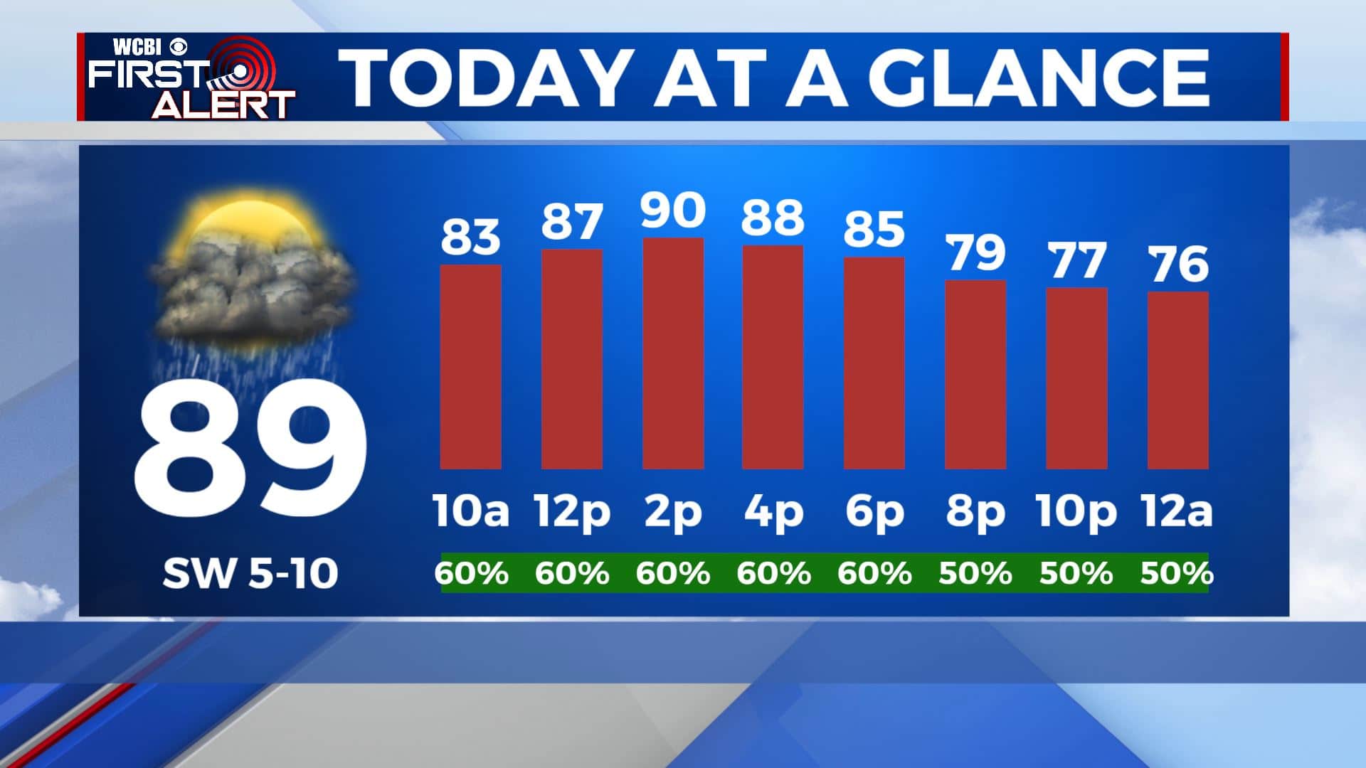
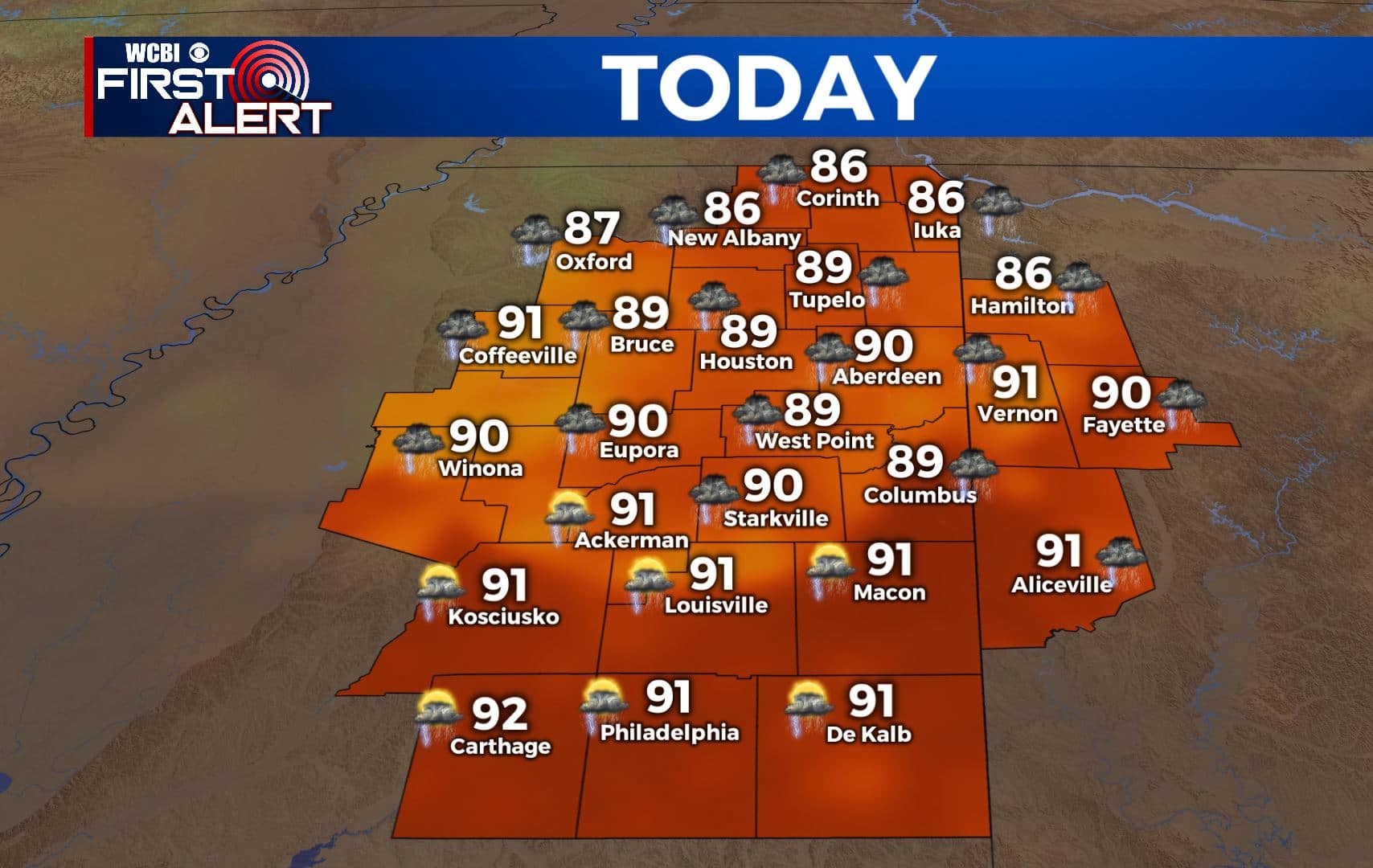
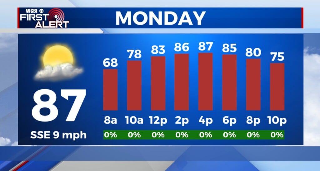
MONDAY: Some of us are waking up to some misty & foggy conditions with temperatures in the 70s. We’ll have some sunshine mixing in with clouds by late morning, but expect several rounds of showers and storms as they will be likely throughout the day. Keep the umbrella nearby. We’ll stay very warm and humid as temperatures climb to near 90. SW winds 5-10 mph.
MONDAY NIGHT: Showers & storms will come to an end early evening, making way for mostly cloudy skies overnight. Lows muggy & warm in the 70s.
TUESDAY: More off-and-on storms are possible through the day on Tuesday. Highs will once again be near 90 with overnight lows in the 70s.
WEDNESDAY-THURSDAY: While rain chances don’t go away completely for Wednesday and Thursday, but they will start going back down a bit. Not everyone will see rain, but a few scattered showers or storms will be possible. Our temperatures will be a bit warmer as temperatures climb into the lower 90s each afternoon. Overnight lows will remain in the 70s.
FRIDAY-WEEKEND: We’ll keep a scattered pop-up chance of showers & storms in play for Friday and the weekend. This basically means to go about your day as normal, but be prepared for a quick downpour if one moves in. Temperatures will be a bit lower with highs in the upper 80s.
Stay connected with @WCBIWEATHER on Facebook, Twitter, Instagram, and the WCBI News App


Leave a Reply