Humid Summer Weather Pattern
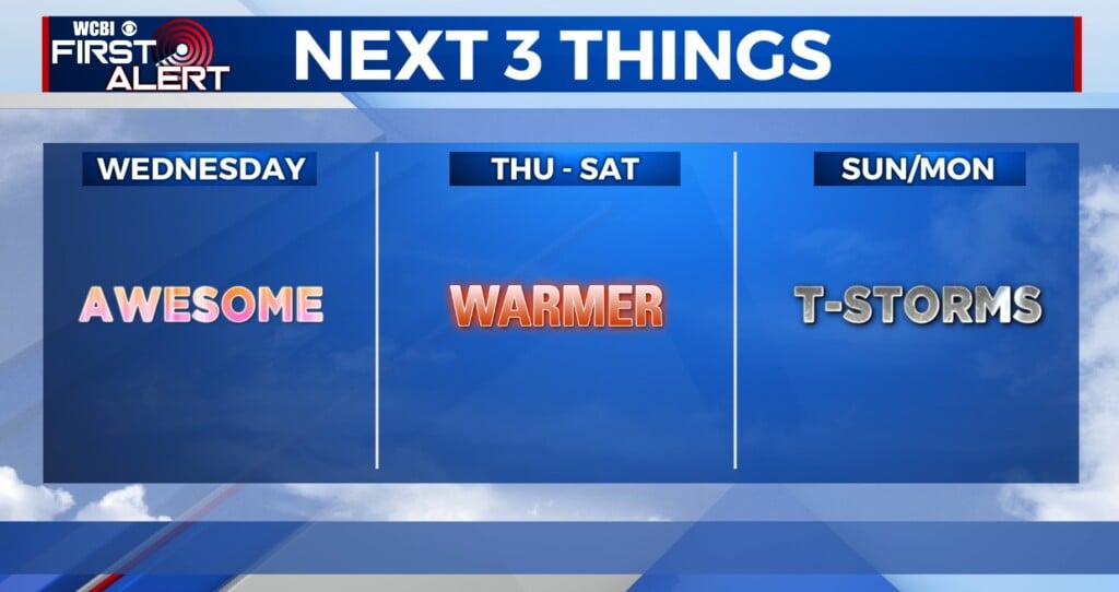
SUNDAY: Another seasonably warm and humid summer day is on tap for us. Highs will be in the low 90s with heat index values in the mid to upper 90s. Pop-up showers and storms may develop with the chance of rain holding steady at 30%. However, shower and storm activity will mainly occur before 7 p.m. then it will diminish during the evening.
MONDAY – WEDNESDAY: No big weather maker is going to affect the region so we’re going to maintain a persistence type forecast… meaning what happens one day will tend to happen the next. Highs stay in the low 90s with heat index values approaching 100. Lows drop into the low 70s. Expect a daily 20-30% chance of rain and storms with most activity occurring during the heating of the day.
INDEPENDENCE DAY: A 30% chance of showers and thunderstorms mainly in the afternoon/evening hours. We look to dry out overnight with quiet conditions expected and lows in the mid 70s.
FRIDAY-WEEKEND: More summer afternoon/evening showers and thunderstorms are possible with highs in the low to mid 90s and lows in the mid 70s.
Stay connected with @WCBIWEATHER on Facebook, Twitter, and Instagram


Leave a Reply