Hot & humid weekend ahead
SUMMARY: Hot and humid conditions will persist through the weekend and next week. Storms are possible each and every day primarily during the daytime heating hours. Heat indices are going to be generally in the 100-110 range for the next 7 days. Be sure to stay in air conditioning as much as possible and drink plenty of water if you’ll be spending time outdoors.
THURSDAY NIGHT: A few isolated evening showers or storms are possible. Otherwise becoming mainly clear and quiet. Lows in the mid to low 70s with light wind. Some patchy fog is possible.
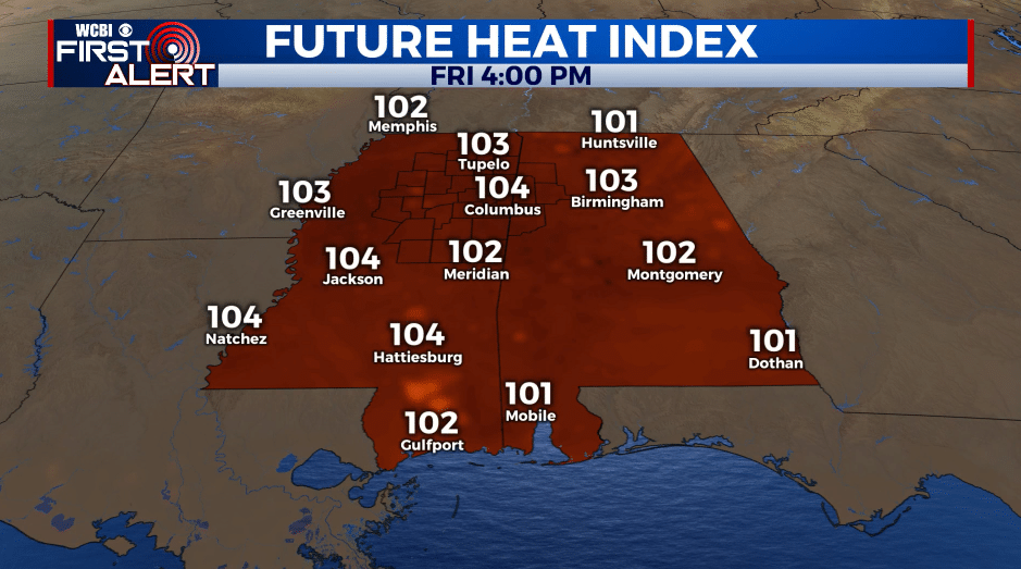
FRIDAY: Partly cloudy with a 20-30% chance of spotty storms. Highs in the mid 90s with heat indices 100-105 or higher.
FRIDAY NIGHT: Partly cloudy and muggy. Lows in the mid 70s.
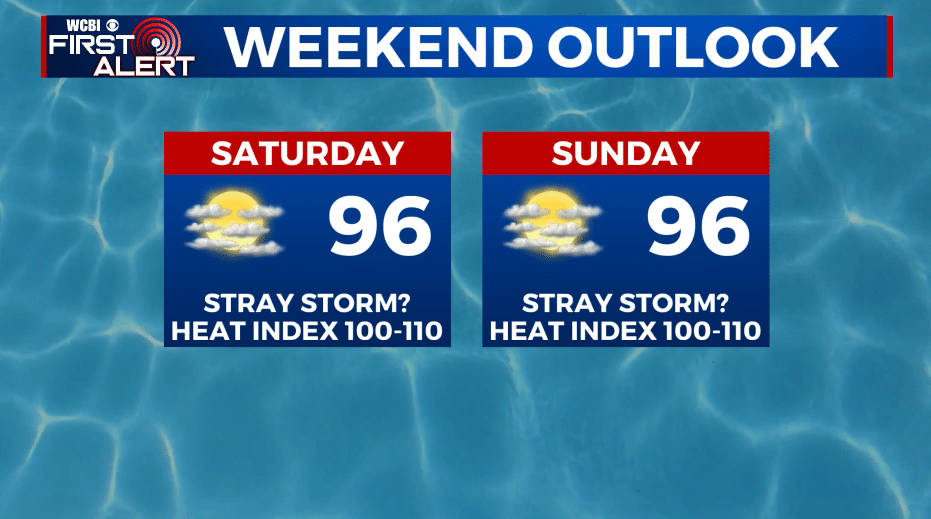
WEEKEND: Partly cloudy, hot, and humid. Highs in the mid 90s with heat indices between 100 and 110. A daily 20% chance of a few stray storms but many periods will be rain free. Lows in the mid 70s.
NEXT WEEK: Highs generally in the mid 90s with lows in the mid 70s. A slight uptick in rain and storm chances by the middle of the week. No big weather makers are foreseen and most of the storm activity is likely going to be during the heating of the day.
Follow @WCBIWEATHER on Facebook, Twitter, Instagram, and the WCBI News App


Leave a Reply