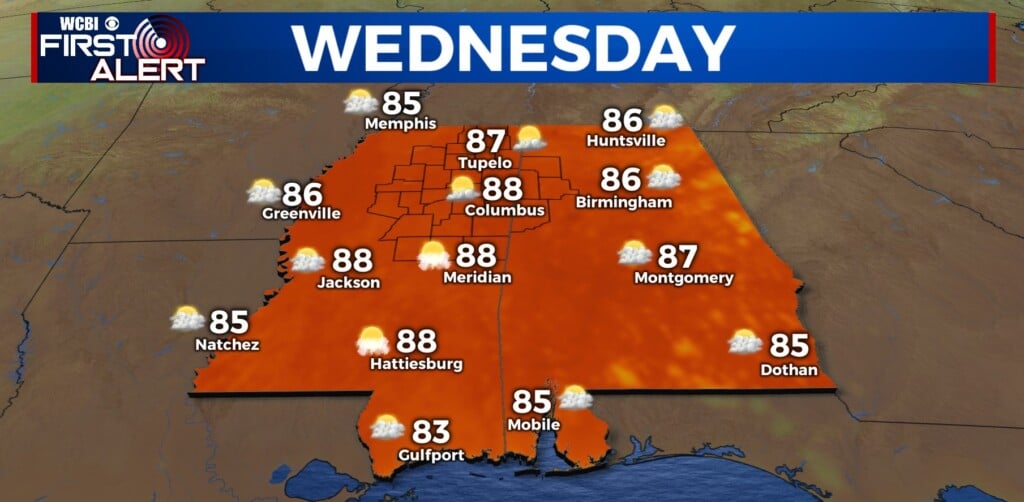
Hot again Wednesday ahead of storm chance Thursday
COLUMBUS, Mississippi (WCBI) – Hot, humid weather continues Wednesday before unsettled weather moves in Thursday and Friday.
WEDNESDAY: The day once again stays dry, hot, and relatively humid with highs well into the 80s. The heat index could again push 90 degrees in some spots as well.
WEDNESDAY NIGHT: A few showers or brief rumbles are possible northwest of the Natchez Trace this evening/overnight as big storms from the west push in…but thankfully they will be rapidly weakening. We don’t expect any severe issues overnight.
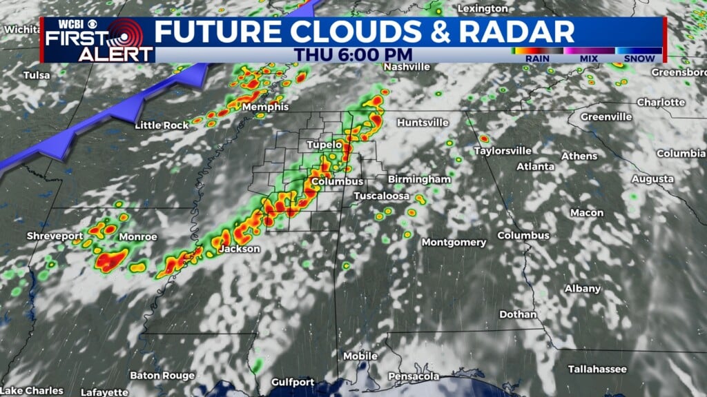
THURSDAY: Scattered storms are expected to redevelop during the peak heating time frame ahead of a cold front. A few storms could contain gusty to potentially damaging winds. Most storms should weaken/push out by Thursday night.

FRIDAY: With a brief lull in the action Friday morning, rain and perhaps a few rumbles will redevelop by afternoon and evening as a final front pushes through the region. Pockets of heavy rain are likely, but we don’t expect any severe storm issues.
WEEKEND: While there is some disagreement on how fast we clear Saturday, we are expecting cooler and drier air to ultimately settle in from the northwest. This will help to drop highs into the 70s, and by Sunday morning, lows will likely be in the lower 50s!