Here comes the “cool” down
COLUMBUS, Mississippi (WCBI) – With a cold front approaching, rain chances will maintain but the temperatures will get slightly cooler compared to the first half of the week.
WEDNESDAY NIGHT: Heat advisory is set to end tonight at 8PM. Heavier clouds stick around tonight. Temperatures falling into the low to middle 70s again.
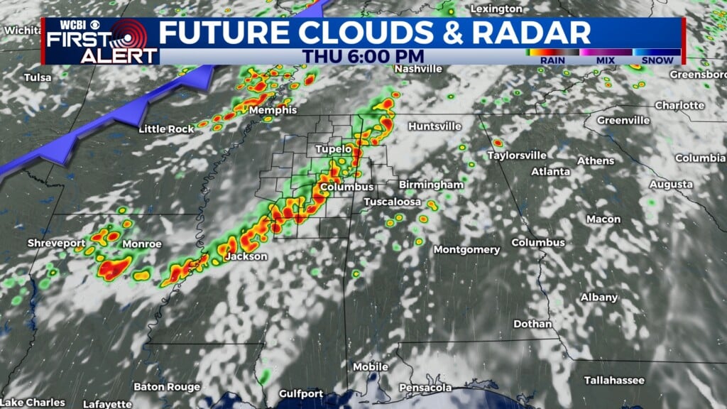
THURSDAY: Cold front will be slowly moving through northern Mississippi throughout the day. High temperatures will be in the lower 90s. Heavy clouds, rain showers and thunderstorms are likely. A quarter to a half an inch of rain are possible, accumulating more within thunderstorms. Overnight low temps maintain in the lower 70s.


FRIDAY: Noticeably cooler!! High temperatures will only reach into the middle to upper 80s! No complaints from anyone are allowed. The rain chance continues with a possible half to three quarters of an inch accumulating in the showers and storms. Lows again in the lower 70s.
WEEKEND: Rain showers and thunderstorms are likely to continue. High temperatures remain slightly cooler, in the upper 80s to lower 90s. Lows in the low to middle 70s.