Heating up for the summer solstice
COLUMBUS, Mississippi (WCBI)- High temperatures will be heat right back up, after today’s Summer Solstice! Rain chances also become lighter for a few days, before returning by the end of the weekend.
WEDNESDAY NIGHT: More warmth and muggy conditions for the middle of the week. Temperatures tonight will again be mild and warm, in the upper 60s to lower 70s. Cloud coverage will maintain mostly cloudy overnight and into tomorrow.

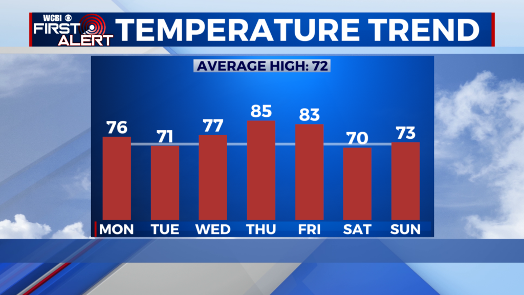
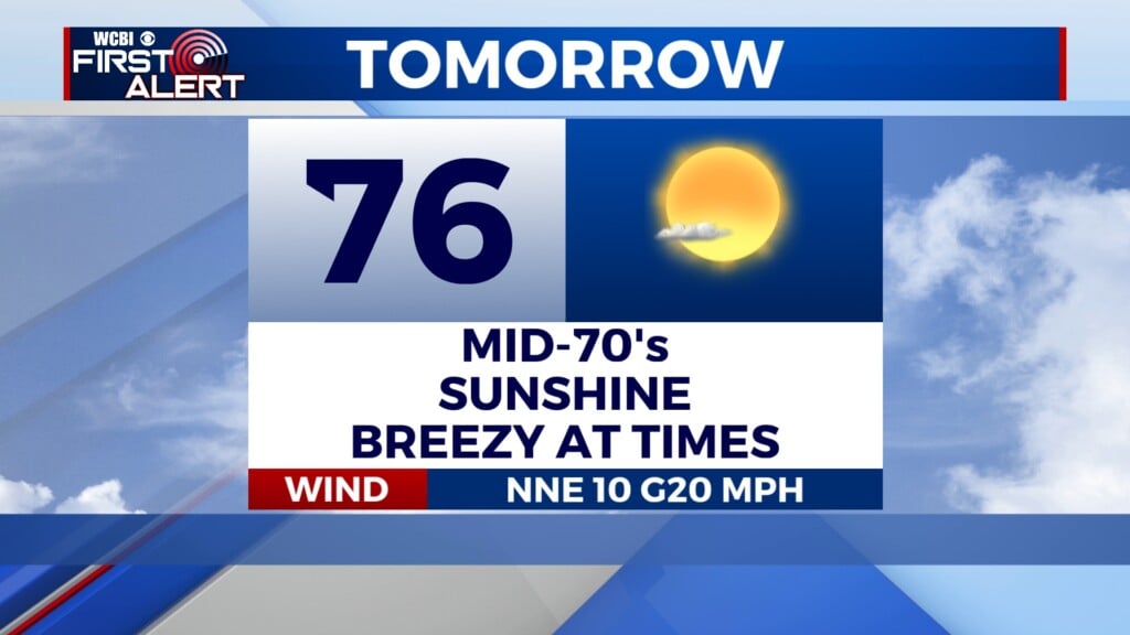
THURSDAY: Still going to be a warm day, though temperatures will be continuing below average. High temps will be in the low to middle 80s. Rain chance will be slightly more scattered than Wednesday, though there is still a chance for late afternoon and early evening showers. Low temperatures will be in the middle 60s.
FRIDAY: The high temperatures are going to begin creeping back up, hitting the middle 80s for the end of the week. Cloud coverage will be lighter, remaining partly cloudy to mostly clear. Rain chance dries up too! Low temps will be in the middle 60s.
WEEKEND: Heading back into the 90s! The first weekend after the Summer Solstice is going to be a hot one. Saturday will be mostly dry and clear. Sunday returns the chance of late showers and storms moving through NE MS into early Monday morning. Expect warm weekend nights too, with temperatures in the upper 60s to lower 70s.