Going into Spring
COLUMBUS, Mississippi (WCBI)- The first night of Spring and there is a potential for frost/freeze. Calmer conditions are likely going into the weekend. Showers and storms likely leaving the weekend and going into the last week of March.
THURSDAY NIGHT: With a mostly clear sky, temperatures will be dropping quickly towards freezing. Most of the coverage area will be at or below the 32 degree freezing threshold. Luckily, the breeze will calm overnight. A FREEZE WARNING is in place for the southern half of our coverage area and for our western AL counties until 8AM Friday morning.

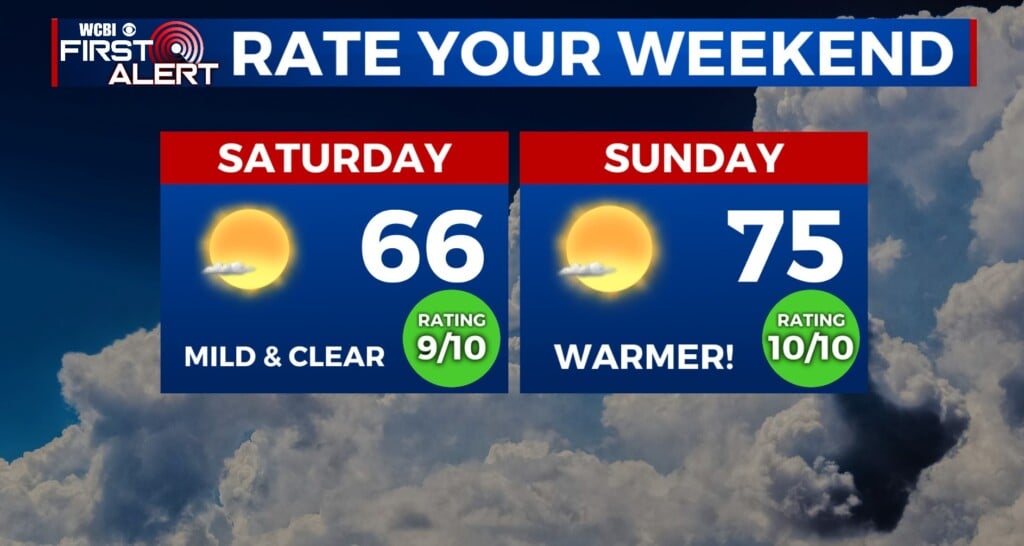
FRI/SAT: Trying to warm up and feel a bit more like Spring. Friday will be mostly clear and sunny, with high temps in the middle 60s. Saturday morning will start in the lower 40s and will reach the middle 70s by the afternoon. Saturday will be the day to get out and enjoy the weekend! Clouds are likely to begin filling in, as the Gulf High moves off to the East.

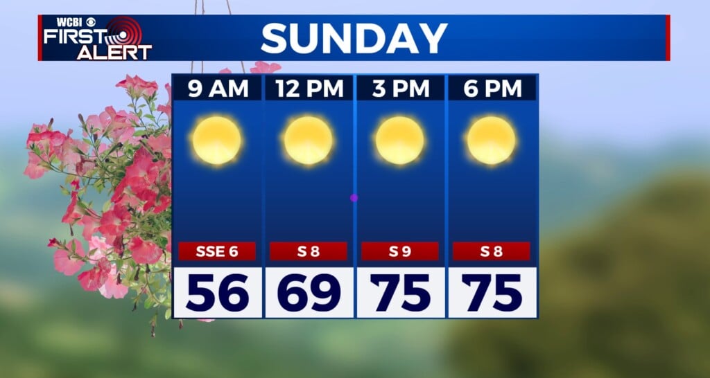
SUNDAY: The first half of the day is expected to stay dry, but heavy clouds will set in by the afternoon. High temperatures are going to reach upper 70s to lower 80s. By the afternoon and throughout the rest of the evening, showers and storms will be likely. Some storms could become strong to severe. The Storm Prediction Center has already placed a broad area in the Level 2 -Slight Risk for severe weather. Gusty wind and hail look to be the main threat. However, in late March, tornadoes cannot be ruled out. Stay with us for more updates!