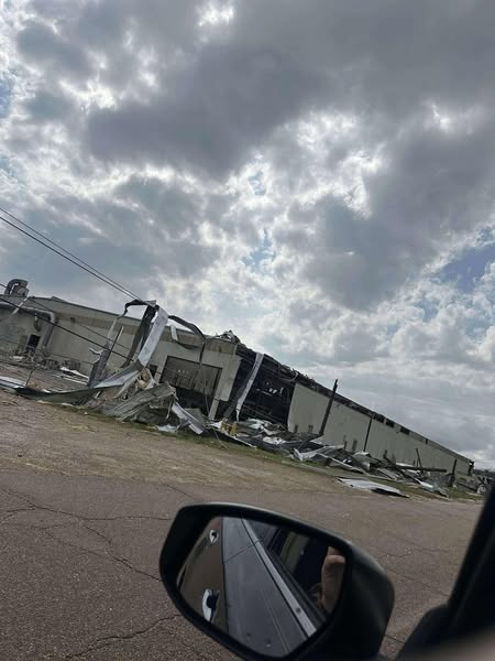
Drying out and heating up
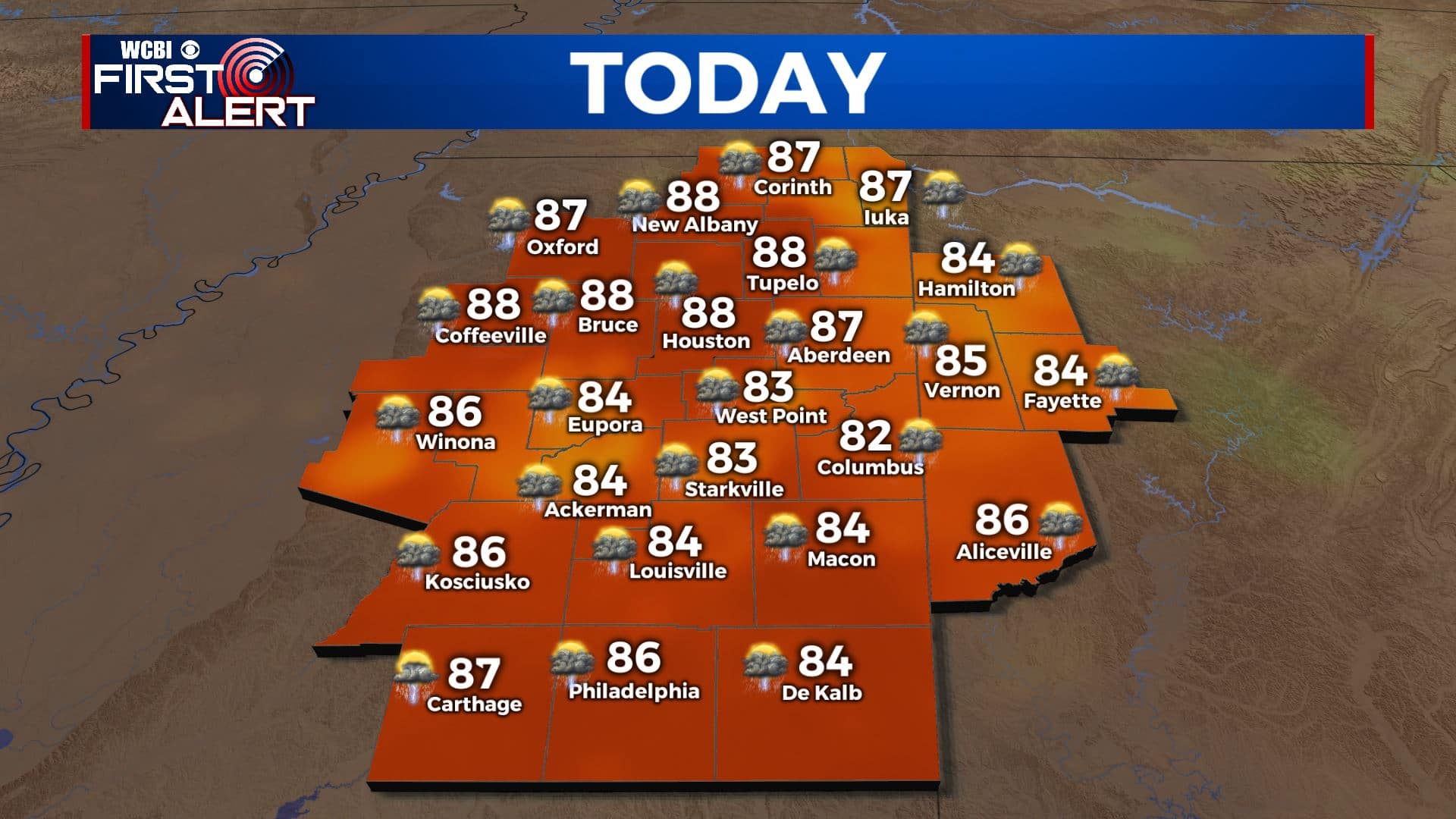
SUMMARY: After days of relentless rain here in NE Mississippi and West Alabama, we are finally going to be drying out! Friday still has a widespread chance of showers and storms, with highs held down by cloud cover. By Saturday, only scattered storms possible in the afternoon. Sunday, most of us should stay dry as we warm back into the upper 80s. Staying dry for most of the week, but this time of year we can never really rule out a stray afternoon shower or storm. Highs will be in the upper 80s or low 90s. Late week could bring a slight cool down and drier air.
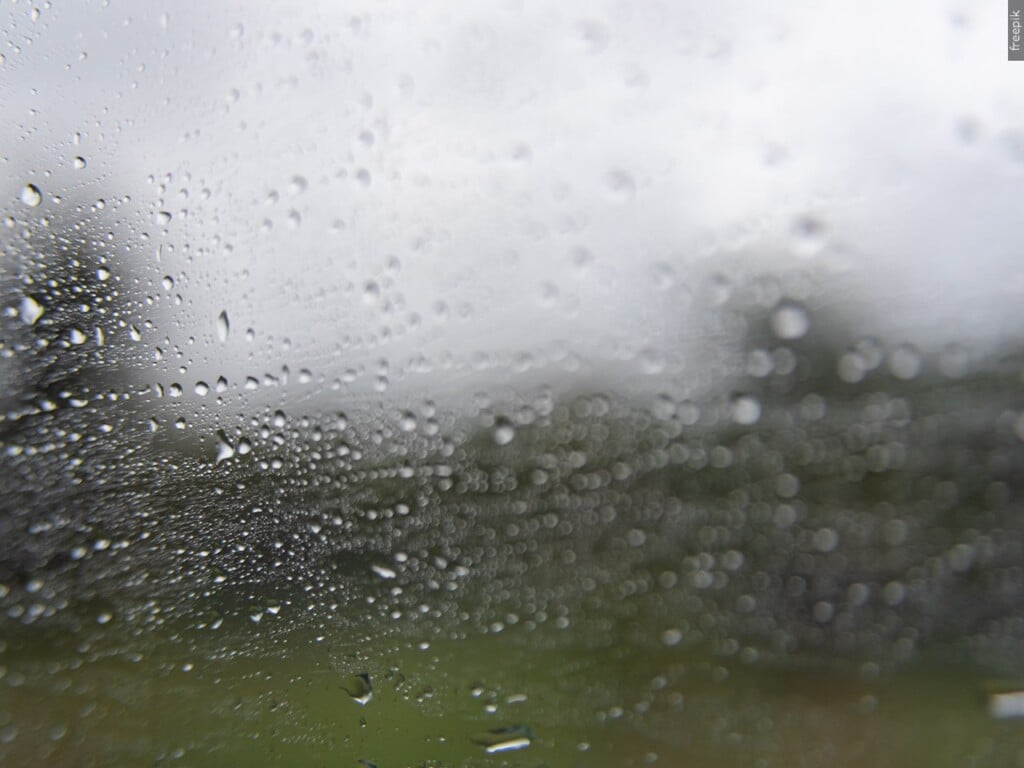
FRIDAY: Another soggy day for many of us, but shower and storm coverage may be a bit less than we have seen in previous days. Highs in the low 80s with mostly cloudy skies, staying very humid.
FRIDAY NIGHT: Rain chances finally diminish quite a bit for tonight. Can’t rule out a scattered shower or 2, but nothing like previous nights where we saw massive T-storm complexes drop 6″ or more of rain. Skies should be partly cloudy, and dense fog could be an issue in areas that clear out. Lows around 70.
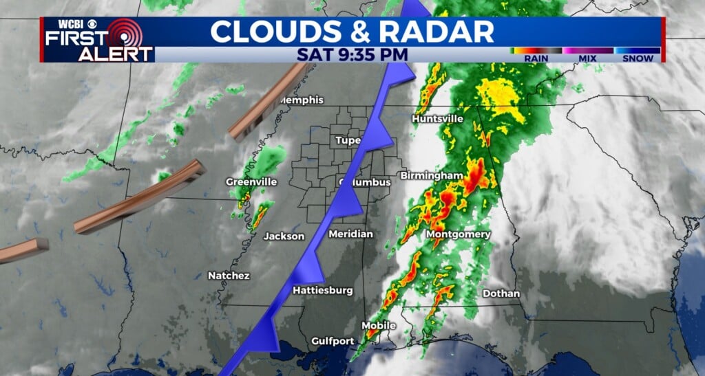
SATURDAY: Still have a scattered storm chance in the afternoon on Saturday, but I think it will be further to the south in our viewing area with lower coverage over northern areas. Expect partly cloudy skies and highs in the upper 80s
SATURDAY NIGHT: Showers and storms end once the sun sets. Partly cloudy skies once again with a low in the low 70s.
SUNDAY: Sunday looks to be the first day in quite a while where most of the area stays dry! A stray shower or storm is not impossible, but otherwise expect highs in the upper 80s to around 90 under partly cloudy skies.
MONDAY TO THURSDAY: Staying dry as we head into the work week. We deserve it! Temps will be warm in the low 90s through Tuesday, but Wednesday we could see a front that brings slightly cooler highs in the mid 80s, drier air, and lows in the low 60s! Very comfortable for June. We’ll also be watching the Gulf for tropical development next week. Nothing on our radar just yet, but the models are hinting something could form there towards the end of next week. As always, we’ll be watching!


Leave a Reply