Dangerous heat continues, storms move in Wednesday
COLUMBUS, Mississippi (WCBI) – Triple digit temps/heat indices continue Tuesday, but a front brings rain & storm chances Wednesday PM.
TUESDAY: With a mostly sunny sky, temperatures will once again soar quickly into the 90s to potentially low 100s area-wide. Heat indices will range from 102 to 112°, with higher values expected nearest I-55.
TUESDAY NIGHT: Mostly clear, warm, and muggy with lows in the middle 70s – not much relief!
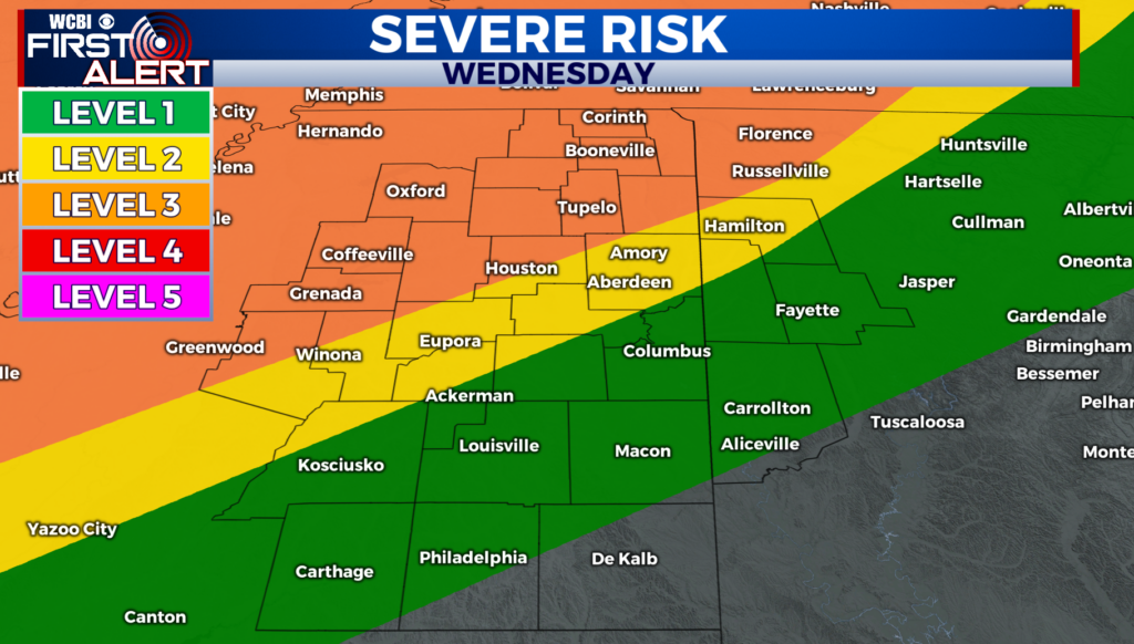
WEDNESDAY: The day begins dry and should quickly get hot and humid yet again into the middle 90s before storms arrive. A stronger front should kick off numerous showers and storms after lunch, and should any storms cluster up, some potential for damaging winds would exist. Rain amounts hopefully exceed one half inch in the heaviest activity, keeping in mind some will probably still miss out as well.

REST OF WEEK: Drier weather returns Thursday and Friday, but humidity levels won’t be much different. In fact, a several day stretch of 100-108° heat indices appears likely from Thursday into the weekend. Rain chances could pick up again Sunday.