Cool, rainy weather continues for most of northeast MS
COLUMBUS, Mississippi (WCBI) – Rain chances continue through Thursday for the region with periods of freezing rain for far north to northwestern MS into Wednesday.
TUESDAY: Steady showers continue north of US 82 this morning, and additional rain is likely to develop this afternoon & evening. Afternoon temperatures should hold steady in the low to mid 40s with north winds 5-15 mph.
TUESDAY NIGHT: Rain stays likely as temperatures drop into the upper 30s for most. Near freezing temperatures are possible northwest of the Natchez Trace, so be extra cautious! The worst of the icing is still expected for places like Corinth, Holly Springs, Southaven, and Memphis.
WEDNESDAY: While some degree of a “break” in the rain could occur Wednesday, more rain is likely Wednesday evening. Temperatures are likely to stay in the middle 40s much of the day.
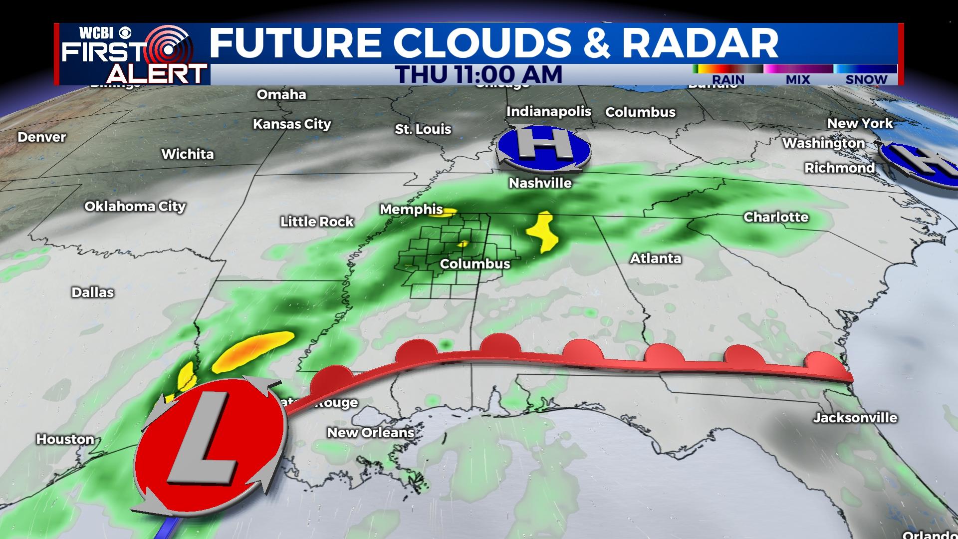
THURSDAY: This still looks to bring the best chance of widespread and heavy rain to the area. Additional rain amounts of 1-2″ are possible along with a few rumbles. There’s even a severe weather concern in the Pine Belt, but no severe weather is expected in the WCBI coverage area.
FRIDAY/WEEKEND: Sunshine makes a welcomed return Friday as highs reach near 50 degrees. Sunshine will continue into the weekend as highs bounce into the 60s Sunday.