Continuing to watch Laura and Marco and their impacts
This information is valid as of 12 pm on August 24, 2020.
All eyes remain on the tropics as Tropical Storms Marco and Laura swirl within a mere few hundred miles of each other as they near the Gulf Coast.
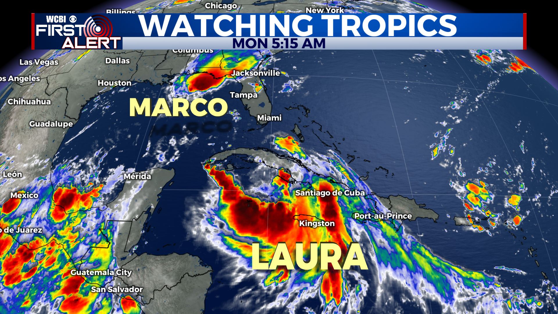
Marco continues to struggle to maintain its intensity as a tropical storm. Winds remain to 50 mph. The storm will continue its northwest movement to a landfall in Louisiana on Monday.
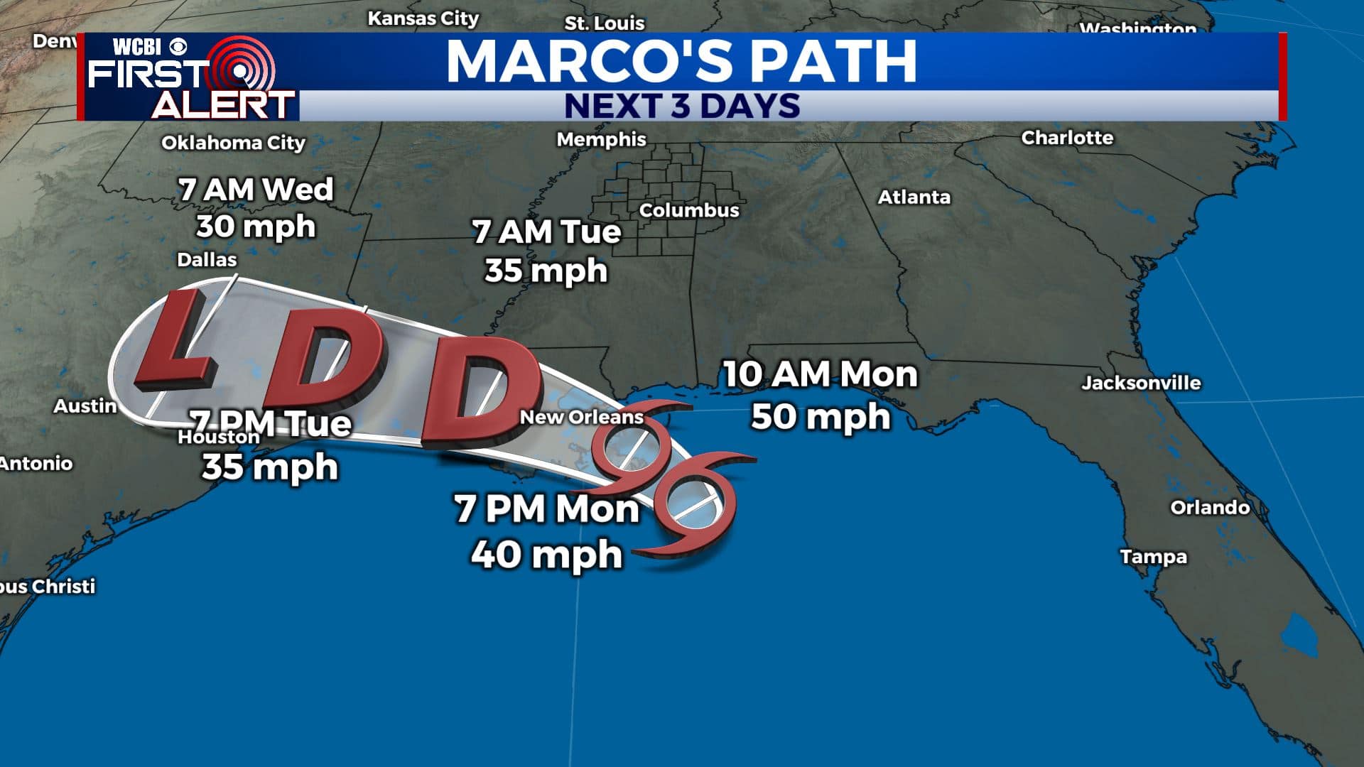
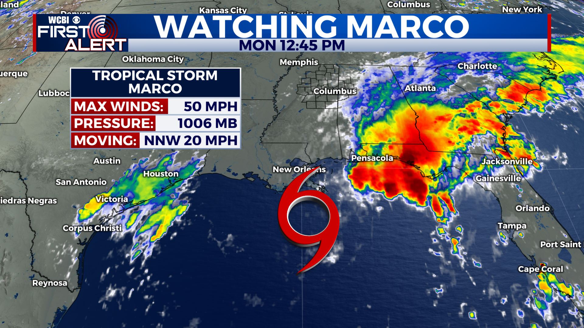
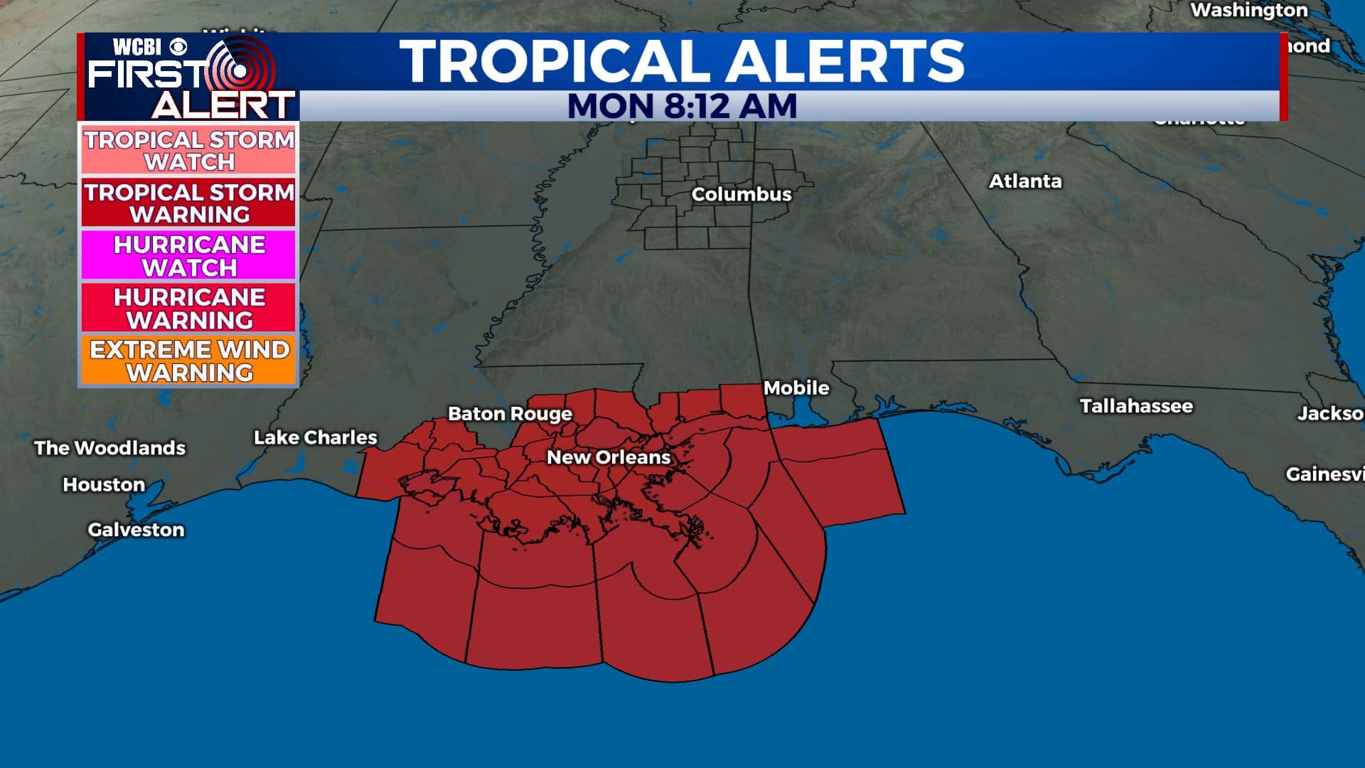
Tropical Storms Warnings are in effect for much of northern Gulf coastline. Marco will make a westerly turn after landfall, bringing heavy rain and gusty winds to Louisiana and East Texas.
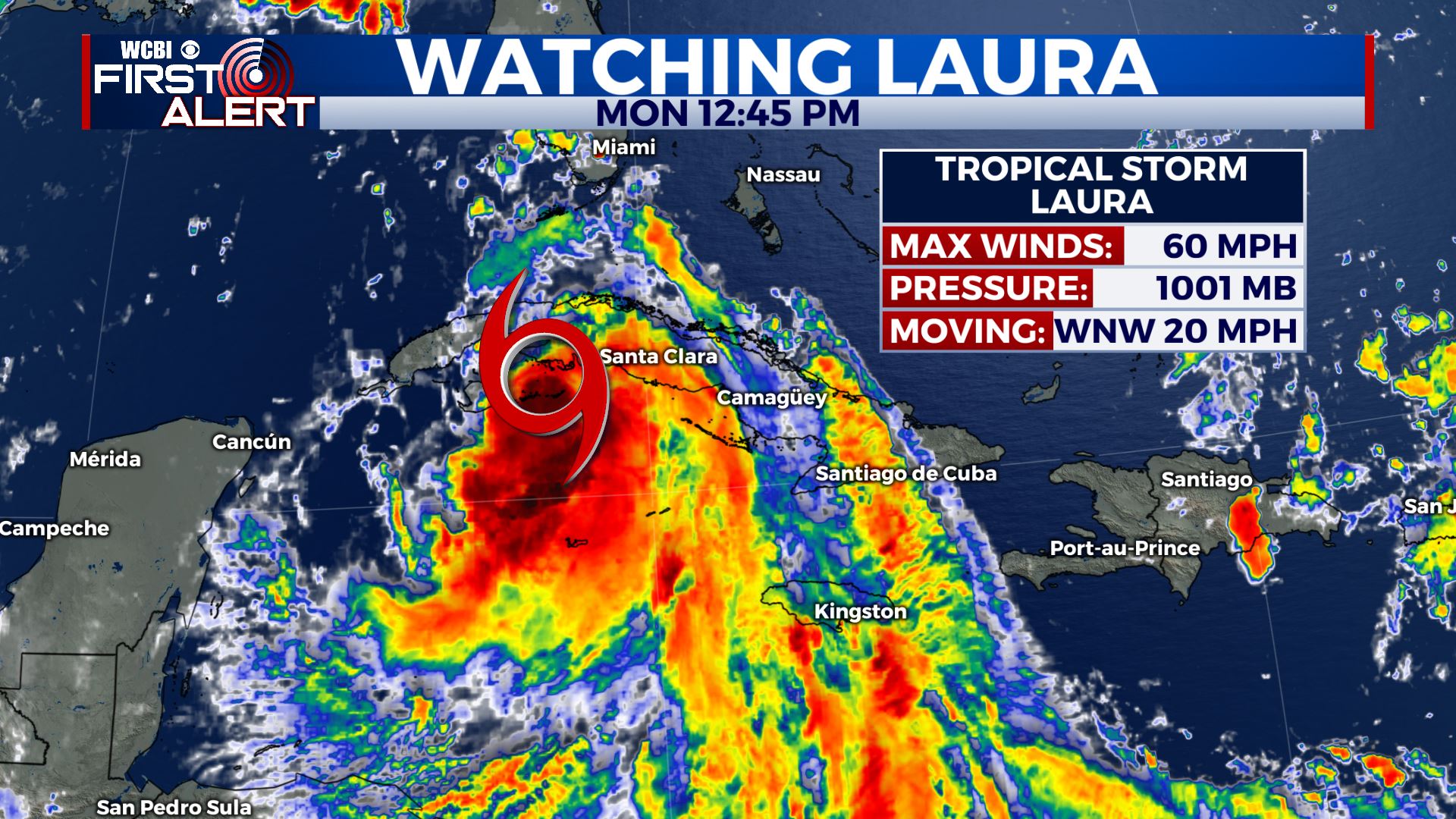
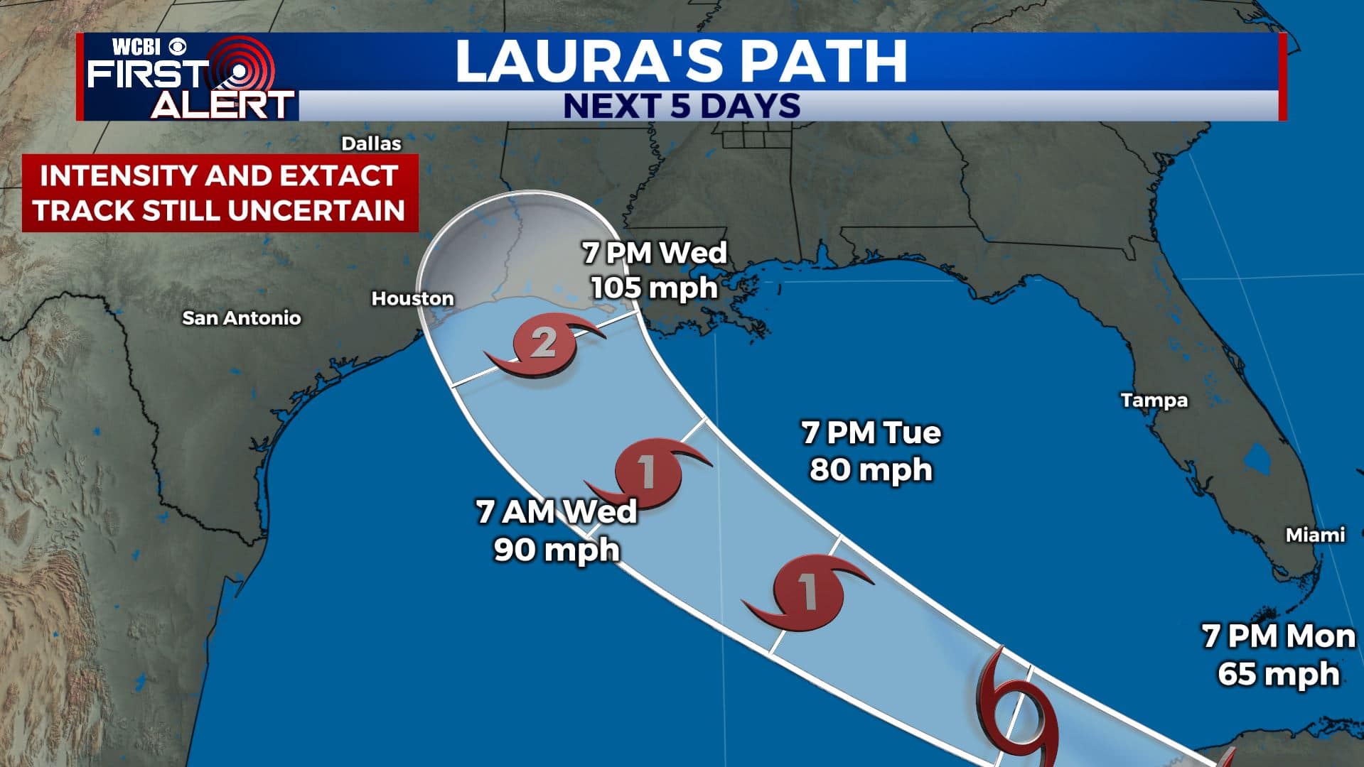
Meanwhile, Tropical Storm Laura is strengthening to the south Cuba. Winds are down to 60 mph, but it is still expected to strengthen and become a hurricane over the very warm waters of the Gulf. This storm is now likely to become a Category 2 hurricane before landfall in Louisiana or East Texas late Wednesday into Thursday.
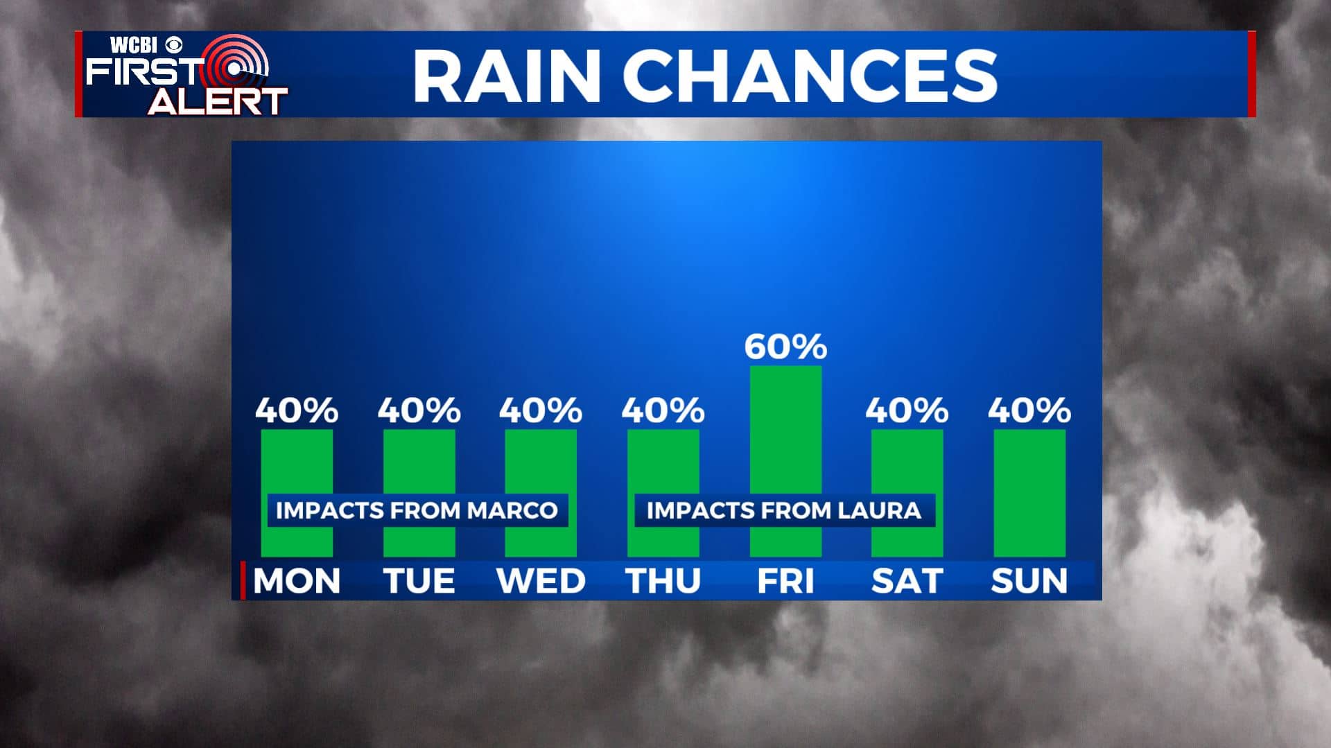
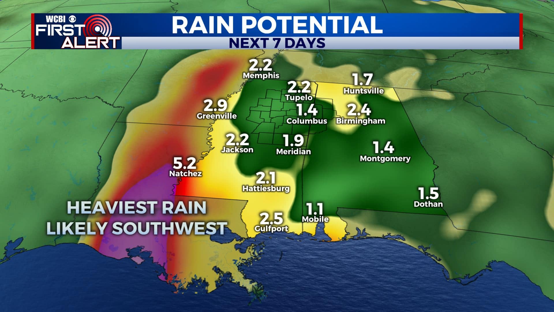
While Louisiana will see the heaviest rain and strongest wind from these two storms, we could see impacts in northeast Mississippi by the end of the week. Laura will pass just to our west, bringing us the chance for some rain on Thursday and Friday. Of course, with a tropical system, brief spin-up tornadoes are also possible. This is something we’ll have to continue to monitor as it largely depends on Laura’s track after landfall.
For the latest local forecast, visit wcbi.com/weather.


Leave a Reply