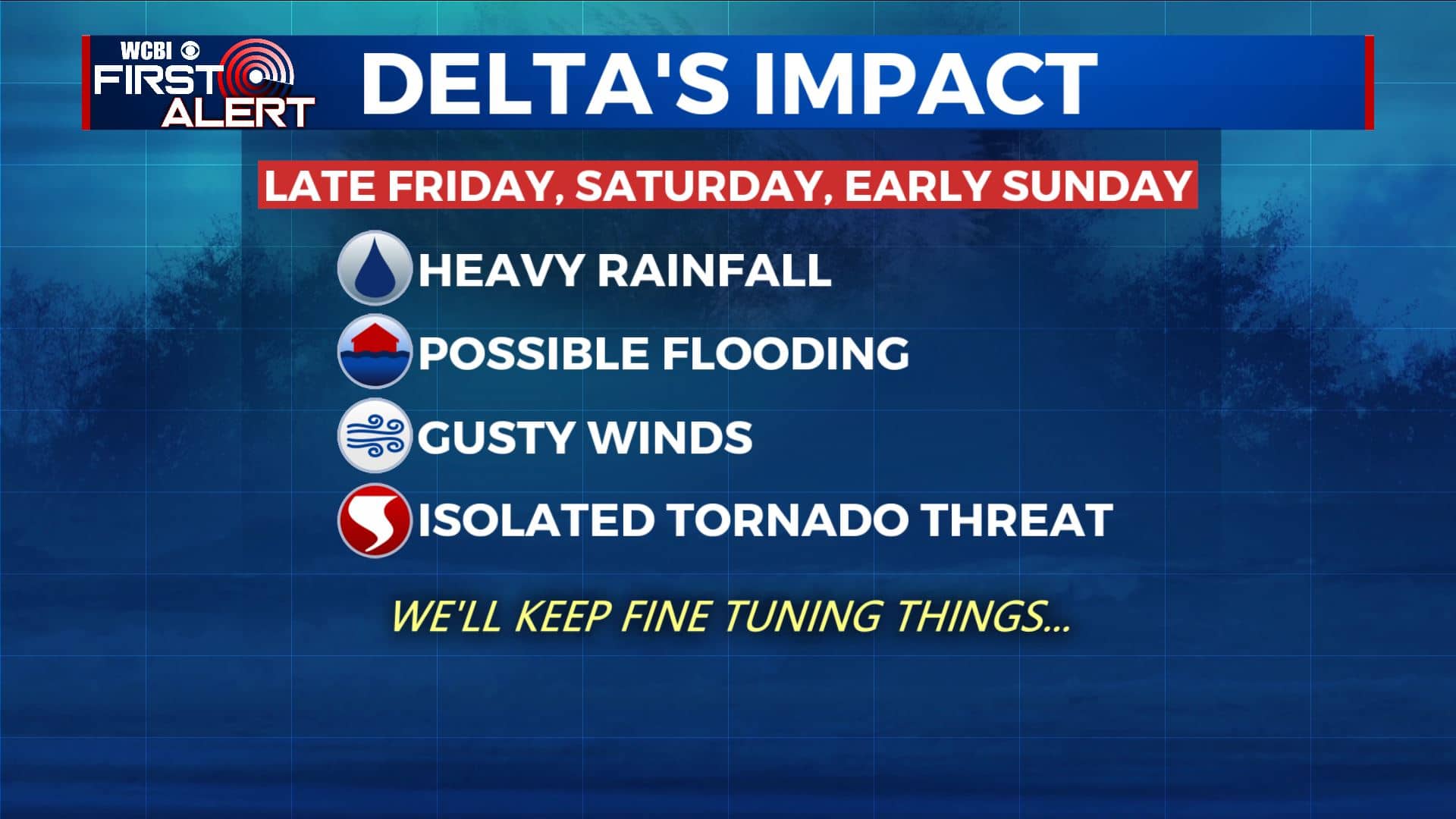
Continuing to watch Hurricane Delta and its possible impacts late week
SUMMARY: Our pleasant and quiet weather is here to stay for a few more days. Temperatures will slowly climb back up to near average by the middle part of the work week with highs into the lower to mid 80s. We’ll stay dry through at least Thursday. Our area may be impacted by the remnants of Hurricane Delta Friday into the weekend. The storm could give our region heavy rainfall, flooding concerns, gusty winds up to 40 mph and perhaps even an isolated tornado threat, if we get on the eastern & more active side of the storm. All of this depends on the exact track. Stay tuned to WCBI!
TUESDAY: All remains quiet this morning on the weather front here in north Mississippi & west Alabama. Expect lots of sunshine once again today for our Tuesday. It will be a bit warmer with highs near 80 degrees. Still will be nice & pleasant to enjoy being outside. Light Northerly to NW winds.
TUESDAY NIGHT: Mainly clear skies and quiet. Still nice & cool with overnight lows in the low 50s. Light winds.
WEDNESDAY & THURSDAY: Staying dry and sunny. A few clouds moving in on Thursday. Still warm with highs in the 80s and overnight lows in the 50s. Cold front passing through late Thursday to help cool down temperatures again to the 70s by Friday.
FRIDAY-WEEKEND: The entire forecast depends on what happens with the remnants of Delta. Heavy rain, some flooding, and wind gusts over 40 mph are possible. There could even be an isolated quick spin-up tornado threat if our area remains east of the remnant low center, but it’s still too early to tell at this point. High school football and even college football could be affected so stay tuned for additional updates on that as well from WCBI Sports.
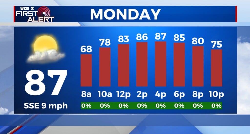
MONDAY: We’ll dry out early next week as we the sunshine returns. Highs back up into the lower to mid 80s.
Stay connected with @WCBIWEATHER on Facebook, Twitter, Instagram, and the WCBI News App


Leave a Reply