Cold front passing through for our Monday
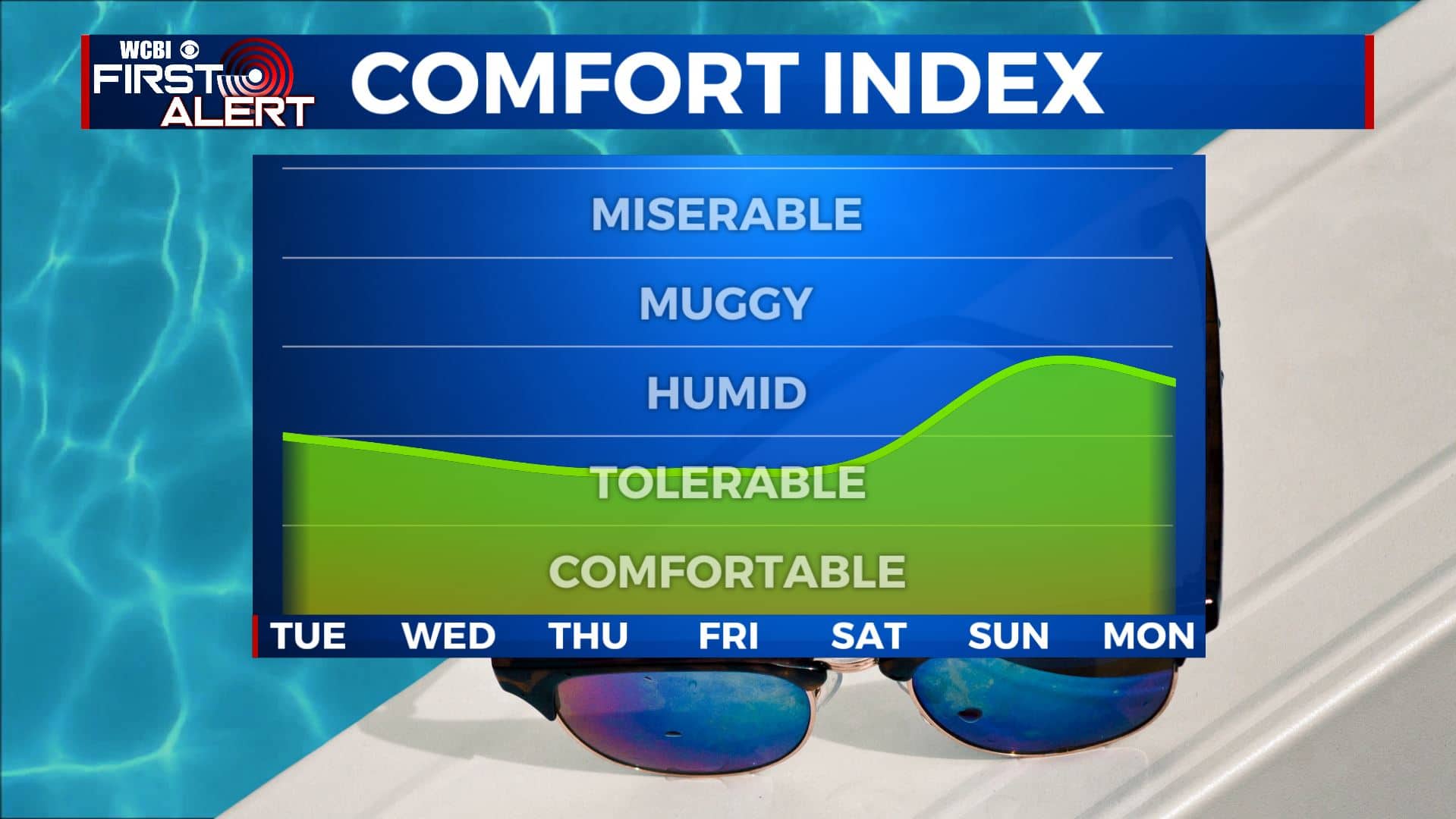
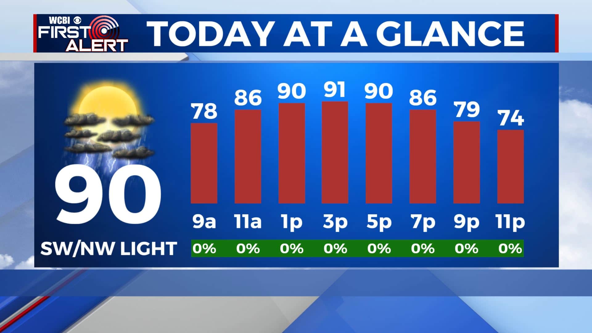
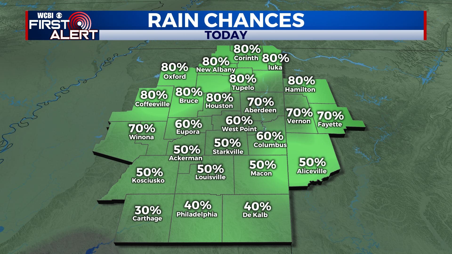
SUMMARY: We are watching a cold front this morning that will be pushing through Monday afternoon. Ahead of it, a warm & humid day is ahead with a few pop-up storms. Behind it, nicer and less humid weather await us. Highs will stay in the upper 80s to near 90, but it will feel less muggy and more comfortable.
MONDAY: A few afternoon pop-up storms are possible today as a cold front pushes through the region. Overall, we’ll see a mix of sun and clouds. Temperatures will top out in the upper 80s to lower 90s. Drier & less humid air will start to filter in Monday night. SW to NW light winds.
MONDAY NIGHT: Drier and less humid air will also start to filter in Monday night, setting us up for a few days of very comfortable weather. Mostly clear skies and pleasant overnight. Winds will remain light out of the northwest as temperatures fall to the mid 60s.
TUESDAY: An isolated storm will also be possible on Tuesday, but rain chances will be mostly diminished. Temperatures will only top out in the mid 80s on Tuesday. Overnight lows will be in the 60s.
WEDNESDAY-FRIDAY: Mid to late week looks very pleasant and nice with mostly sunny skies and highs in the upper 80s to near 90. Heat and humidity will start to creep back in by Friday. Overnight lows will remain in the mid to upper 60s.
SATURDAY-SUNDAY: It will be hot & humid once again by the weekend as highs return to the mid 90s. There will also be the chance of some isolated pop-up storms on Saturday and Sunday with a mix of sun & clouds.
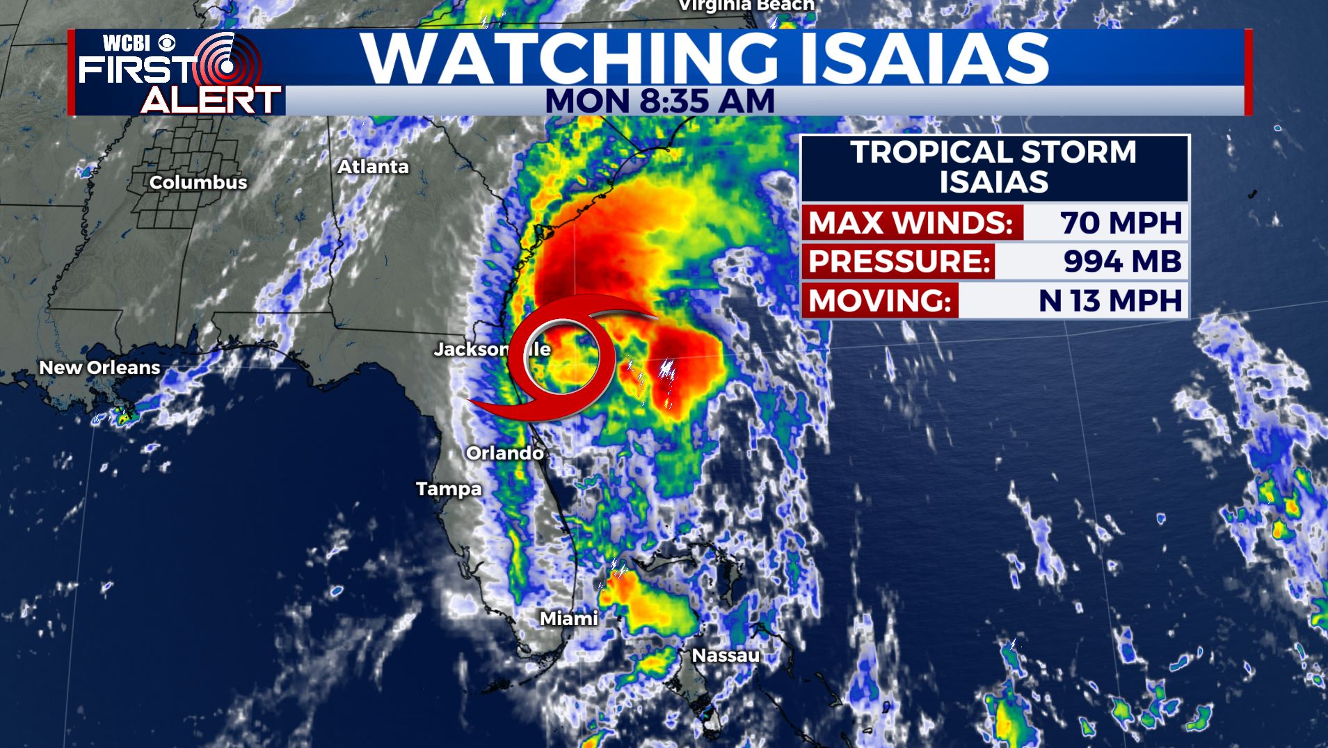
TROPICS: Tropical Storm Isaias is forecast to become a hurricane later today. While Florida has been spared most of the impacts, Isaias is expected to make landfall in the Carolinas late Monday/early Tuesday then racing up the East Coast bringing the threat of heavy rain & flooding.
Stay connected with @WCBIWEATHER on Facebook, Twitter, Instagram, and the WCBI News App


Leave a Reply