Clouds increase then rain & storms return for your Friday
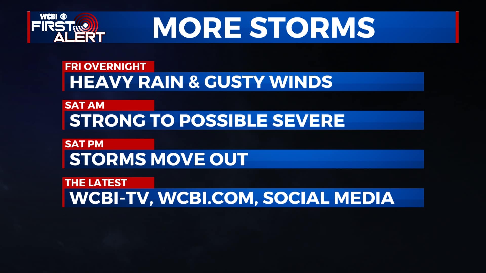
SUMMARY: We’re continuing to keep an eye on our next chances for heavy rain and thunderstorm activity late Friday night into early Saturday morning. The sunshine will return by late Saturday afternoon into Sunday as temperatures continue to warm up into the 70s and 80s into early next week. We’ll have another chance of showers & storms mid to late week.
FRIDAY: Mostly cloudy skies during the day. Maybe a stray shower by late afternoon but looking to stay mostly dry through sunset. Highs warming up into the upper 60s to near 70 degrees. SE winds 5-10 mph.
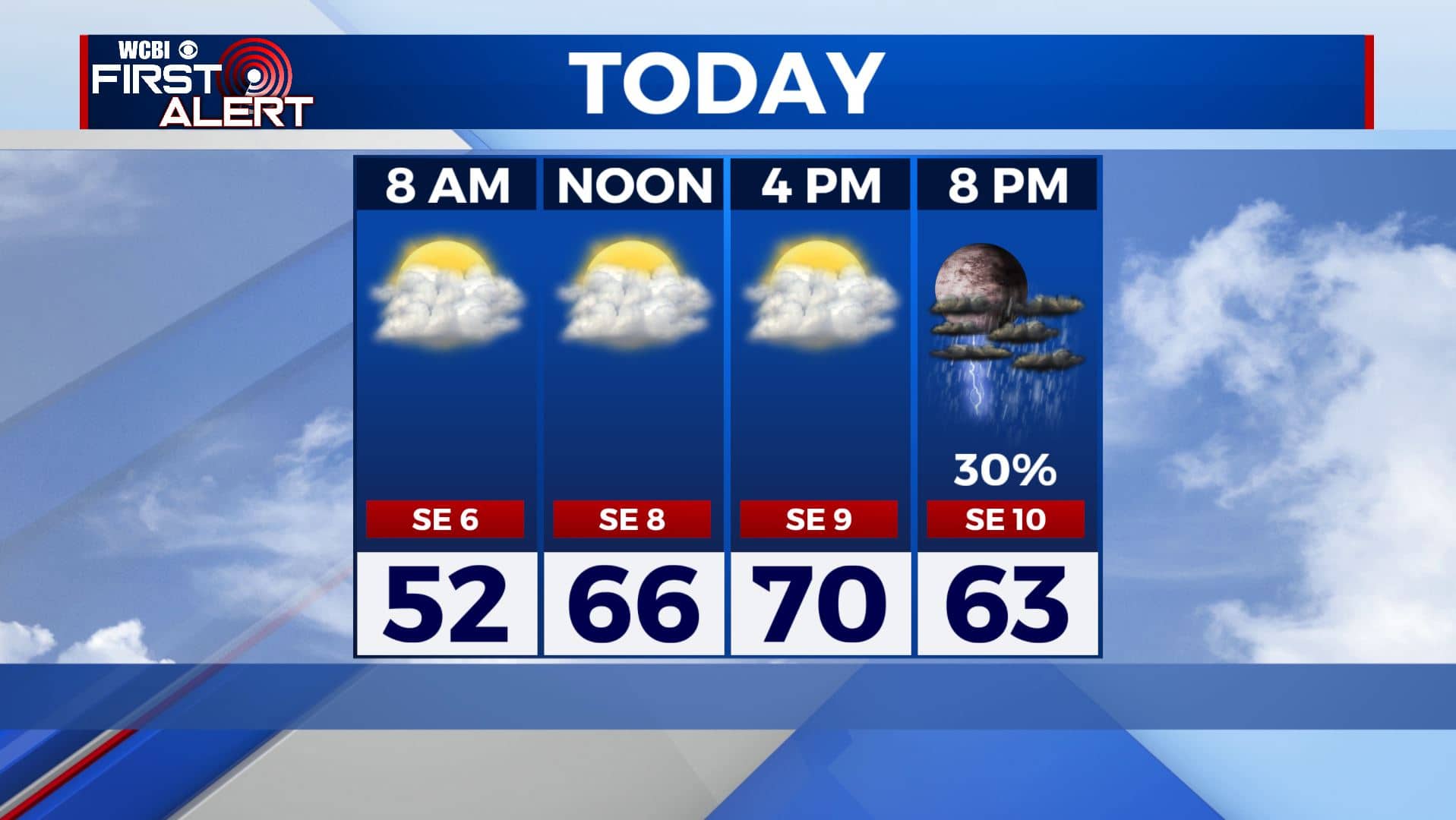
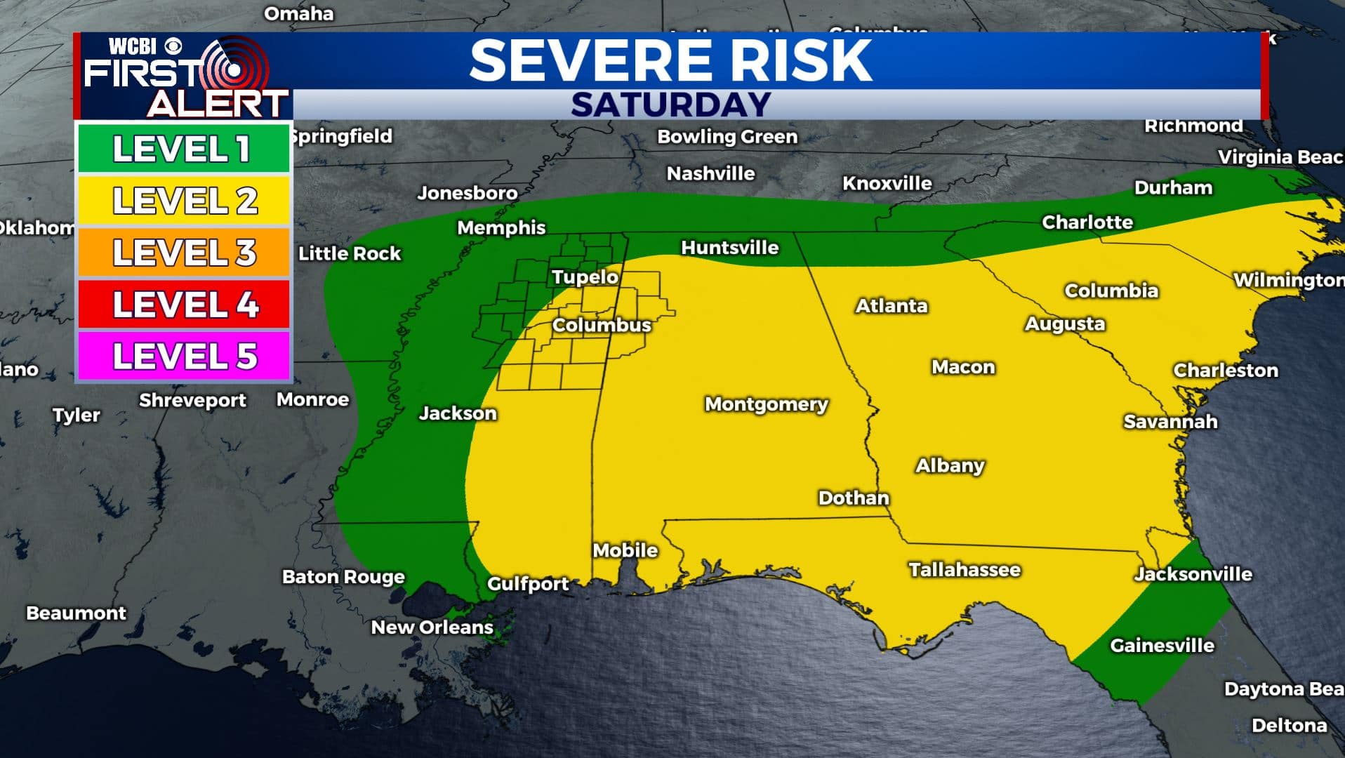
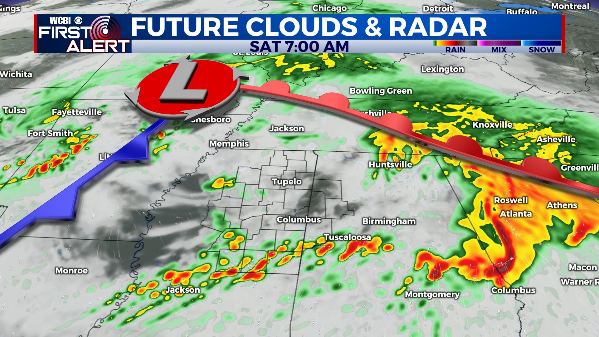
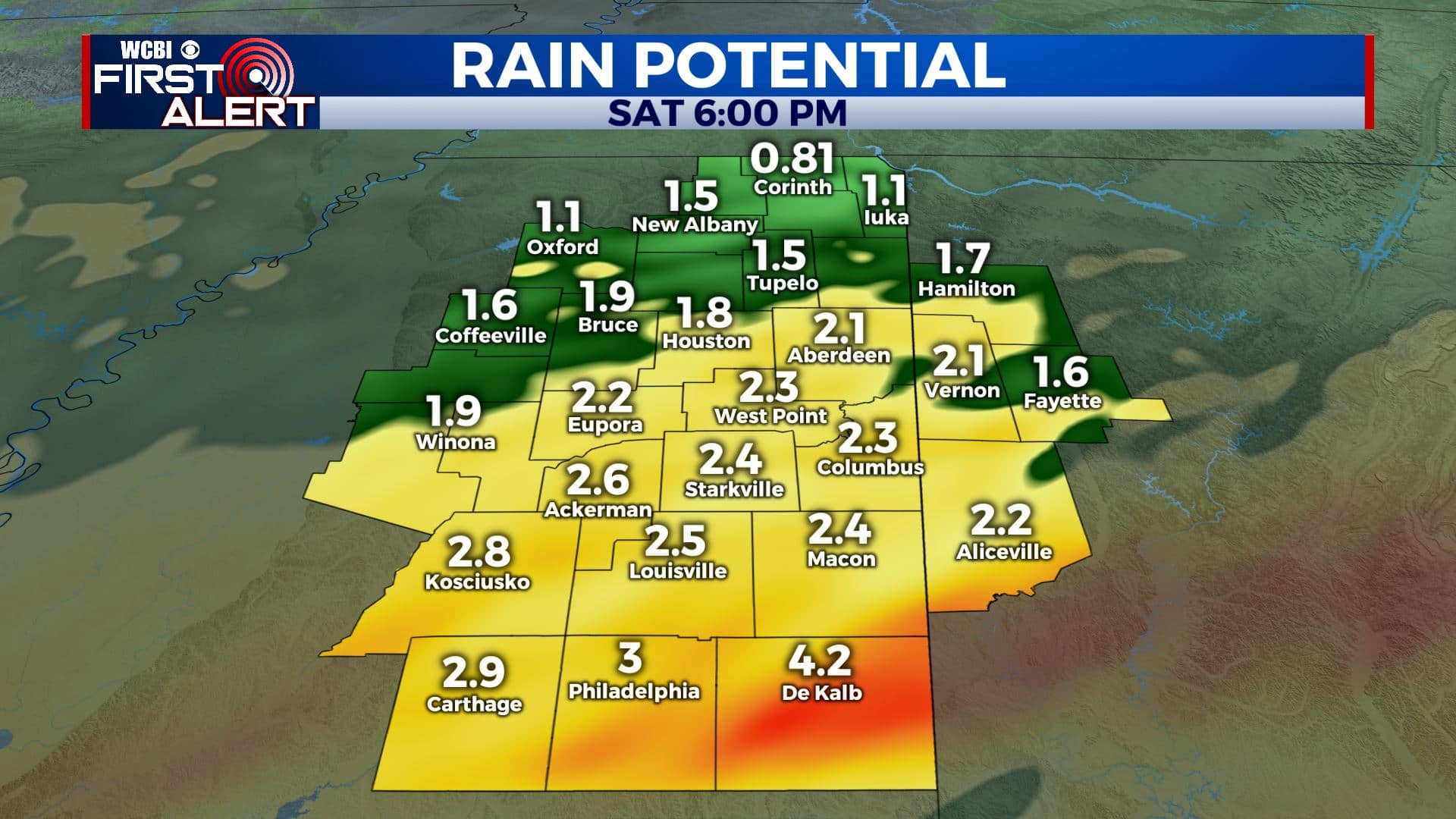
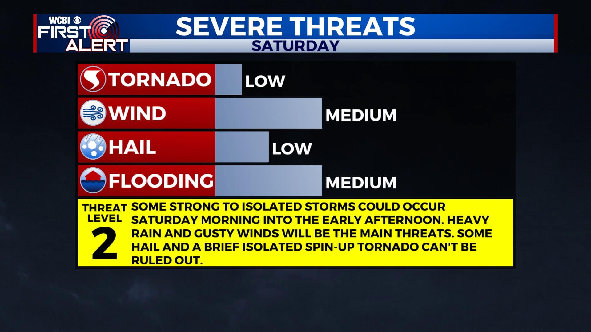
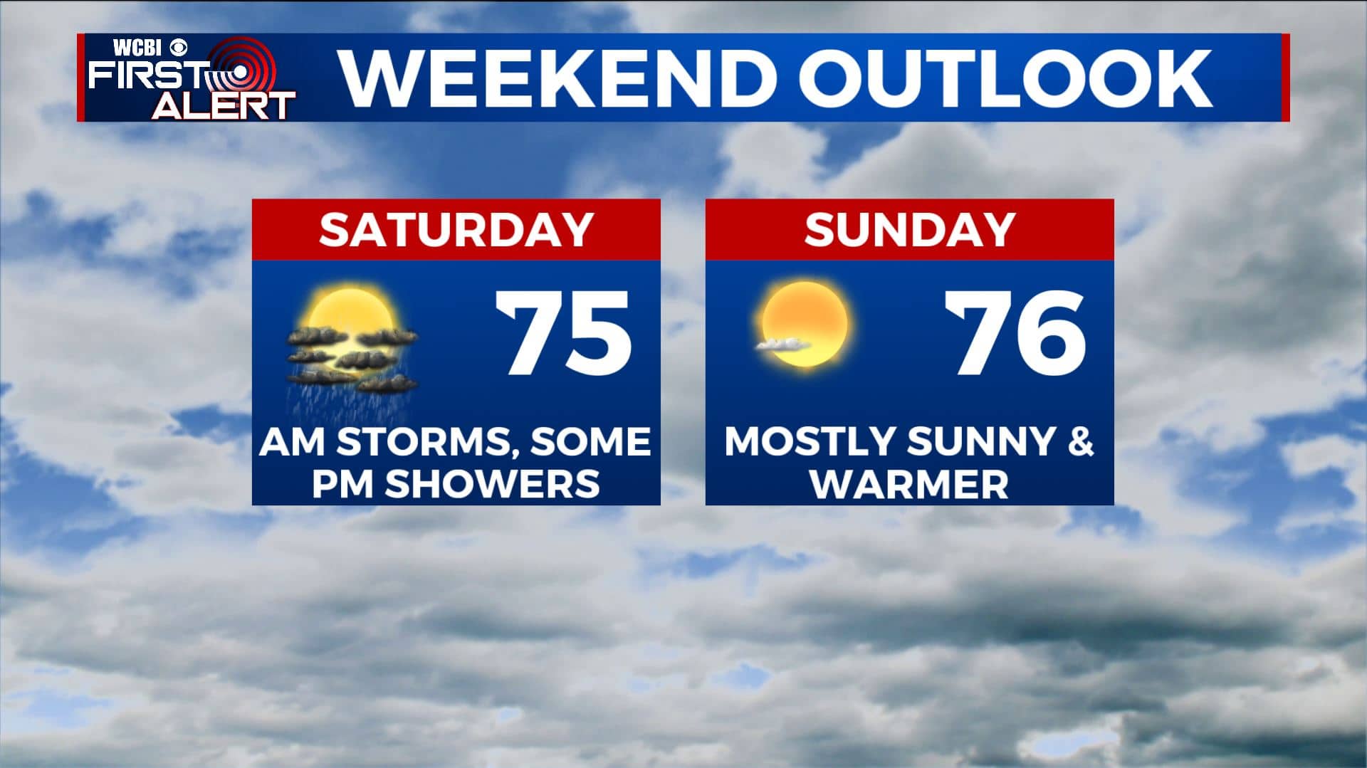
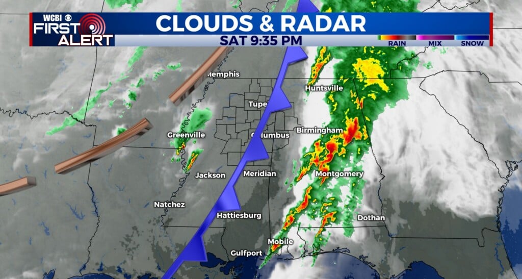
FRIDAY NIGHT-SATURDAY: Rain showers will become more steady after 10pm and could be heavy at times during the overnight hours into Saturday morning. Rainfall amounts could be anywhere from 1-3+ inches. The main severe weather threat appears to remain along and south of I-20, but we can’t rule out some gusty winds and lightning. Spotty showers or storms will remain possible Saturday morning. Those could be strong to possibly severe with gusty winds, hail and heavy downpours. Can’t rule out a brief spin up. We’ll be watching things. Highs in the mid 70s.
SUNDAY: Rain will exit by Saturday late afternoon into the evening, leaving us dry for Sunday. We’ll see mostly sunny skies with highs in the mid 70s. Overnight lows in the upper 40s.
MONDAY: We’ll see mostly sunny skies with highs continuing to warm up to near 80 degrees. Overnight lows in the 50s.
TUESDAY: A mix of sun and clouds as temperatures continue to warm up into the lower 80s.
WEDNESDAY: Rain chances return to the forecast with highs in the lower to mid 80s.
THURSDAY: It appears storms could move through on Thursday. Highs will be in the 70s with overnight lows in the 60s.
Stay connected with @WCBIWEATHER on Facebook, Twitter, Instagram, and the WCBI News App.


Leave a Reply