Cindy keeps rain around
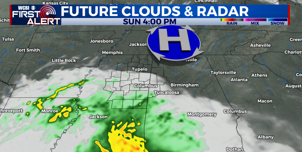
Areas of rain and embedded storms will continue Wednesday Night, Thursday, and Friday. The heaviest rain tonight and Thursday in the WCBI coverage area may be over eastern MS and AL but we’ll see how it all shakes out. Additional heavy rain is possible in all areas on Friday with the actual remnants of the system moving through the Mid South.
RAINFALL:
A good 1” to 3” is possible across the area between now and the end of Friday with some locations perhaps seeing 4” to 5” or more. This doesn’t mean everybody will see extreme rainfall but the potential is there so be aware. Heavy rain in a short duration may lead to flash flooding or just plain flooding.
SEVERE WEATHER:
There is the threat of some damaging wind gusts and isolated spin-up tornadoes Thursday and Friday, especially during the heating of the day when showers/storms become more robust.
WEEKEND & BEYOND:
Additional showers and storms are possible during the weekend but they will not be associated with the remnants of Cindy. A drying trend is likely early next week.
TEMPERATURE TREND:
Areas of heavy rain will tend to keep temperatures in the 70s during the near term but locations that see less rain coverage will jump back into the 80s. Humidity levels will remain quite high leading to uncomfortable conditions. We’re looking at highs in the 80s during the weekend with a shot at some upper 80s once conditions dry out early next week.
Follow WCBI WEATHER on Facebook, Twitter, and Instagram


Leave a Reply