Changes to our weather coming out ahead of Delta
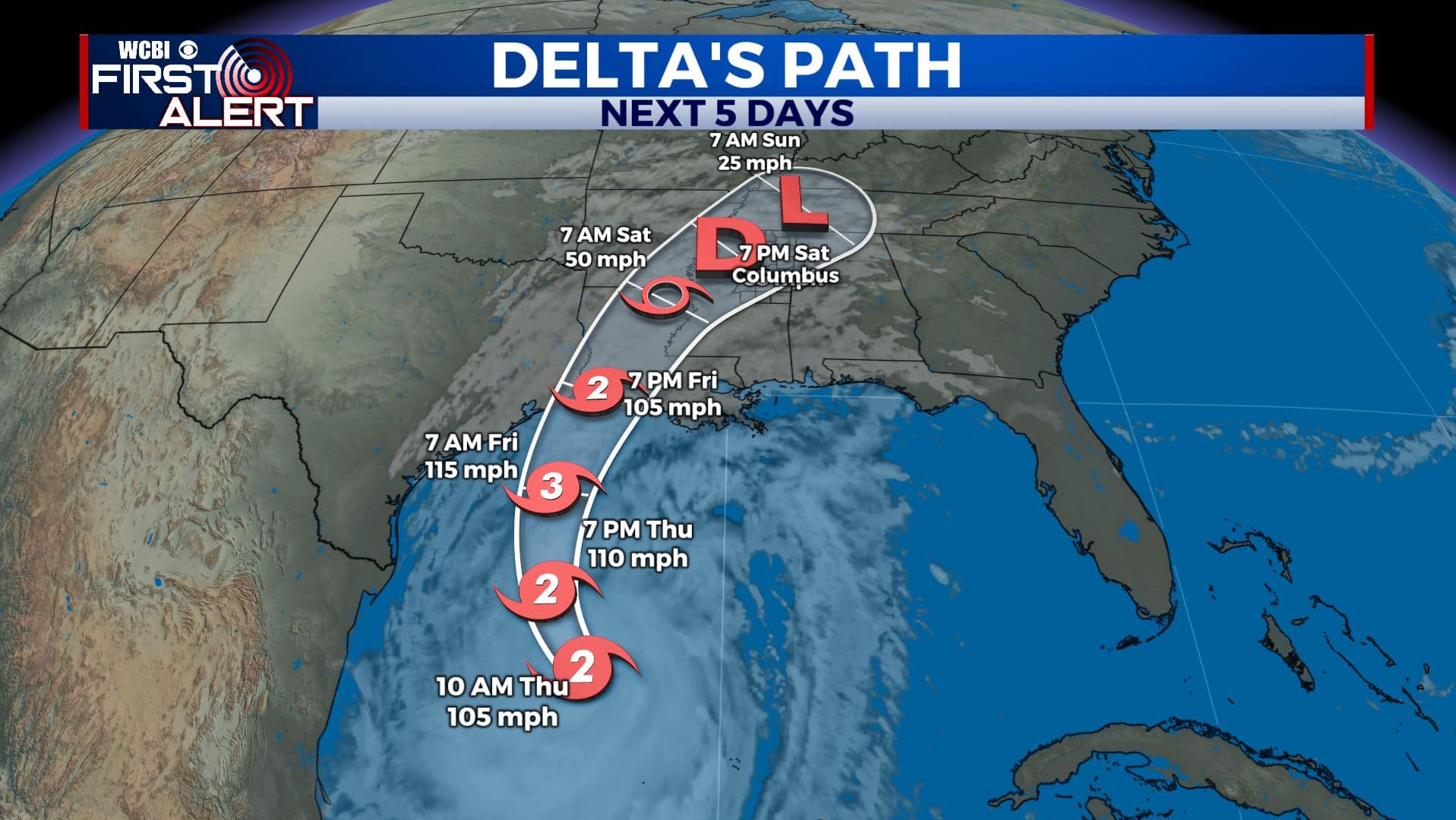
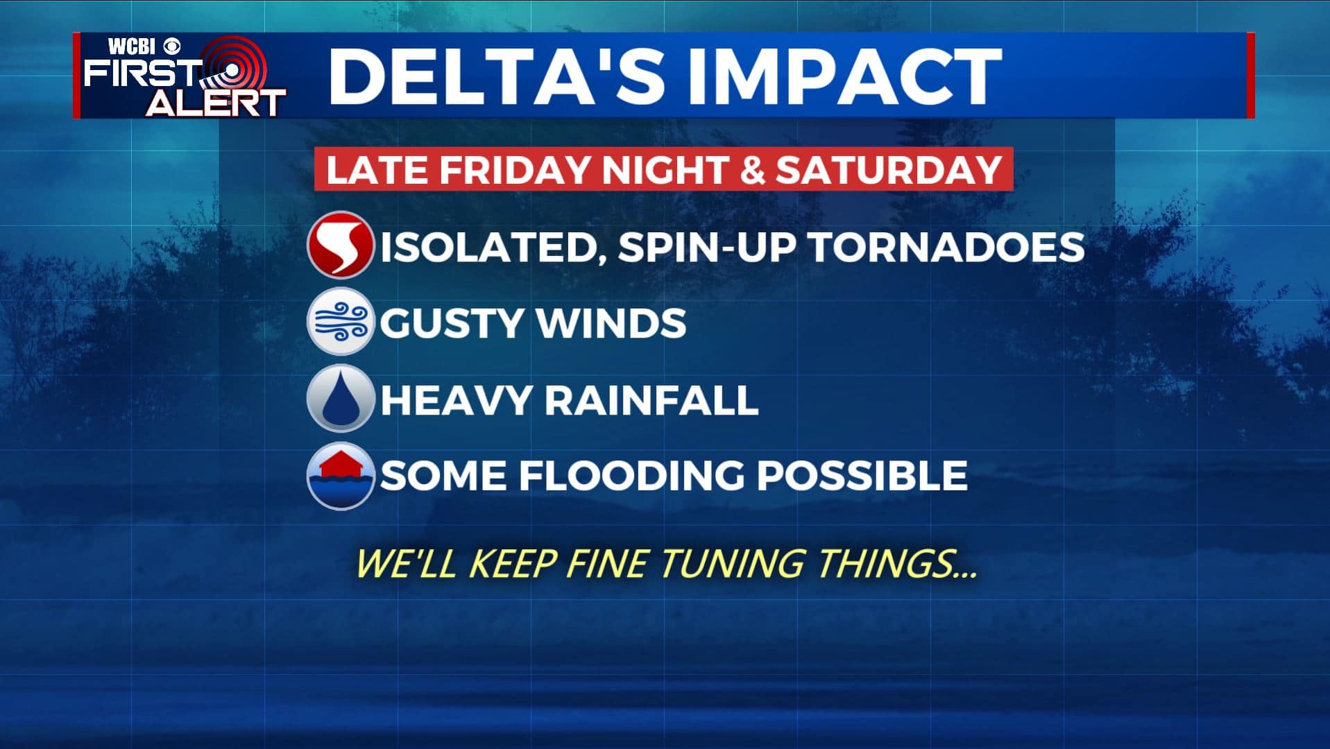
HURRICANE DELTA: As of 10 am Thursday, Delta is a Category 2 storm with winds at 105 mph. It will continue to gain strength today and could become a major Category 3 hurricane tonight. Landfall is forecast for Friday afternoon or evening along the SW Louisiana coast and impact us on Saturday. Our area is still in line for isolated tornadoes, gusty winds, and heavy rainfall. Stay tuned to WCBI.
THURSDAY: A few clouds are beginning to move in this Thursday morning and will continue throughout the day. Still going to be a warm one with highs in the 80s. A cold front will be passing through late Thursday to help cool down temperatures again by Friday. Light ENE.
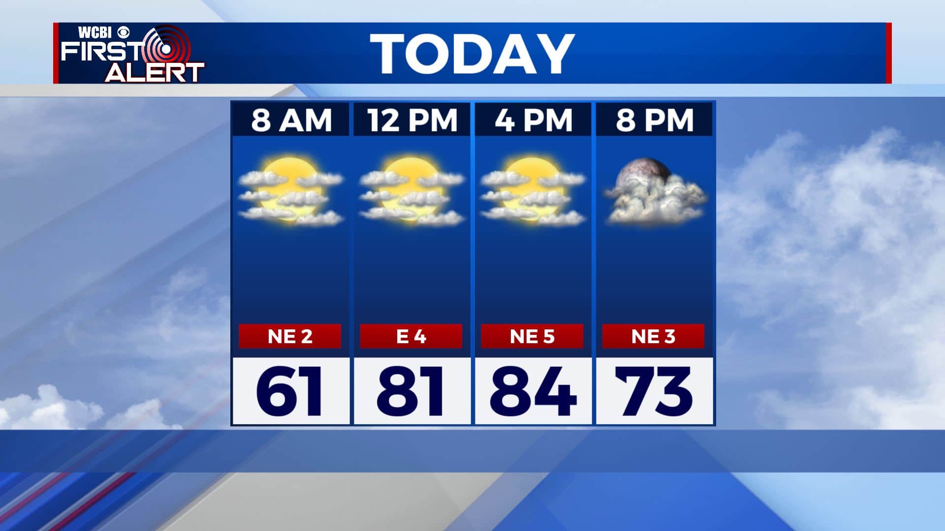
THURSDAY NIGHT: Clouds thicken with areas of light rain possible. Overnight lows in the mid 60s.
FRIDAY: Mostly cloudy with a chance of a few rain showers ahead of Delta’s landfall on the northern Gulf Coast. Highs in the mid to upper 70s. Winds E 5-10 mph.
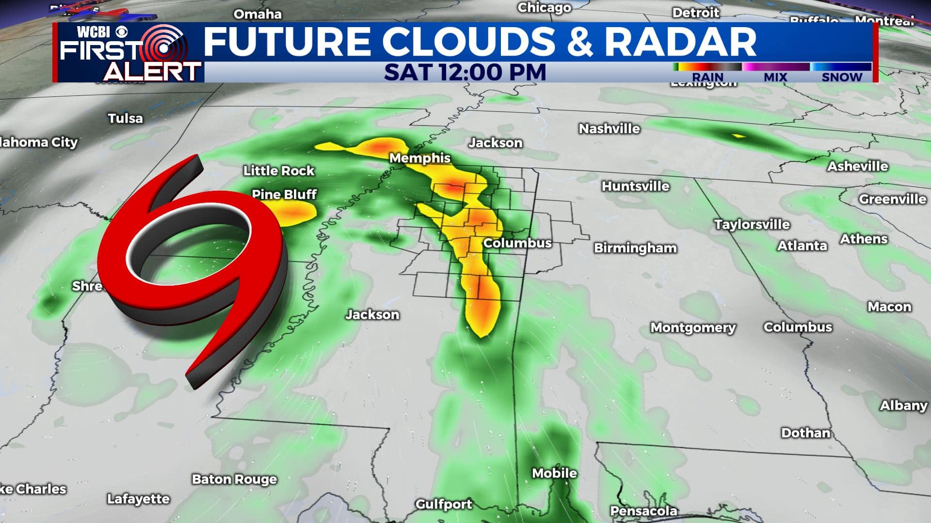
FRIDAY NIGHT & SATURDAY: The remnants of Hurricane Delta will swirl through the region. Impacts include isolated tornadoes, wind gusts 30-40 mph (or higher), and 1-4″ of rain (or more). The heaviest rain now looks to be along the Natchez Trace. Humid highs the 70s are favored with the storm bringing in tropical air from the Gulf of Mexico.
SUNDAY: Some rain and clouds could linger but it depends on how soon the remnants of Delta exit the region. Highs in the upper 70s to around 80 are possible.
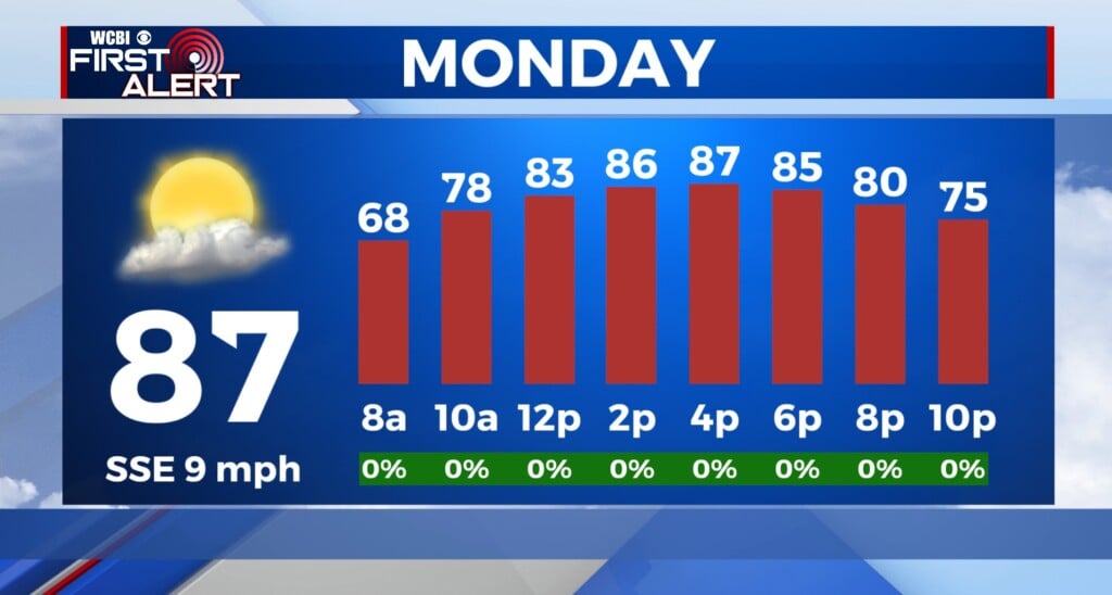
MONDAY: We’ll dry out early next week as we the sunshine returns. Highs back up into the lower to mid 80s.
TUESDAY: Some rain and thunder could develop along a cold front Tuesday. Highs in the upper 70s.
Stay connected with @WCBIWEATHER on Facebook, Twitter, Instagram, and the WCBI News App


Leave a Reply