Beautiful Tuesday ahead of warmer, potentially stormy stretch of days
COLUMBUS, Mississippi (WCBI) – The weather looks fantastic for Tuesday before a more active stretch settles in to end the week and kick off the weekend.
TUESDAY: After a cool start, temperatures will rebound into the middle 70s w/plenty of sunshine.
TUESDAY NIGHT: Temperatures will drop into the low 60s early, but increased southerly breezes overnight will actually raise temperatures into the upper 60s by daybreak Wednesday. Clouds will also increase.
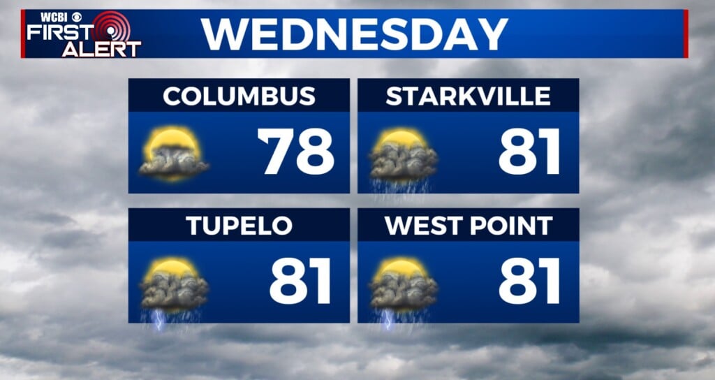
WEDNESDAY: Warm, humid, and very unstable air will quickly develop across the region as temperatures soar into the middle and possibly upper 80s. Southerly winds could also gust up to 30 mph. While the best upper-level forcing is *just* northwest of the region, we can’t rule out the chance of a few rogue, locally strong to severe storms skirting the northwestern part of the coverage area (northwest of the Trace). Should storms occur, all severe hazards would occur…including damaging winds, large hail, and tornadoes. It’s entirely possible any storms will stay just northwest of the region, but places like Grenada, Coffeeville, Oxford, and New Albany will need to be weather aware!

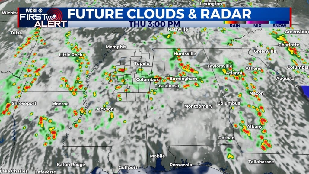
THU/FRI: The same active pattern will continue, mainly for areas just northwest of the coverage area. We’ll stay mostly dry and warm w/highs well into the 80s.
SAT/SUN: The active weather will set its sights on the rest of the Deep South by Saturday afternoon into Sunday. We expect widespread rain and storms across the region, with an attendant all-hazard severe weather risk setting up Saturday evening into early Sunday. We’ll finally quiet down and cool down Sunday night into next week.