An active weather pattern returns this new workweek
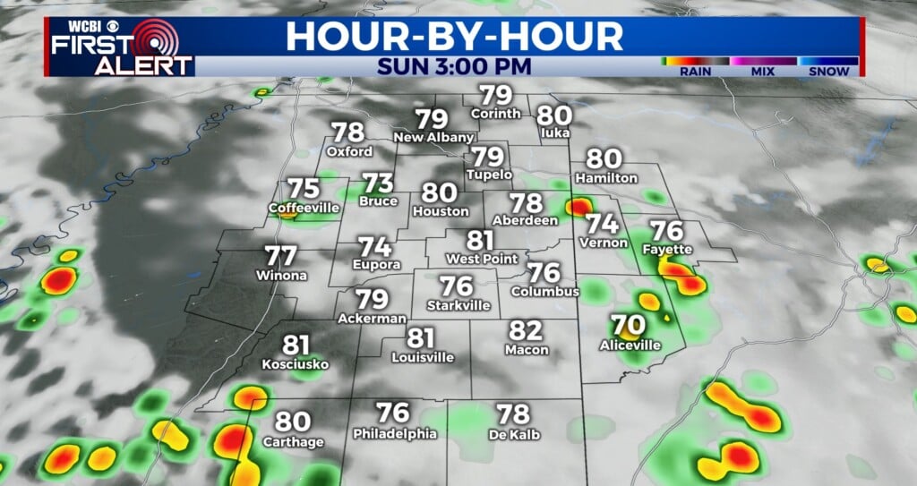
SUMMARY: After a hot & humid last few weeks, we’ll be seeing our weather pattern switch up a bit this upcoming week with rain & storm chances increasing. Some storms will be capable of producing gusty winds and heavy rain, with some areas picking up 1-3″ of rain by the weekend. More rain means our temperatures will not be as hot with highs in the mid to upper 80s as opposed to the 90s.

MONDAY: As we’ve seen for the last several days, there will be a chance of afternoon and evening pop-up scattered storms on Monday. Not everyone will see rain, but the chance will be there. If you can manage to dodge the rain, you’ll see a mix of sun and clouds. Highs will be in the upper 80s to lower 90s. SW winds 5-10 mph.

MONDAY NIGHT: Partly cloudy skies after the chance of a shower or storm before midnight. Overnight lows will be in the mid 70s with a light SW wind.
TUESDAY-FRIDAY: Rain & storms chances become more likely each day mid to late week as a cold front will stall out to our north. Some storms could produce heavy rain and gusty winds at times. These increased rain chances mean our temperatures won’t be quite as hot, as temperatures will only reach the mid to upper 80s each afternoon. 1-3″ of rain is possible depending on if you get caught under several downpours through the week. We’re not looking at a complete washout as there will be some dry breaks, but just keep the umbrella with you.
WEEKEND: The cold front looks to pass through the area, ending our rain chances for the most part. We’ll leave in a chance for pop-up scattered showers and storms just in case, but in general, things look to trend drier. We’ll also be a little more comfortable & less humid temperature-wise with highs in the mid 80s.
Stay connected with @WCBIWEATHER on Facebook, Twitter, Instagram, and the WCBI News App


Leave a Reply