A nice & sunny end to the workweek
SUMMARY: Plan on comfortable summer nights and warm summer days as we end the workweek. The summer heat and humidity will return for the upcoming weekend followed by the return of afternoon pop-up storm chances next week.
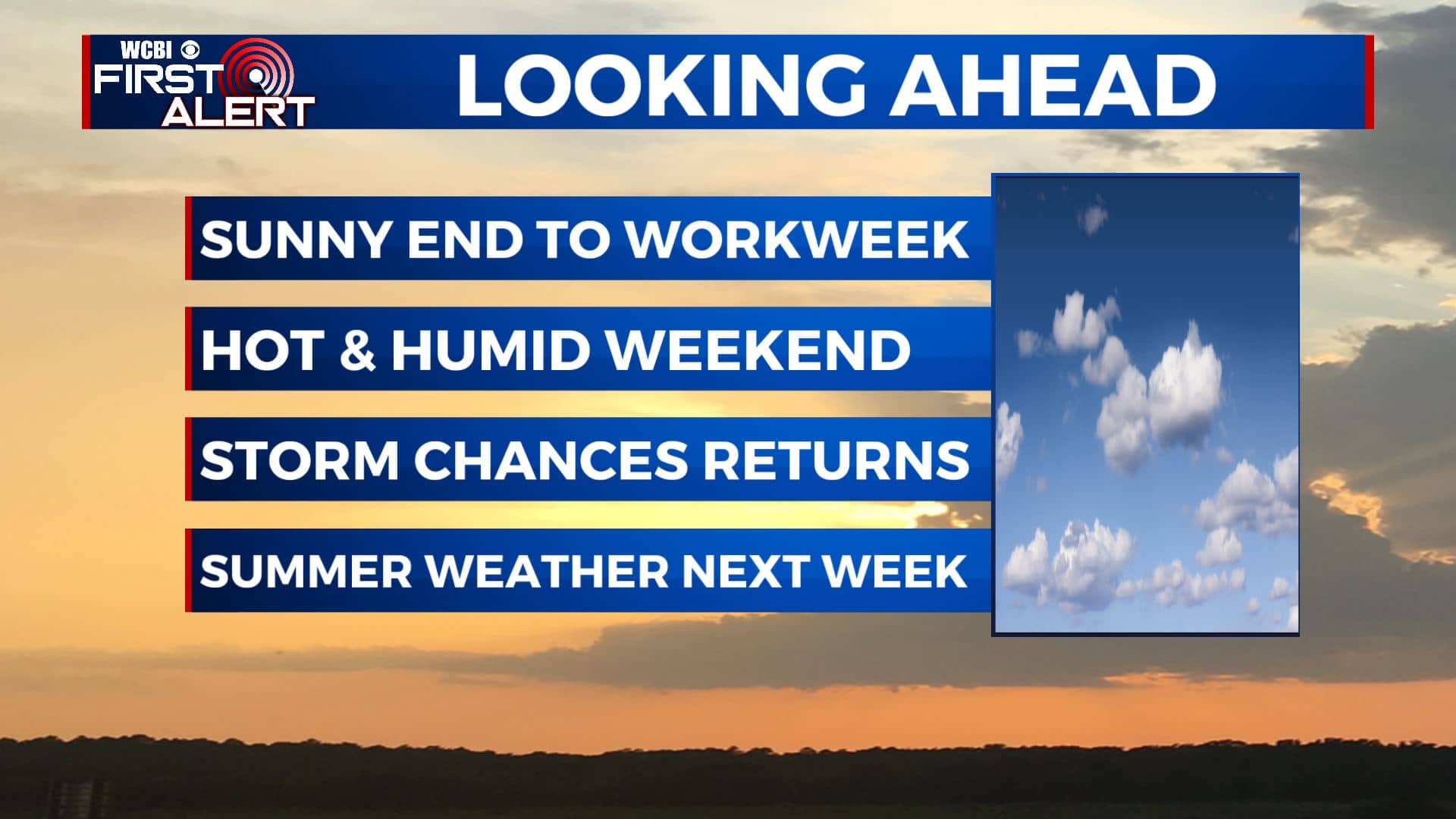
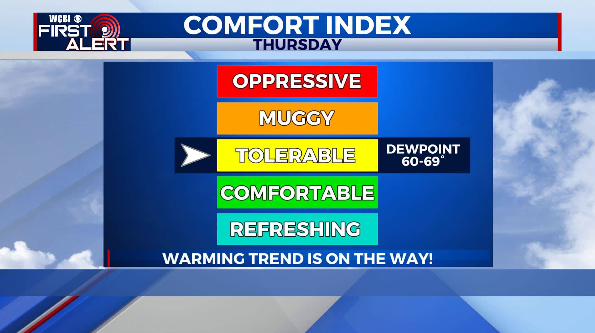
THURSDAY: A nice & mostly sunny day is ahead. High temperatures will go up to upper 80s to near 90 for your Thursday. Humidity values will still keep us pleasant but not for much longer. Light NW winds.
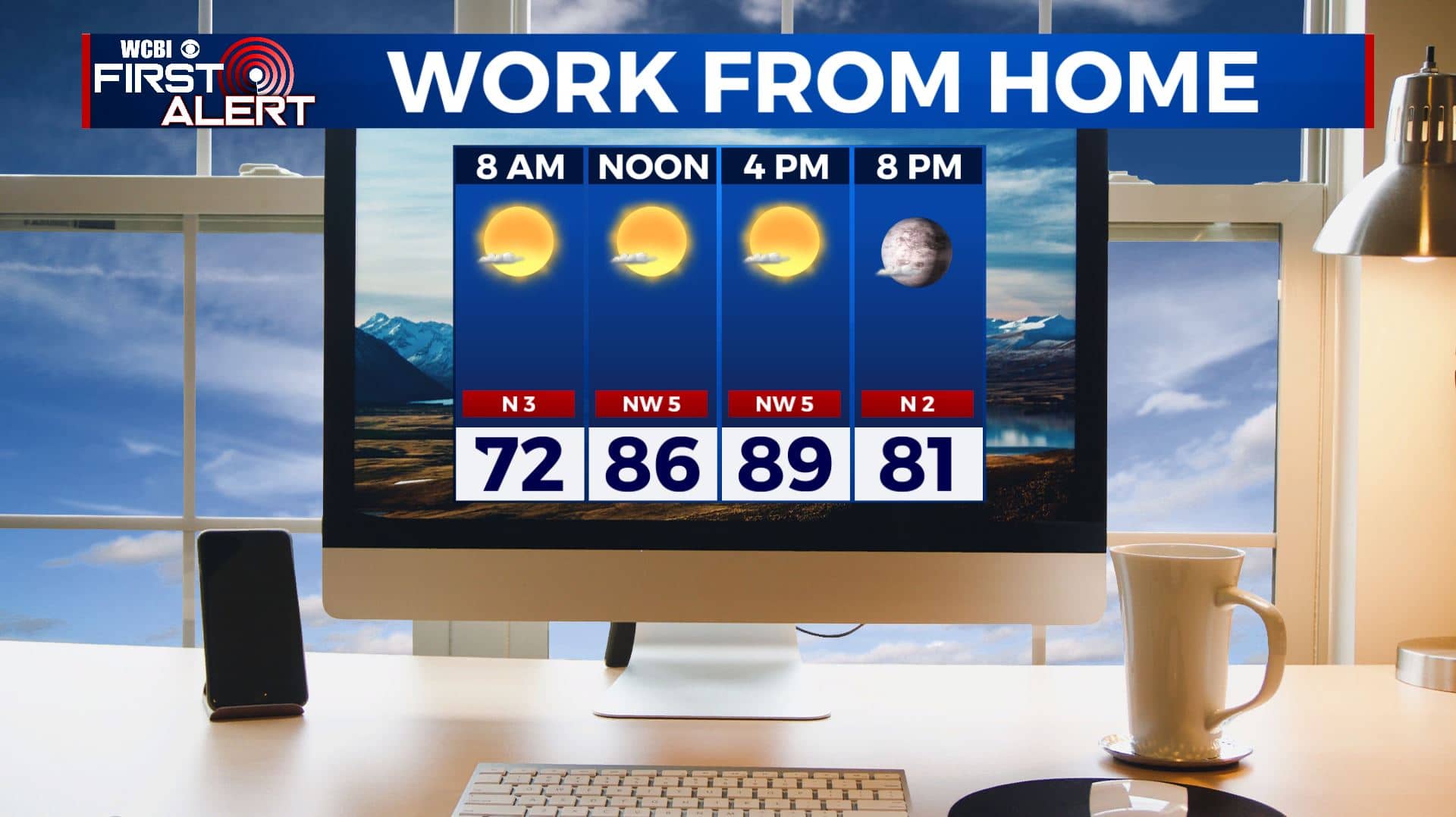
THURSDAY NIGHT: Another mostly clear, quiet and comfortable night. Overnight lows in the mid 60s. Calm winds.
FRIDAY: Mostly sunny skies and staying dry as we end the workweek. High temperatures will start warming back up into the lower 90s along with the humidity. Light N winds.
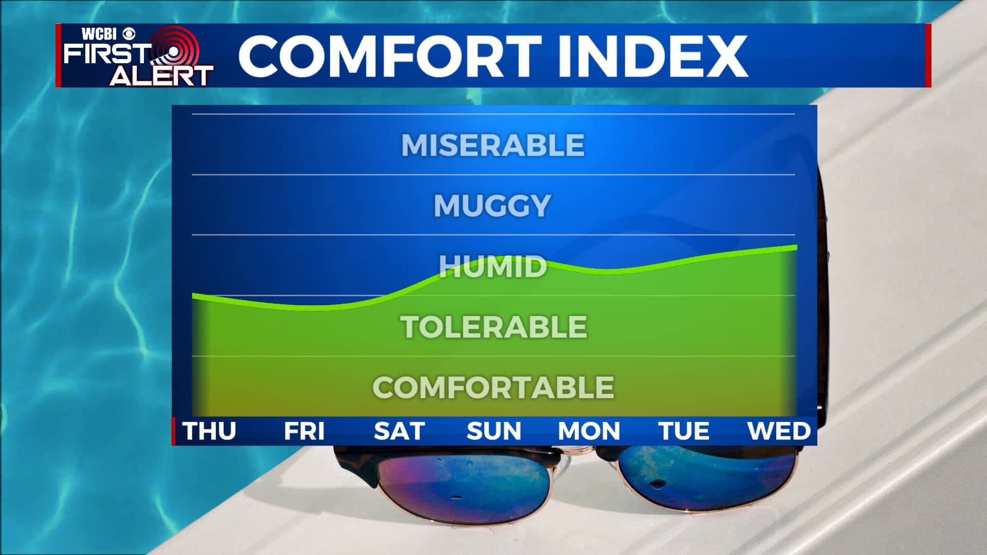
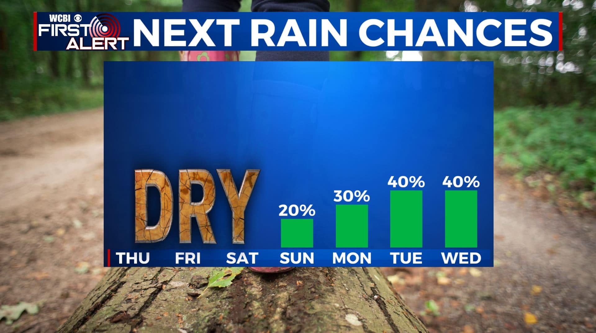
WEEKEND: A mix of sun and clouds, hot and humid. Temperatures will be hot & humid with highs in the mid 90s with heat indices over 100°. There’s also a chance of afternoon pop-up showers and storms due to the heating of the day. Muggy overnight lows in the 70s.
NEXT WEEK: We’ll be back to seasonably hot and humid conditions for early August. Highs in the 90s with daily rain and storm chances. Lows in the 70s.
Stay connected with @WCBIWEATHER on Facebook, Twitter, Instagram, and the WCBI News App


Leave a Reply